 |
|
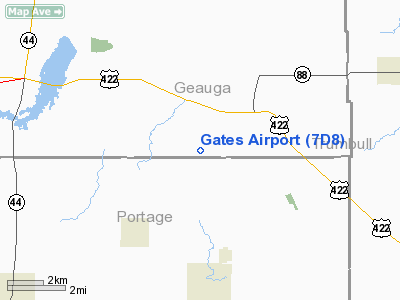
Location & QuickFacts
| FAA Information Effective: | 2008-09-25 |
| Airport Identifier: | 7D8 |
| Airport Status: | Operational |
| Longitude/Latitude: | 081-05-58.3490W/41-21-04.1970N
-81.099541/41.351166 (Estimated) |
| Elevation: | 1110 ft / 338.33 m (Estimated) |
| Land: | 146 acres |
| From nearest city: | 4 nautical miles N of Garrettsville, OH |
| Location: | Geauga County, OH |
| Magnetic Variation: | 07W (1985) |
Owner & Manager
| Ownership: | Privately owned |
| Owner: | Cleveland Parachute Center |
| Address: | 15199 Grove Rd
Garrettsville, OH 44231 |
| Phone number: | 216-548-4511 |
| Manager: | Robert D. Gates |
| Address: | 15199 Grove Rd
Garrettsville, OH 44231 |
| Phone number: | 216-548-4511 |
Airport Operations and Facilities
| Airport Use: | Open to public |
| Wind indicator: | Yes |
| Segmented Circle: | No |
| Control Tower: | No |
| Landing fee charge: | No |
| Sectional chart: | Detroit |
| Region: | AGL - Great Lakes |
| Boundary ARTCC: | ZOB - Cleveland |
| Tie-in FSS: | CLE - Cleveland |
| FSS on Airport: | No |
| FSS Toll Free: | 1-800-WX-BRIEF |
| NOTAMs Facility: | CLE (NOTAM-d service avaliable) |
Airport Communications
Airport Services
Runway Information
Runway 08/26
| Dimension: | 2800 x 100 ft / 853.4 x 30.5 m |
| Surface: | TURF-GRVL, Fair Condition |
| |
Runway 08 |
Runway 26 |
| Longitude: | 081-06-16.3000W | 081-05-40.3800W |
| Latitude: | 41-21-01.3100N | 41-21-07.0600N |
| Elevation: | 1110.00 ft | 1110.00 ft |
| Traffic Pattern: | Left | Left |
| Markings: | None, | None, |
| Runway End Identifier: | No | No |
| Centerline Lights: | No | No |
| Touchdown Lights: | No | No |
| Obstruction: | 4 ft fence | 47 ft trees, 0.0 ft from runway, 75 ft right of centerline |
|
Radio Navigation Aids
| ID |
Type |
Name |
Ch |
Freq |
Var |
Dist |
| AK | NDB | Akron | | 362.00 | 07W | 21.3 nm |
| LQL | NDB | Lakeland | | 263.00 | 08W | 23.6 nm |
| BKL | NDB | Burke Lakefront | | 416.00 | 07W | 27.6 nm |
| HBD | NDB | Hubbard | | 408.00 | 08W | 28.3 nm |
| EZE | NDB | Engel | | 226.00 | 07W | 29.3 nm |
| UCP | NDB | Castle | | 272.00 | 09W | 36.7 nm |
| CL | NDB | Harri | | 344.00 | 07W | 39.0 nm |
| TSO | NDB | Tolson | | 395.00 | 07W | 47.4 nm |
| CXR | VOR/DME | Chardon | 074X | 112.70 | 05W | 10.4 nm |
| ACO | VOR/DME | Akron | 091X | 114.40 | 04W | 15.3 nm |
| LNN | VOR/DME | Lost Nation | 039X | 110.20 | 08W | 23.9 nm |
| JFN | VOR/DME | Jefferson | 099X | 115.20 | 05W | 29.2 nm |
| BSV | VOR/DME | Briggs | 071X | 112.40 | 04W | 39.7 nm |
| DJB | VOR/DME | Dryer | 083X | 113.60 | 05W | 47.9 nm |
| YNG | VORTAC | Youngstown | 027X | 109.00 | 05W | 19.2 nm |
| CAK | VOT | Akron/canton Regional | | 110.60 | | 30.4 nm |
| CLE | VOT | Cleveland | | 110.40 | | 34.0 nm |
Remarks
- CAUTION: ARPT IS A SPORT PARACHUTING CENTER.
- RWY DROPS 10' ON EAST END.
- RY 26 HAS 16 FT HILL/BRUSH STARTING 0 FT FM RY APCH END.
- VFR ONLY
Images and information placed above are from
http://www.airport-data.com/airport/7D8/
We thank them for the data!
| General Info
|
| Country |
United States
|
| State |
OHIO
|
| FAA ID |
7D8
|
| Latitude |
41-21-04.197N
|
| Longitude |
081-05-58.349W
|
| Elevation |
1110 feet
|
| Near City |
GARRETTSVILLE
|
We don't guarantee the information is fresh and accurate. The data may
be wrong or outdated.
For more up-to-date information please refer to other sources.
|
|


