 |
|
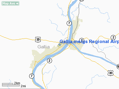
Gallia-meigs Rgnl Airport |
Location & QuickFacts
| FAA Information Effective: | 2008-09-25 |
| Airport Identifier: | GAS |
| Airport Status: | Operational |
| Longitude/Latitude: | 082-09-48.3474W/38-50-02.8015N
-82.163430/38.834112 (Estimated) |
| Elevation: | 566 ft / 172.52 m (Estimated) |
| Land: | 44 acres |
| From nearest city: | 2 nautical miles NE of Gallipolis, OH |
| Location: | Gallia County, OH |
| Magnetic Variation: | 07W (2000) |
Owner & Manager
| Ownership: | Publicly owned |
| Owner: | Gallia Meigs Regnl A Auth |
| Address: | 312 Airport Rd
Gallipolis, OH 45631 |
| Phone number: | 740-446-9004 |
| Manager: | Harold Butcher |
| Address: | 312 Airport Rd
Gallipolis, OH 45631 |
| Phone number: | 740-446-9004 |
Airport Operations and Facilities
| Airport Use: | Open to public |
| Wind indicator: | Yes |
| Segmented Circle: | Yes |
| Control Tower: | No |
| Lighting Schedule: | RDO-CTL
ACTVT MIRL RY 05/23; PAPI RYS 05 & 23; REIL RY 23 - CTAF. |
| Beacon Color: | Clear-Green (lighted land airport) |
| Landing fee charge: | No |
| Sectional chart: | Cincinnati |
| Region: | AGL - Great Lakes |
| Boundary ARTCC: | ZID - Indianapolis |
| Tie-in FSS: | DAY - Dayton |
| FSS on Airport: | No |
| FSS Toll Free: | 1-800-WX-BRIEF |
| NOTAMs Facility: | DAY (NOTAM-d service avaliable) |
| Federal Agreements: | N |
Airport Communications
| CTAF: | 123.000 |
| Unicom: | 123.000 |
Airport Services
| Fuel available: | 100LLA1+ |
| Airframe Repair: | NONE |
| Power Plant Repair: | NONE |
| Bottled Oxygen: | NONE |
| Bulk Oxygen: | NONE |
Runway Information
Runway 05/23
| Dimension: | 3998 x 75 ft / 1218.6 x 22.9 m |
| Surface: | ASPH, Good Condition |
| Weight Limit: | Single wheel: 30000 lbs. |
| Edge Lights: | Medium |
| |
Runway 05 |
Runway 23 |
| Longitude: | 082-10-07.0890W | 082-09-29.6038W |
| Latitude: | 38-49-49.5464N | 38-50-16.0558N |
| Elevation: | 561.00 ft | 561.00 ft |
| Alignment: | 48 | 127 |
| Traffic Pattern: | Left | Left |
| Markings: | Non-precision instrument, Good Condition | Non-precision instrument, Good Condition |
| Crossing Height: | 40.00 ft | 40.00 ft |
| VASI: | 2-light PAPI on left side | 2-light PAPI on left side |
| Visual Glide Angle: | 3.00° | 3.00° |
| Runway End Identifier: | | Yes
OTS INDEFLY. |
| Obstruction: | 8 ft fence, 201.0 ft from runway, 150 ft right of centerline
RWY 05 +5 FT BRUSH 0 FT FROM 148 FT R AND 107 FT L EXTENDING TO 200 FT FM. | 6 ft brush, 201.0 ft from runway, 75 ft left of centerline
RWY 23 +3 FT TO + 20 FT BRUSH 0 FT FM 150 FT L TO 200 FT FR 75 FT L. |
|
Radio Navigation Aids
| ID |
Type |
Name |
Ch |
Freq |
Var |
Dist |
| AJY | FAN MARKER | Ashland | | | 03W | 34.0 nm |
| PKB | FAN MARKER | Marietta Ohio | | | 03W | 48.1 nm |
| UGS | NDB | University | | 250.00 | 06W | 25.5 nm |
| PMH | NDB | Portsmouth | | 373.00 | 04W | 32.1 nm |
| EOP | NDB | Waverly | | 385.00 | 06W | 41.1 nm |
| HNN | VORTAC | Henderson | 106X | 115.90 | 03W | 8.0 nm |
| HVQ | VORTAC | Charleston | 121X | 117.40 | 03W | 34.5 nm |
| YRK | VORTAC | York | 075X | 112.80 | 05W | 39.9 nm |
| CRW | VOT | Charleston Kanawha | | 108.80 | | 38.5 nm |
Remarks
- DEER & BIRDS ON & INVOF ARPT.
- FBO CLSD THANKSGIVING, CHRISTMAS AND NEW YEARS DAY.
Images and information placed above are from
http://www.airport-data.com/airport/GAS/
We thank them for the data!
| General Info
|
| Country |
United States
|
| State |
OHIO
|
| FAA ID |
GAS
|
| Latitude |
38-50-02.790N
|
| Longitude |
082-09-48.323W
|
| Elevation |
567 feet
|
| Near City |
GALLIPOLIS
|
We don't guarantee the information is fresh and accurate. The data may
be wrong or outdated.
For more up-to-date information please refer to other sources.
|
|


