 |
|
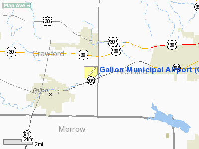
Location & QuickFacts
| FAA Information Effective: | 2008-09-25 |
| Airport Identifier: | GQQ |
| Airport Status: | Operational |
| Longitude/Latitude: | 082-43-25.7000W/40-45-12.2000N
-82.723806/40.753389 (Estimated) |
| Elevation: | 1224 ft / 373.08 m (Surveyed) |
| Land: | 152 acres |
| From nearest city: | 3 nautical miles NE of Galion, OH |
| Location: | Richland County, OH |
| Magnetic Variation: | 03W (1965) |
Owner & Manager
| Ownership: | Publicly owned |
| Owner: | City Of Galion |
| Address: | 301 Harding Way East
Galion, OH 44833 |
| Phone number: | 419-468-2818 |
| Manager: | Les Spring |
| Address: | 5710 Sr 309
Galion, OH 44833 |
| Phone number: | 419-468-5115
FBO 419-565-3647. |
Airport Operations and Facilities
| Airport Use: | Open to public |
| Wind indicator: | Yes |
| Segmented Circle: | No |
| Control Tower: | No |
| Lighting Schedule: | DUSK-DAWN
ACTVT MIRL RY 05/23; VASI & REIL RY 23; REIL RY 05 1800-0600 - CTAF. ACTVT PAPI RY 05 - CTAF. |
| Beacon Color: | Clear-Green (lighted land airport) |
| Landing fee charge: | No |
| Sectional chart: | Detroit |
| Region: | AGL - Great Lakes |
| Boundary ARTCC: | ZOB - Cleveland |
| Tie-in FSS: | CLE - Cleveland |
| FSS on Airport: | No |
| FSS Toll Free: | 1-800-WX-BRIEF |
| NOTAMs Facility: | CLE (NOTAM-d service avaliable) |
| Federal Agreements: | NGY |
Airport Communications
| CTAF: | 122.800 |
| Unicom: | 122.800 |
Airport Services
| Fuel available: | 100LL
FUEL SELF SERVICE - 24 HRS WITH CREDIT CARD. |
| Airframe Repair: | MAJOR |
| Power Plant Repair: | MAJOR |
| Bottled Oxygen: | NONE |
| Bulk Oxygen: | NONE |
Runway Information
Runway 05/23
| Dimension: | 3505 x 75 ft / 1068.3 x 22.9 m |
| Surface: | ASPH, Good Condition |
| Weight Limit: | Single wheel: 12000 lbs. |
| Edge Lights: | Medium |
| |
Runway 05 |
Runway 23 |
| Longitude: | 082-43-42.4240W | 082-43-08.8690W |
| Latitude: | 40-45-00.5010N | 40-45-23.9200N |
| Elevation: | 1222.00 ft | 1218.00 ft |
| Alignment: | 47 | 127 |
| Traffic Pattern: | Left | Left |
| Markings: | Non-precision instrument, Poor Condition
05/23 MARKINGS POOR & WEATHERED. | Non-precision instrument, Poor Condition |
| Crossing Height: | 33.00 ft | 26.00 ft |
| Displaced threshold: | 188.00 ft | 0.00 ft |
| VASI: | 4-light PAPI on left side | 2-box on left side
OTS INDEFLY. |
| Visual Glide Angle: | 3.00° | 3.00° |
| Runway End Identifier: | Yes | Yes |
| Centerline Lights: | No | No |
| Touchdown Lights: | No | No |
| Obstruction: | 19 ft pline, 476.0 ft from runway, 270 ft right of centerline, 14:1 slope to clear
APCH RATIO 1:1 TO DSPLCD THLD - OVER ADDITIONAL OBSTN +19 FT PLINE 220 FT FROM THLD - 410 FT R. | 66 ft trees, 2300.0 ft from runway, 142 ft right of centerline, 31:1 slope to clear |
|
Radio Navigation Aids
| ID |
Type |
Name |
Ch |
Freq |
Var |
Dist |
| MF | NDB | Manns | | 372.00 | 06W | 12.7 nm |
| MNN | NDB | Marion | | 201.00 | 05W | 17.8 nm |
| AAU | NDB | Ashland | | 329.00 | 07W | 24.8 nm |
| TII | NDB | Tiffin | | 269.00 | 05W | 30.2 nm |
| DLZ | NDB | Delaware | | 215.00 | 06W | 33.5 nm |
| FZI | NDB | Fostoria | | 379.00 | 05W | 40.2 nm |
| MLR | NDB | Millersburg/dcmsnd | | 382.00 | 06W | 40.8 nm |
| MRT | NDB | Marysville | | 403.00 | 05W | 42.7 nm |
| DKG | NDB | Don Scott | | 348.00 | 05W | 43.6 nm |
| HEH | NDB | Newark | | 524.00 | 06W | 45.3 nm |
| BNR | NDB | Benton Ridge | | 334.00 | 05W | 45.9 nm |
| CM | NDB | Sumie | | 391.00 | 05W | 46.1 nm |
| OS | NDB | Fuler | | 515.00 | 05W | 46.3 nm |
| PCW | NDB | Port Clinton | | 423.00 | 06W | 46.5 nm |
| RUV | NDB | Rushsylvania | | 326.00 | 05W | 46.6 nm |
| CHC | NDB | Grens | | 272.00 | 04W | 46.8 nm |
| CL | NDB | Harri | | 344.00 | 07W | 49.2 nm |
| BUD | VOR | Buckeye | | 109.80 | 05W | 17.5 nm |
| MAH | VOR | Marathon | | 114.90 | 05W | 45.5 nm |
| TVT | VOR/DME | Tiverton | 112X | 116.50 | 03W | 32.5 nm |
| SKY | VOR/DME | Sandusky | 029X | 109.20 | 04W | 41.1 nm |
| DJB | VOR/DME | Dryer | 083X | 113.60 | 05W | 44.4 nm |
| MFD | VORTAC | Mansfield | 025X | 108.80 | 03W | 9.2 nm |
| APE | VORTAC | Appleton | 114X | 116.70 | 06W | 36.7 nm |
| FDY | VORTAC | Findlay | 019X | 108.20 | 02W | 48.5 nm |
| CMH | VOT | Port Columbus | | 111.00 | | 46.2 nm |
Remarks
- STUDENT TRAINING ACTIVITY.
Images and information placed above are from
http://www.airport-data.com/airport/GQQ/
We thank them for the data!
| General Info
|
| Country |
United States
|
| State |
OHIO
|
| FAA ID |
GQQ
|
| Latitude |
40-45-12.200N
|
| Longitude |
082-43-25.700W
|
| Elevation |
1224 feet
|
| Near City |
GALION
|
We don't guarantee the information is fresh and accurate. The data may
be wrong or outdated.
For more up-to-date information please refer to other sources.
|
|


