 |
|
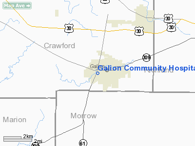
Galion Community Hospital Heliport |
Location & QuickFacts
| FAA Information Effective: | 2008-09-25 |
| Airport Identifier: | 01OI |
| Airport Status: | Operational |
| Longitude/Latitude: | 082-48-05.6510W/40-43-50.2080N
-82.801570/40.730613 (Estimated) |
| Elevation: | 1140 ft / 347.47 m (Estimated) |
| Land: | 0 acres |
| From nearest city: | 0 nautical miles N of Galion, OH |
| Location: | Crawford County, OH |
| Magnetic Variation: | 06W (1990) |
Owner & Manager
| Ownership: | Privately owned |
| Owner: | Galion Community Hospital |
| Address: | Portland Way South
Galion, OH44833 |
| Phone number: | 419-468-4841 |
| Manager: | David A West |
| Address: | Portland Way South
Galion, OH 44833 |
| Phone number: | 419-468-4841 |
Airport Operations and Facilities
| Airport Use: | Private
MEDICAL USE. |
| Segmented Circle: | No |
| Control Tower: | No |
| Lighting Schedule: | PHONE REQ
FOR PERIMETER LGTS CALL 419-468-4841. |
| Sectional chart: | Detroit |
| Region: | AGL - Great Lakes |
| Boundary ARTCC: | ZOB - Cleveland |
| Tie-in FSS: | CLE - Cleveland |
| FSS on Airport: | No |
| FSS Toll Free: | 1-800-WX-BRIEF |
Runway Information
Helipad H1
| Dimension: | 30 x 30 ft / 9.1 x 9.1 m |
| Surface: | CONC, Good Condition |
| |
Runway H1 |
Runway |
| Traffic Pattern: | Left | Left |
|
Radio Navigation Aids
| ID |
Type |
Name |
Ch |
Freq |
Var |
Dist |
| MNN | NDB | Marion | | 201.00 | 05W | 14.0 nm |
| MF | NDB | Manns | | 372.00 | 06W | 16.4 nm |
| AAU | NDB | Ashland | | 329.00 | 07W | 28.6 nm |
| TII | NDB | Tiffin | | 269.00 | 05W | 28.8 nm |
| DLZ | NDB | Delaware | | 215.00 | 06W | 30.6 nm |
| FZI | NDB | Fostoria | | 379.00 | 05W | 38.6 nm |
| MRT | NDB | Marysville | | 403.00 | 05W | 39.3 nm |
| DKG | NDB | Don Scott | | 348.00 | 05W | 41.1 nm |
| RUV | NDB | Rushsylvania | | 326.00 | 05W | 42.8 nm |
| BNR | NDB | Benton Ridge | | 334.00 | 05W | 43.1 nm |
| OS | NDB | Fuler | | 515.00 | 05W | 43.5 nm |
| MLR | NDB | Millersburg/dcmsnd | | 382.00 | 06W | 43.9 nm |
| CHC | NDB | Grens | | 272.00 | 04W | 44.5 nm |
| CM | NDB | Sumie | | 391.00 | 05W | 44.8 nm |
| HEH | NDB | Newark | | 524.00 | 06W | 45.1 nm |
| PCW | NDB | Port Clinton | | 423.00 | 06W | 47.5 nm |
| BUD | VOR | Buckeye | | 109.80 | 05W | 13.8 nm |
| MAH | VOR | Marathon | | 114.90 | 05W | 42.8 nm |
| TVT | VOR/DME | Tiverton | 112X | 116.50 | 03W | 34.9 nm |
| SKY | VOR/DME | Sandusky | 029X | 109.20 | 04W | 42.8 nm |
| DJB | VOR/DME | Dryer | 083X | 113.60 | 05W | 47.6 nm |
| MFD | VORTAC | Mansfield | 025X | 108.80 | 03W | 12.7 nm |
| APE | VORTAC | Appleton | 114X | 116.70 | 06W | 36.2 nm |
| FDY | VORTAC | Findlay | 019X | 108.20 | 02W | 45.5 nm |
| CMH | VOT | Port Columbus | | 111.00 | | 44.4 nm |
Remarks
- PRVDD APCH/DEP RTE OPNS FROM 070-090 DEG & FROM 320-350 DEG; TKOF/LNDG AREA MARKED; WIND INDICATOR IS MAINTD.
Images and information placed above are from
http://www.airport-data.com/airport/01OI/
We thank them for the data!
| General Info
|
| Country |
United States
|
| State |
OHIO
|
| FAA ID |
01OI
|
| Latitude |
40-43-50.208N
|
| Longitude |
082-48-05.651W
|
| Elevation |
1140 feet
|
| Near City |
GALION
|
We don't guarantee the information is fresh and accurate. The data may
be wrong or outdated.
For more up-to-date information please refer to other sources.
|
|


