 |
|
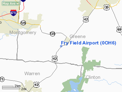
Location & QuickFacts
| FAA Information Effective: | 2008-09-25 |
| Airport Identifier: | 0OH6 |
| Airport Status: | Operational |
| Longitude/Latitude: | 084-01-10.7580W/39-36-02.2160N
-84.019655/39.600616 (Estimated) |
| Elevation: | 775 ft / 236.22 m (Estimated) |
| Land: | 5 acres |
| From nearest city: | 1 nautical miles SW of Spring Valley, OH |
| Location: | Greene County, OH |
| Magnetic Variation: | 04W (1985) |
Owner & Manager
| Ownership: | Privately owned |
| Owner: | Timothy John Fry |
| Address: | 2125 Centerville Rd
Spring Valley, OH 45370 |
| Phone number: | 513-862-5271 |
| Manager: | Timothy John Fry |
| Address: | 2125 Centerville Rd
Spring Valley, OH 45370 |
| Phone number: | 513-862-5271 |
Airport Operations and Facilities
| Airport Use: | Private |
| Wind indicator: | Yes |
| Segmented Circle: | No |
| Control Tower: | No |
| Sectional chart: | Cincinnati |
| Region: | AGL - Great Lakes |
| Boundary ARTCC: | ZID - Indianapolis |
| Tie-in FSS: | DAY - Dayton |
| FSS Toll Free: | 1-800-WX-BRIEF |
Runway Information
Runway 04/22
| Dimension: | 800 x 50 ft / 243.8 x 15.2 m |
| Surface: | TURF, |
| |
Runway 04 |
Runway 22 |
| Traffic Pattern: | Left | Left |
| Obstruction: | | 30 ft pline, 0.0 ft from runway |
|
Radio Navigation Aids
| ID |
Type |
Name |
Ch |
Freq |
Var |
Dist |
| XEN | NDB | Xenia | | 395.00 | 03W | 8.0 nm |
| IL | NDB | Airbo | | 407.00 | 04W | 14.7 nm |
| HW | NDB | Cubla | | 299.00 | 04W | 16.3 nm |
| CCJ | NDB | Clark County | | 341.00 | 04W | 19.8 nm |
| HKF | NDB | Hook Field | | 239.00 | 04W | 20.8 nm |
| ISZ | NDB | Cincinnati-blue Ash | | 388.00 | 04W | 27.2 nm |
| MDE | NDB | Madeira | | 379.00 | 04W | 27.5 nm |
| HAO | NDB | Hamilton | | 260.00 | 04W | 29.1 nm |
| CSS | NDB | Court House | | 414.00 | 05W | 29.1 nm |
| LUK | NDB | Cincinnati | | 335.00 | 04W | 30.4 nm |
| UYF | NDB | London | | 263.00 | 06W | 32.5 nm |
| PWF | NDB | Sportys | | 245.00 | 04W | 32.8 nm |
| HOC | NDB | Hillsboro | | 278.00 | 05W | 33.4 nm |
| OXD | NDB | Oxford | | 282.00 | 04W | 35.7 nm |
| BU | NDB | Boutn | | 230.00 | 05W | 39.9 nm |
| VES | NDB | Versailles | | 356.00 | 04W | 43.2 nm |
| RZT | NDB | Ross County | | 236.00 | 05W | 47.0 nm |
| EDJ | NDB | Bellefontaine | | 242.00 | 05W | 47.3 nm |
| OS | NDB | Fuler | | 515.00 | 05W | 47.4 nm |
| UR | NDB | Burln | | 321.00 | 04W | 48.4 nm |
| CYO | NDB | Circleville | | 366.00 | 05W | 48.4 nm |
| MRT | NDB | Marysville | | 403.00 | 05W | 48.7 nm |
| AMT | NDB | West Union | | 359.00 | 04W | 49.5 nm |
| FFO | TACAN | Patterson | 099X | | 04W | 13.2 nm |
| XSF | TACAN | Springfield | 065X | | 04W | 16.5 nm |
| XUB | VOR | Yellow Bud | | 112.50 | 05W | 48.5 nm |
| MXQ | VOR/DME | Midwest | 076X | 112.90 | 04W | 14.4 nm |
| SGH | VOR/DME | Springfield | 079X | 113.20 | 04W | 16.3 nm |
| DQN | VOR/DME | Dayton | 092X | 114.50 | 01W | 30.5 nm |
| RID | VORTAC | Richmond | 043X | 110.60 | 03W | 39.0 nm |
| ROD | VORTAC | Rosewood | 122X | 117.50 | 05W | 41.3 nm |
| CVG | VORTAC | Cincinnati | 120X | 117.30 | 04W | 47.4 nm |
| DAY | VOT | Dayton J M Cox-day | | 111.00 | | 20.3 nm |
| LUK | VOT | Cincinnati Muni/lunken | | 108.40 | | 34.0 nm |
Remarks
- 60' PLINE 1 MILE WEST OF ARPT.
- MAINTAIN MINIMUM 20:1 APCH SFC OVER OBST OR MOVE/REMOVE OBST; TFC PAT TO THE S OF LITTLE MIAMI RIVER.
Images and information placed above are from
http://www.airport-data.com/airport/0OH6/
We thank them for the data!
| General Info
|
| Country |
United States
|
| State |
OHIO
|
| FAA ID |
0OH6
|
| Latitude |
39-36-02.216N
|
| Longitude |
084-01-10.758W
|
| Elevation |
775 feet
|
| Near City |
SPRING VALLEY
|
We don't guarantee the information is fresh and accurate. The data may
be wrong or outdated.
For more up-to-date information please refer to other sources.
|
|


