 |
|
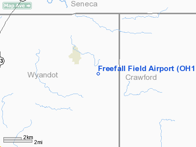
Location & QuickFacts
| FAA Information Effective: | 2008-09-25 |
| Airport Identifier: | OH18 |
| Airport Status: | Operational |
| Longitude/Latitude: | 083-08-25.0000W/40-55-57.0000N
-83.140278/40.932500 (Estimated) |
| Elevation: | 885 ft / 269.75 m (Surveyed) |
| Land: | 0 acres |
| From nearest city: | 2 nautical miles SE of Sycamore, OH |
| Location: | Wyandot County, OH |
| Magnetic Variation: | 06W (1985) |
Owner & Manager
| Ownership: | Privately owned |
| Owner: | David A Sniffen Iii |
| Address: | 4090 Sh 231
Sycamore, OH 44882 |
| Phone number: | 419-927-2710 |
| Address: |
|
Airport Operations and Facilities
| Airport Use: | Private |
| Segmented Circle: | No |
| Control Tower: | No |
| Sectional chart: | Detroit |
| Region: | AGL - Great Lakes |
| Boundary ARTCC: | ZOB - Cleveland |
| Tie-in FSS: | CLE - Cleveland |
| FSS on Airport: | No |
| FSS Toll Free: | 1-800-WX-BRIEF |
Runway Information
Runway 13/31
| Dimension: | 2000 x 66 ft / 609.6 x 20.1 m |
| Surface: | TURF, |
| |
Runway 13 |
Runway 31 |
| Traffic Pattern: | Left | Left |
| Obstruction: | 35 ft trees, 625.0 ft from runway | 35 ft trees, 600.0 ft from runway |
|
Radio Navigation Aids
| ID |
Type |
Name |
Ch |
Freq |
Var |
Dist |
| TII | NDB | Tiffin | | 269.00 | 05W | 10.4 nm |
| MNN | NDB | Marion | | 201.00 | 05W | 19.2 nm |
| FZI | NDB | Fostoria | | 379.00 | 05W | 19.3 nm |
| BNR | NDB | Benton Ridge | | 334.00 | 05W | 24.6 nm |
| MF | NDB | Manns | | 372.00 | 06W | 33.2 nm |
| RUV | NDB | Rushsylvania | | 326.00 | 05W | 37.3 nm |
| PCW | NDB | Port Clinton | | 423.00 | 06W | 37.3 nm |
| PDR | NDB | Ottawa | | 233.00 | 05W | 38.3 nm |
| DLZ | NDB | Delaware | | 215.00 | 06W | 39.4 nm |
| AAU | NDB | Ashland | | 329.00 | 07W | 40.3 nm |
| LYL | NDB | Lima | | 362.00 | 04W | 42.4 nm |
| MRT | NDB | Marysville | | 403.00 | 05W | 43.5 nm |
| EDJ | NDB | Bellefontaine | | 242.00 | 05W | 45.6 nm |
| TOL | TACAN | Toledo | 072X | | 05W | 49.7 nm |
| BUD | VOR | Buckeye | | 109.80 | 05W | 19.3 nm |
| MAH | VOR | Marathon | | 114.90 | 05W | 24.3 nm |
| AOH | VOR | Allen County | | 108.40 | 04W | 40.0 nm |
| SKY | VOR/DME | Sandusky | 029X | 109.20 | 04W | 37.3 nm |
| VWV | VOR/DME | Waterville | 078X | 113.10 | 02W | 38.5 nm |
| MFD | VORTAC | Mansfield | 025X | 108.80 | 03W | 25.3 nm |
| FDY | VORTAC | Findlay | 019X | 108.20 | 02W | 28.0 nm |
Remarks
- WEEKEND SKYDIVING & ULTRALIGHT OPNS.
- PROVIDED OBSTRUCTIONS ARE REMOVED/LOWERED TO PROVIDE 20:1 APCH SURFACE CLEARANCE.
Images and information placed above are from
http://www.airport-data.com/airport/OH18/
We thank them for the data!
| General Info
|
| Country |
United States
|
| State |
OHIO
|
| FAA ID |
OH18
|
| Latitude |
40-55-57.000N
|
| Longitude |
083-08-25.000W
|
| Elevation |
885 feet
|
| Near City |
SYCAMORE
|
We don't guarantee the information is fresh and accurate. The data may
be wrong or outdated.
For more up-to-date information please refer to other sources.
|
|


