 |
|
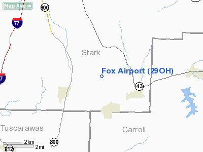
Location & QuickFacts
| FAA Information Effective: | 2008-09-25 |
| Airport Identifier: | 29OH |
| Airport Status: | Operational |
| Longitude/Latitude: | 081-18-09.3980W/40-41-11.2170N
-81.302611/40.686449 (Estimated) |
| Elevation: | 1020 ft / 310.90 m (Estimated) |
| Land: | 0 acres |
| From nearest city: | 2 nautical miles N of Magnolia, OH |
| Location: | Stark County, OH |
| Magnetic Variation: | 07W (1985) |
Owner & Manager
| Ownership: | Privately owned |
| Owner: | Reese E. Fox |
| Address: | 5496 Elson Se
Magnolia, OH 44643 |
| Phone number: | 216-866-3533 |
| Address: |
|
Airport Operations and Facilities
| Airport Use: | Private |
| Wind indicator: | Yes |
| Segmented Circle: | No |
| Control Tower: | No |
| Lighting Schedule: | PHONE REQ
FOR RWY LGTS CALL 216-866-9761 OR 3533. |
| Landing fee charge: | No |
| Sectional chart: | Detroit |
| Region: | AGL - Great Lakes |
| Boundary ARTCC: | ZOB - Cleveland |
| Tie-in FSS: | CLE - Cleveland |
| FSS on Airport: | No |
| FSS Toll Free: | 1-800-WX-BRIEF |
Airport Services
| Airframe Repair: | NONE |
| Power Plant Repair: | NONE |
Runway Information
Runway 10/28
| Dimension: | 1450 x 75 ft / 442.0 x 22.9 m |
| Surface: | TURF, |
| Edge Lights: | Low |
| |
Runway 10 |
Runway 28 |
| Traffic Pattern: | Left | Right |
| Obstruction: | 20 ft pline, 300.0 ft from runway | |
|
Radio Navigation Aids
| ID |
Type |
Name |
Ch |
Freq |
Var |
Dist |
| TSO | NDB | Tolson | | 395.00 | 07W | 12.7 nm |
| AK | NDB | Akron | | 362.00 | 07W | 23.4 nm |
| MLR | NDB | Millersburg/dcmsnd | | 382.00 | 06W | 27.4 nm |
| CFX | NDB | Cadiz | | 239.00 | 07W | 30.1 nm |
| HBD | NDB | Hubbard | | 408.00 | 08W | 44.9 nm |
| UCP | NDB | Castle | | 272.00 | 09W | 45.1 nm |
| AAU | NDB | Ashland | | 329.00 | 07W | 46.3 nm |
| CL | NDB | Harri | | 344.00 | 07W | 49.4 nm |
| BSV | VOR/DME | Briggs | 071X | 112.40 | 04W | 6.7 nm |
| ACO | VOR/DME | Akron | 091X | 114.40 | 04W | 25.7 nm |
| CTW | VOR/DME | Newcomerstown | 055X | 111.80 | 07W | 28.6 nm |
| TVT | VOR/DME | Tiverton | 112X | 116.50 | 03W | 40.1 nm |
| HLG | VOR/DME | Wheeling | 059X | 112.20 | 07W | 42.2 nm |
| AIR | VOR/DME | Bellaire | 118X | 117.10 | 07W | 46.0 nm |
| YNG | VORTAC | Youngstown | 027X | 109.00 | 05W | 48.1 nm |
| CAK | VOT | Akron/canton Regional | | 110.60 | | 15.2 nm |
Remarks
- USE IN VFR CONDITIONS ONLY.
Images and information placed above are from
http://www.airport-data.com/airport/29OH/
We thank them for the data!
| General Info
|
| Country |
United States
|
| State |
OHIO
|
| FAA ID |
29OH
|
| Latitude |
40-41-11.217N
|
| Longitude |
081-18-09.398W
|
| Elevation |
1020 feet
|
| Near City |
MAGNOLIA
|
We don't guarantee the information is fresh and accurate. The data may
be wrong or outdated.
For more up-to-date information please refer to other sources.
|
|


