 |
|
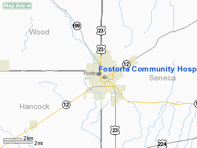
Fostoria Community Hospital Heliport |
Location & QuickFacts
| FAA Information Effective: | 2008-09-25 |
| Airport Identifier: | 99OI |
| Airport Status: | Operational |
| Longitude/Latitude: | 083-25-25.7330W/41-09-46.1920N
-83.423815/41.162831 (Estimated) |
| Elevation: | 768 ft / 234.09 m (Estimated) |
| Land: | 0 acres |
| From nearest city: | 0 nautical miles NW of Fostoria, OH |
| Location: | Hancock County, OH |
| Magnetic Variation: | 06W (2000) |
Owner & Manager
| Ownership: | Publicly owned |
| Owner: | Fostoria Hospital Association |
| Address: | 501 Van Buren St
Fostoria, OH 44830 |
| Phone number: | 419-435-7734 |
| Manager: | James Kneen |
| Address: | 501 Van Buren St
Fostoria, OH 44830 |
| Phone number: | 419-435-7734 |
Airport Operations and Facilities
| Airport Use: | Private
MEDICAL USE. |
| Wind indicator: | Yes |
| Segmented Circle: | No |
| Control Tower: | No |
| Sectional chart: | Detroit |
| Region: | AGL - Great Lakes |
| Boundary ARTCC: | ZOB - Cleveland |
| Tie-in FSS: | CLE - Cleveland |
| FSS Toll Free: | 1-800-WX-BRIEF |
Runway Information
Helipad H1
| Dimension: | 60 x 60 ft / 18.3 x 18.3 m |
| Surface: | ASPH, |
| |
Runway H1 |
Runway |
| Traffic Pattern: | Left | Left |
|
Radio Navigation Aids
| ID |
Type |
Name |
Ch |
Freq |
Var |
Dist |
| FZI | NDB | Fostoria | | 379.00 | 05W | 2.0 nm |
| TII | NDB | Tiffin | | 269.00 | 05W | 10.5 nm |
| BNR | NDB | Benton Ridge | | 334.00 | 05W | 14.0 nm |
| PDR | NDB | Ottawa | | 233.00 | 05W | 26.2 nm |
| PCW | NDB | Port Clinton | | 423.00 | 06W | 32.9 nm |
| MNN | NDB | Marion | | 201.00 | 05W | 36.5 nm |
| LYL | NDB | Lima | | 362.00 | 04W | 38.7 nm |
| USE | NDB | Fulton | | 375.00 | 05W | 41.7 nm |
| RUV | NDB | Rushsylvania | | 326.00 | 05W | 43.7 nm |
| DFI | NDB | Defiance | | 246.00 | 05W | 46.5 nm |
| TOL | TACAN | Toledo | 072X | | 05W | 30.9 nm |
| MAH | VOR | Marathon | | 114.90 | 05W | 14.1 nm |
| BUD | VOR | Buckeye | | 109.80 | 05W | 36.7 nm |
| AOH | VOR | Allen County | | 108.40 | 04W | 36.9 nm |
| VWV | VOR/DME | Waterville | 078X | 113.10 | 02W | 19.9 nm |
| SKY | VOR/DME | Sandusky | 029X | 109.20 | 04W | 38.4 nm |
| FDY | VORTAC | Findlay | 019X | 108.20 | 02W | 19.6 nm |
| MFD | VORTAC | Mansfield | 025X | 108.80 | 03W | 41.7 nm |
Remarks
- PROVIDED INGRESS/EGRESS FROM 010 TO 030 DEG AND 220 TO 330; AREA IS MKD; WIND INDICATOR IS MAINTAINED.
Images and information placed above are from
http://www.airport-data.com/airport/99OI/
We thank them for the data!
| General Info
|
| Country |
United States
|
| State |
OHIO
|
| FAA ID |
99OI
|
| Latitude |
41-09-46.192N
|
| Longitude |
083-25-25.733W
|
| Elevation |
768 feet
|
| Near City |
FOSTORIA
|
We don't guarantee the information is fresh and accurate. The data may
be wrong or outdated.
For more up-to-date information please refer to other sources.
|
|


