 |
|
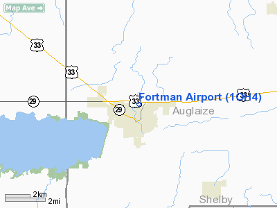
Location & QuickFacts
| FAA Information Effective: | 2008-09-25 |
| Airport Identifier: | 1OH4 |
| Airport Status: | Operational |
| Longitude/Latitude: | 084-23-11.8270W/40-33-19.1710N
-84.386619/40.555325 (Estimated) |
| Elevation: | 885 ft / 269.75 m (Estimated) |
| Land: | 0 acres |
| From nearest city: | 0 nautical miles N of St Marys, OH |
| Location: | Auglaize County, OH |
| Magnetic Variation: | 04W (1985) |
Owner & Manager
| Ownership: | Privately owned |
| Owner: | Tom Fortman |
| Address: | 14496 Co Road 66h
St Marys, OH 45885 |
| Phone number: | 419-394-4188 |
| Address: |
|
Airport Operations and Facilities
| Airport Use: | Private |
| Wind indicator: | Yes |
| Segmented Circle: | No |
| Control Tower: | No |
| Landing fee charge: | No |
| Sectional chart: | Detroit |
| Region: | AGL - Great Lakes |
| Boundary ARTCC: | ZID - Indianapolis |
| Tie-in FSS: | DAY - Dayton |
| FSS on Airport: | No |
| FSS Toll Free: | 1-800-WX-BRIEF |
Airport Services
| Airframe Repair: | NONE |
| Power Plant Repair: | NONE |
Runway Information
Runway 09/27
| Dimension: | 2400 x 70 ft / 731.5 x 21.3 m |
| Surface: | TURF, |
| |
Runway 09 |
Runway 27 |
| Traffic Pattern: | Right | Right |
|
Radio Navigation Aids
| ID |
Type |
Name |
Ch |
Freq |
Var |
Dist |
| CQA | NDB | Lakefield | | 205.00 | 04W | 9.2 nm |
| LYL | NDB | Lima | | 362.00 | 04W | 18.8 nm |
| VFU | NDB | Stanley | | 411.00 | 05W | 21.2 nm |
| VES | NDB | Versailles | | 356.00 | 04W | 21.9 nm |
| PLD | NDB | Portland | | 257.00 | 03W | 28.0 nm |
| EDJ | NDB | Bellefontaine | | 242.00 | 05W | 28.5 nm |
| RUV | NDB | Rushsylvania | | 326.00 | 05W | 33.3 nm |
| PDR | NDB | Ottawa | | 233.00 | 05W | 34.2 nm |
| BNR | NDB | Benton Ridge | | 334.00 | 05W | 43.0 nm |
| DFI | NDB | Defiance | | 246.00 | 05W | 46.9 nm |
| CCJ | NDB | Clark County | | 341.00 | 04W | 49.6 nm |
| FFO | TACAN | Patterson | 099X | | 04W | 46.8 nm |
| XSF | TACAN | Springfield | 065X | | 04W | 49.9 nm |
| AOH | VOR | Allen County | | 108.40 | 04W | 21.2 nm |
| MAH | VOR | Marathon | | 114.90 | 05W | 42.9 nm |
| DQN | VOR/DME | Dayton | 092X | 114.50 | 01W | 32.4 nm |
| SGH | VOR/DME | Springfield | 079X | 113.20 | 04W | 49.9 nm |
| MIE | VOR/DME | Muncie | 091X | 114.40 | 03W | 49.9 nm |
| ROD | VORTAC | Rosewood | 122X | 117.50 | 05W | 22.5 nm |
| FDY | VORTAC | Findlay | 019X | 108.20 | 02W | 37.4 nm |
| FWA | VORTAC | Fort Wayne | 125X | 117.80 | 00E | 44.5 nm |
| DAY | VOT | Dayton J M Cox-day | | 111.00 | | 40.0 nm |
| FWA | VOT | Fort Wayne Baer | | 111.00 | | 44.6 nm |
Remarks
- SILO 50' S OF RWY, HWY 66 E OF APT.
- VFR WEATHER CONDITIONS ONLY.
Images and information placed above are from
http://www.airport-data.com/airport/1OH4/
We thank them for the data!
| General Info
|
| Country |
United States
|
| State |
OHIO
|
| FAA ID |
1OH4
|
| Latitude |
40-33-19.171N
|
| Longitude |
084-23-11.827W
|
| Elevation |
885 feet
|
| Near City |
ST MARYS
|
We don't guarantee the information is fresh and accurate. The data may
be wrong or outdated.
For more up-to-date information please refer to other sources.
|
|


