 |
|
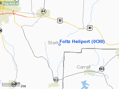
Location & QuickFacts
| FAA Information Effective: | 2008-09-25 |
| Airport Identifier: | 0OI0 |
| Airport Status: | Operational |
| Longitude/Latitude: | 081-14-48.3900W/40-44-09.2140N
-81.246775/40.735893 (Estimated) |
| Elevation: | 1012 ft / 308.46 m (Estimated) |
| Land: | 0 acres |
| From nearest city: | 4 nautical miles SE of East Canton, OH |
| Location: | Stark County, OH |
| Magnetic Variation: | 07W (1985) |
Owner & Manager
| Ownership: | Privately owned |
| Owner: | Dwain R. Foltz |
| Address: | 8810 Hill Church St Se
East Canton, OH 44730 |
| Phone number: | 216-488-1295 |
| Address: |
|
Airport Operations and Facilities
| Airport Use: | Private
PERSONAL USE. |
| Wind indicator: | Yes |
| Segmented Circle: | No |
| Control Tower: | No |
| Sectional chart: | Detroit |
| Region: | AGL - Great Lakes |
| Boundary ARTCC: | ZOB - Cleveland |
| Tie-in FSS: | CLE - Cleveland |
| FSS on Airport: | No |
| FSS Toll Free: | 1-800-WX-BRIEF |
Runway Information
Helipad H1
| Dimension: | 12 x 12 ft / 3.7 x 3.7 m |
| Surface: | CONC, |
| |
Runway H1 |
Runway |
| Traffic Pattern: | Left | Left |
|
Radio Navigation Aids
| ID |
Type |
Name |
Ch |
Freq |
Var |
Dist |
| TSO | NDB | Tolson | | 395.00 | 07W | 13.0 nm |
| AK | NDB | Akron | | 362.00 | 07W | 21.1 nm |
| MLR | NDB | Millersburg/dcmsnd | | 382.00 | 06W | 30.8 nm |
| CFX | NDB | Cadiz | | 239.00 | 07W | 31.8 nm |
| HBD | NDB | Hubbard | | 408.00 | 08W | 41.0 nm |
| UCP | NDB | Castle | | 272.00 | 09W | 41.5 nm |
| AAU | NDB | Ashland | | 329.00 | 07W | 47.8 nm |
| CL | NDB | Harri | | 344.00 | 07W | 48.7 nm |
| BSV | VOR/DME | Briggs | 071X | 112.40 | 04W | 8.4 nm |
| ACO | VOR/DME | Akron | 091X | 114.40 | 04W | 22.5 nm |
| CTW | VOR/DME | Newcomerstown | 055X | 111.80 | 07W | 32.2 nm |
| HLG | VOR/DME | Wheeling | 059X | 112.20 | 07W | 42.2 nm |
| TVT | VOR/DME | Tiverton | 112X | 116.50 | 03W | 43.5 nm |
| CXR | VOR/DME | Chardon | 074X | 112.70 | 05W | 47.1 nm |
| AIR | VOR/DME | Bellaire | 118X | 117.10 | 07W | 47.5 nm |
| YNG | VORTAC | Youngstown | 027X | 109.00 | 05W | 44.2 nm |
| EWC | VORTAC | Ellwood City | 105X | 115.80 | 08W | 47.4 nm |
| CAK | VOT | Akron/canton Regional | | 110.60 | | 14.0 nm |
| CLE | VOT | Cleveland | | 110.40 | | 48.9 nm |
Remarks
- E111: PRVDD APCH/DEP OPNS ARE CONDUCTED IN AN AREA FROM 180 DEGS CLKWS TO 360 DEGS USING THE TD PAD AS THE CNTR OF A COMPASS ROSE; E111 CONT'D: TKOF/LNDG AREA IS APROPLY MARKED; NON-OBSTRUCTING WIND INDCR IS MAINTD.
Images and information placed above are from
http://www.airport-data.com/airport/0OI0/
We thank them for the data!
| General Info
|
| Country |
United States
|
| State |
OHIO
|
| FAA ID |
0OI0
|
| Latitude |
40-44-09.214N
|
| Longitude |
081-14-48.390W
|
| Elevation |
1012 feet
|
| Near City |
EAST CANTON
|
We don't guarantee the information is fresh and accurate. The data may
be wrong or outdated.
For more up-to-date information please refer to other sources.
|
|


