 |
|
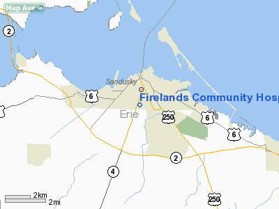
Firelands Community Hospital Nr 1 Heliport |
Location & QuickFacts
| FAA Information Effective: | 2008-09-25 |
| Airport Identifier: | 15OI |
| Airport Status: | Operational |
| Longitude/Latitude: | 082-42-39.6580W/41-26-10.1830N
-82.711016/41.436162 (Estimated) |
| Elevation: | 599 ft / 182.58 m (Estimated) |
| Land: | 0 acres |
| From nearest city: | 0 nautical miles N of Sandusky, OH |
| Location: | Erie County, OH |
| Magnetic Variation: | 06W (1985) |
Owner & Manager
| Ownership: | Privately owned |
| Owner: | Firelands Community Hospital
HAYES AVE FACILITY. |
| Address: | 2020 Hays Ave
Sandusky, OH 44870 |
| Phone number: | 419-627-5000 |
| Manager: | Administrator |
| Address: | 2020 Hayes Ave
Sandusky, OH 44870 |
| Phone number: | 419-627-5000 |
Airport Operations and Facilities
| Airport Use: | Private
MEDICAL USE. |
| Wind indicator: | Yes |
| Segmented Circle: | No |
| Control Tower: | No |
| Landing fee charge: | No |
| Sectional chart: | Detroit |
| Region: | AGL - Great Lakes |
| Boundary ARTCC: | ZOB - Cleveland |
| Tie-in FSS: | CLE - Cleveland |
| FSS on Airport: | No |
| FSS Toll Free: | 1-800-WX-BRIEF |
Runway Information
Helipad H1
| Dimension: | 400 x 330 ft / 121.9 x 100.6 m |
| Surface: | TURF, |
| |
Runway H1 |
Runway |
| Traffic Pattern: | Left | Left |
|
Radio Navigation Aids
| ID |
Type |
Name |
Ch |
Freq |
Var |
Dist |
| PCW | NDB | Port Clinton | | 423.00 | 06W | 8.7 nm |
| PT | NDB | Pelee Island | | 283.00 | 05W | 20.7 nm |
| TII | NDB | Tiffin | | 269.00 | 05W | 30.3 nm |
| CL | NDB | Harri | | 344.00 | 07W | 34.2 nm |
| FZI | NDB | Fostoria | | 379.00 | 05W | 34.3 nm |
| AAU | NDB | Ashland | | 329.00 | 07W | 35.2 nm |
| MF | NDB | Manns | | 372.00 | 06W | 42.0 nm |
| RYS | NDB | Grosse Ile | | 419.00 | 06W | 44.6 nm |
| EZE | NDB | Engel | | 226.00 | 07W | 44.6 nm |
| BKL | NDB | Burke Lakefront | | 416.00 | 07W | 47.5 nm |
| BNR | NDB | Benton Ridge | | 334.00 | 05W | 50.0 nm |
| TOL | TACAN | Toledo | 072X | | 05W | 49.9 nm |
| MAH | VOR | Marathon | | 114.90 | 05W | 50.0 nm |
| SKY | VOR/DME | Sandusky | 029X | 109.20 | 04W | 2.5 nm |
| DJB | VOR/DME | Dryer | 083X | 113.60 | 05W | 25.2 nm |
| VWV | VOR/DME | Waterville | 078X | 113.10 | 02W | 41.8 nm |
| YQG | VOR/DME | Windsor | 085X | 113.80 | 06W | 49.2 nm |
| MFD | VORTAC | Mansfield | 025X | 108.80 | 03W | 34.5 nm |
| CRL | VORTAC | Carleton | 104X | 115.70 | 03W | 49.7 nm |
| CLE | VOT | Cleveland | | 110.40 | | 38.9 nm |
Remarks
- PVDD INGRESS/EGRESS RTES ESTBD FM 160-250 DEG CLKWS FM HELI USING PAD AS CNTR OF COMPASS ROSE.
Images and information placed above are from
http://www.airport-data.com/airport/15OI/
We thank them for the data!
| General Info
|
| Country |
United States
|
| State |
OHIO
|
| FAA ID |
15OI
|
| Latitude |
41-26-10.183N
|
| Longitude |
082-42-39.658W
|
| Elevation |
599 feet
|
| Near City |
SANDUSKY
|
We don't guarantee the information is fresh and accurate. The data may
be wrong or outdated.
For more up-to-date information please refer to other sources.
|
|


