|
|
| Fayette County Airport |
| IATA: none – ICAO: none – FAA LID: I23 |
| Summary |
| Airport type |
Public |
| Owner |
Fayette County Commissioners |
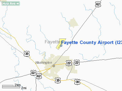
| Serves |
Washington Court House, Ohio |
| Elevation AMSL |
980 ft / 299 m |
| Coordinates |
39°34′13″N 083°25′14″W / 39.57028°N 83.42056°W / 39.57028; -83.42056 |
| Runways |
| Direction |
Length |
Surface |
| ft |
m |
| 5/23 |
5,097 |
1,554 |
Asphalt |
| Statistics (2009) |
| Aircraft operations |
29,405 |
| Based aircraft |
21 |
| Source: Federal Aviation Administration |
Fayette County Airport (FAA LID: I23) is a county-owned, public-use airport located two nautical miles (3.7 km) northeast of the central business district of Washington Court House, a city in Fayette County, Ohio, United States. According to the FAA's National Plan of Integrated Airport Systems for 2009–2013, it was classified as a general aviation airport.
Facilities and aircraft
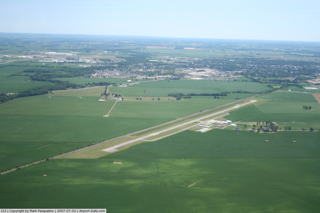
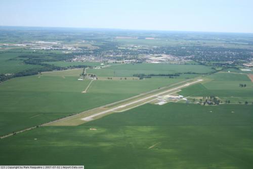
Fayette County Airport covers an area of 40 acres (16 ha) at an elevation of 980 feet (299 m) above mean sea level. It has one runway designated 5/23 with an asphalt surface measuring 5,097 by 75 feet (1,554 x 23 m).
For the 12-month period ending May 28, 2009, the airport had 29,405 aircraft operations, an average of 80 per day: 97% general aviation, 2% air taxi, and 1% military. At that time there were 21 aircraft based at this airport: 95% single-engine and 5% multi-engine.
The above content comes from Wikipedia and is published under free licenses – click here to read more.
 |
(Click on the photo to enlarge) |
 |
(Click on the photo to enlarge) |
Location & QuickFacts
| FAA Information Effective: | 2008-09-25 |
| Airport Identifier: | I23 |
| Airport Status: | Operational |
| Longitude/Latitude: | 083-25-13.8582W/39-34-13.4545N
-83.420516/39.570404 (Estimated) |
| Elevation: | 980 ft / 298.70 m (Surveyed) |
| Land: | 40 acres |
| From nearest city: | 2 nautical miles NE of Washington Court House, OH |
| Location: | Fayette County, OH |
| Magnetic Variation: | 06W (2000) |
Owner & Manager
| Ownership: | Publicly owned |
| Owner: | Fayette County Commissioners |
| Address: | 2770 State Route 38
Wash. Courthouse, OH 43160 |
| Phone number: | 740-335-2430 |
| Manager: | Thomas D. Esper |
| Address: | 2770 St Rt 38 Ne
Wash. Courthouse, OH 43160 |
| Phone number: | 740-335-2430 |
Airport Operations and Facilities
| Airport Use: | Open to public |
| Wind indicator: | Yes |
| Segmented Circle: | No |
| Control Tower: | No |
| Lighting Schedule: | DAWN-DUSK
ACTIVATE MIRL RY 05/23 & REIL RY 23 - CTAF. |
| Beacon Color: | Clear-Green (lighted land airport) |
| Landing fee charge: | No |
| Sectional chart: | Cincinnati |
| Region: | AGL - Great Lakes |
| Traffic Pattern Alt: | 800 ft |
| Boundary ARTCC: | ZID - Indianapolis |
| Tie-in FSS: | DAY - Dayton |
| FSS on Airport: | No |
| FSS Toll Free: | 1-800-WX-BRIEF |
| NOTAMs Facility: | DAY (NOTAM-d service avaliable) |
| Federal Agreements: | N |
Airport Communications
| CTAF: | 122.800 |
| Unicom: | 122.800 |
Airport Services
| Fuel available: | 100LLA MOGAS |
| Bottled Oxygen: | NONE |
| Bulk Oxygen: | NONE |
Runway Information
Runway 05/23
| Dimension: | 5097 x 75 ft / 1553.6 x 22.9 m |
| Surface: | ASPH, Good Condition |
| Weight Limit: | Single wheel: 30000 lbs.
Dual wheel: 40000 lbs. |
| Edge Lights: | Medium |
| |
Runway 05 |
Runway 23 |
| Longitude: | 083-25-32.0818W | 083-24-55.6316W |
| Latitude: | 39-33-52.5901N | 39-34-34.3180N |
| Elevation: | 978.00 ft | 976.00 ft |
| Alignment: | 34 | 127 |
| Traffic Pattern: | Left | Left |
| Markings: | Non-precision instrument, Good Condition | Non-precision instrument, Good Condition
RWY 23 MARKINGS POOR, WEATHERED. |
| VASI: | | 4-light PAPI on left side |
| Runway End Identifier: | No | Yes |
| Centerline Lights: | No | No |
| Touchdown Lights: | No | No |
| Obstruction: | 28 ft rr, 201.0 ft from runway, 245 ft right of centerline
+28 FT RR 0 FT FM END 240 FT R. | 28 ft rr, 201.0 ft from runway, 240 ft left of centerline
+28 RR 0' FM RY END 220 FT L; +12-20 FT BRUSH/TREES 0-200 FT FM 220 L. |
|
Radio Navigation Aids
| ID |
Type |
Name |
Ch |
Freq |
Var |
Dist |
| CSS | NDB | Court House | | 414.00 | 05W | 2.3 nm |
| IL | NDB | Airbo | | 407.00 | 04W | 15.4 nm |
| BU | NDB | Boutn | | 230.00 | 05W | 18.0 nm |
| RZT | NDB | Ross County | | 236.00 | 05W | 19.8 nm |
| CYO | NDB | Circleville | | 366.00 | 05W | 20.6 nm |
| UYF | NDB | London | | 263.00 | 06W | 22.0 nm |
| HOC | NDB | Hillsboro | | 278.00 | 05W | 23.9 nm |
| CCJ | NDB | Clark County | | 341.00 | 04W | 24.6 nm |
| HW | NDB | Cubla | | 299.00 | 04W | 24.8 nm |
| XEN | NDB | Xenia | | 395.00 | 03W | 25.1 nm |
| OS | NDB | Fuler | | 515.00 | 05W | 31.9 nm |
| CHC | NDB | Grens | | 272.00 | 04W | 32.0 nm |
| EOP | NDB | Waverly | | 385.00 | 06W | 33.2 nm |
| DKG | NDB | Don Scott | | 348.00 | 05W | 34.5 nm |
| PZO | NDB | Peebles | | 329.00 | 02W | 39.3 nm |
| MRT | NDB | Marysville | | 403.00 | 05W | 39.6 nm |
| CM | NDB | Sumie | | 391.00 | 05W | 39.6 nm |
| AMT | NDB | West Union | | 359.00 | 04W | 43.5 nm |
| DLZ | NDB | Delaware | | 215.00 | 06W | 44.9 nm |
| PWF | NDB | Sportys | | 245.00 | 04W | 47.4 nm |
| HKF | NDB | Hook Field | | 239.00 | 04W | 47.8 nm |
| MDE | NDB | Madeira | | 379.00 | 04W | 48.2 nm |
| ISZ | NDB | Cincinnati-blue Ash | | 388.00 | 04W | 49.0 nm |
| LUK | NDB | Cincinnati | | 335.00 | 04W | 49.4 nm |
| XSF | TACAN | Springfield | 065X | | 04W | 25.2 nm |
| LCK | TACAN | Rickenbacker | 069X | | 05W | 26.9 nm |
| FFO | TACAN | Patterson | 099X | | 04W | 32.9 nm |
| XUB | VOR | Yellow Bud | | 112.50 | 05W | 20.7 nm |
| MXQ | VOR/DME | Midwest | 076X | 112.90 | 04W | 19.6 nm |
| SGH | VOR/DME | Springfield | 079X | 113.20 | 04W | 25.3 nm |
| CMH | VOT | Port Columbus | | 111.00 | | 35.5 nm |
| DAY | VOT | Dayton J M Cox-day | | 111.00 | | 42.0 nm |
Remarks
Images and information placed above are from
http://www.airport-data.com/airport/I23/
We thank them for the data!
| General Info
|
| Country |
United States
|
| State |
OHIO
|
| FAA ID |
I23
|
| Latitude |
39-34-13.446N
|
| Longitude |
083-25-13.888W
|
| Elevation |
982 feet
|
| Near City |
WASHINGTON COURT HOUSE
|
We don't guarantee the information is fresh and accurate. The data may
be wrong or outdated.
For more up-to-date information please refer to other sources.
|
|