 |
|
Location & QuickFacts
| FAA Information Effective: | 2008-09-25 |
| Airport Identifier: | 00OH |
| Airport Status: | Operational |
| Longitude/Latitude: | 084-08-31.8110W/41-35-27.1840N
-84.142170/41.590884 (Estimated) |
| Elevation: | 785 ft / 239.27 m (Estimated) |
| Land: | 20 acres |
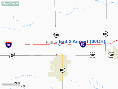
| From nearest city: | 3 nautical miles N of Wauseon, OH |
| Location: | Fulton County, OH |
| Magnetic Variation: | 05W (1985) |
Owner & Manager
| Ownership: | Privately owned |
| Owner: | Orville Richer |
| Address: | Rr 3 14796 Sh 108
Wauseon, OH 43567 |
| Phone number: | 419-335-6766 |
| Manager: | Orville Richer |
| Address: | Rr 3, Box 41
Wauseon, OH 43567 |
| Phone number: | 419-335-6766 |
Airport Operations and Facilities
| Airport Use: | Private |
| Wind indicator: | No |
| Segmented Circle: | No |
| Control Tower: | No |
| Landing fee charge: | No |
| Sectional chart: | Detroit |
| Region: | AGL - Great Lakes |
| Boundary ARTCC: | ZOB - Cleveland |
| Tie-in FSS: | CLE - Cleveland |
| FSS on Airport: | No |
| FSS Toll Free: | 1-800-WX-BRIEF |
Airport Services
| Airframe Repair: | NONE |
| Power Plant Repair: | NONE |
| Bottled Oxygen: | NONE |
| Bulk Oxygen: | NONE |
Runway Information
Runway 08/26
| Dimension: | 2695 x 90 ft / 821.4 x 27.4 m |
| Surface: | TURF, Good Condition |
| |
Runway 08 |
Runway 26 |
| Traffic Pattern: | Right | Left |
| Markings: | Basic, Fair Condition | Basic, Fair Condition |
| Runway End Identifier: | No | No |
| Centerline Lights: | No | No |
| Touchdown Lights: | No | No |
| Obstruction: | 40 ft pline, 805.0 ft from runway, 20:1 slope to clear | 44 ft sign, 380.0 ft from runway, 96 ft right of centerline, 9:1 slope to clear |
|
Radio Navigation Aids
| ID |
Type |
Name |
Ch |
Freq |
Var |
Dist |
| USE | NDB | Fulton | | 375.00 | 05W | 1.2 nm |
| BYN | NDB | Bryan | | 260.00 | 04W | 16.0 nm |
| ADG | NDB | Adrian | | 278.00 | 06W | 17.0 nm |
| DFI | NDB | Defiance | | 246.00 | 05W | 20.0 nm |
| TCU | NDB | Tecumseh | | 239.00 | 04W | 29.2 nm |
| PDR | NDB | Ottawa | | 233.00 | 05W | 34.5 nm |
| BNR | NDB | Benton Ridge | | 334.00 | 05W | 40.4 nm |
| FZI | NDB | Fostoria | | 379.00 | 05W | 41.4 nm |
| ANQ | NDB | Angola | | 347.00 | 05W | 42.6 nm |
| VFU | NDB | Stanley | | 411.00 | 05W | 48.7 nm |
| TOL | TACAN | Toledo | 072X | | 05W | 15.4 nm |
| MAH | VOR | Marathon | | 114.90 | 05W | 40.8 nm |
| VWV | VOR/DME | Waterville | 078X | 113.10 | 02W | 24.2 nm |
| LFD | VOR/DME | Litchfield | 049X | 111.20 | 05W | 39.8 nm |
| JXN | VOR/DME | Jackson | 033X | 109.60 | 05W | 42.6 nm |
| CRL | VORTAC | Carleton | 104X | 115.70 | 03W | 41.2 nm |
| FDY | VORTAC | Findlay | 019X | 108.20 | 02W | 42.0 nm |
| YIP | VOT | Willow Run | | 112.00 | | 47.6 nm |
Remarks
Images and information placed above are from
http://www.airport-data.com/airport/00OH/
We thank them for the data!
| General Info
|
| Country |
United States
|
| State |
OHIO
|
| FAA ID |
00OH
|
| Latitude |
41-35-27.184N
|
| Longitude |
084-08-31.811W
|
| Elevation |
785 feet
|
| Near City |
WAUSEON
|
We don't guarantee the information is fresh and accurate. The data may
be wrong or outdated.
For more up-to-date information please refer to other sources.
|
|


