 |
|
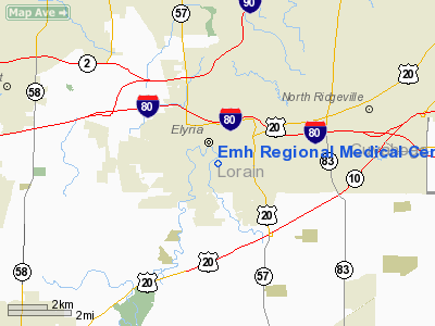
Emh Rgnl Medical Center Heliport |
Location & QuickFacts
| FAA Information Effective: | 2008-09-25 |
| Airport Identifier: | OI23 |
| Airport Status: | Operational |
| Longitude/Latitude: | 082-05-51.5320W/41-21-54.1680N
-82.097648/41.365047 (Estimated) |
| Elevation: | 867 ft / 264.26 m (Estimated) |
| Land: | 0 acres |
| From nearest city: | 0 nautical miles of Elyria, OH |
| Location: | Lorain County, OH |
| Magnetic Variation: | 06W (1985) |
Owner & Manager
| Ownership: | Privately owned |
| Owner: | Emh Regional Medical Center |
| Address: | 630 East River Street
Elyria, OH 44035 |
| Phone number: | 216-323-7500 |
| Manager: | James Keegan |
| Address: | 630 East River Street
Elyria, OH 44035 |
| Phone number: | 216-329-7500 |
Airport Operations and Facilities
| Airport Use: | Private
MEDICAL USE. |
| Wind indicator: | Yes |
| Segmented Circle: | No |
| Control Tower: | No |
| Landing fee charge: | No |
| Sectional chart: | Detroit |
| Region: | AGL - Great Lakes |
| Boundary ARTCC: | ZOB - Cleveland |
| Tie-in FSS: | CLE - Cleveland |
| FSS on Airport: | No |
| FSS Toll Free: | 1-800-WX-BRIEF |
Runway Information
Helipad H1
| Dimension: | 30 x 30 ft / 9.1 x 9.1 m |
| Surface: | CONC, |
| |
Runway H1 |
Runway |
| Traffic Pattern: | Left | Left |
|
Radio Navigation Aids
| ID |
Type |
Name |
Ch |
Freq |
Var |
Dist |
| CL | NDB | Harri | | 344.00 | 07W | 6.2 nm |
| EZE | NDB | Engel | | 226.00 | 07W | 18.5 nm |
| BKL | NDB | Burke Lakefront | | 416.00 | 07W | 21.9 nm |
| AAU | NDB | Ashland | | 329.00 | 07W | 25.2 nm |
| PT | NDB | Pelee Island | | 283.00 | 05W | 35.8 nm |
| PCW | NDB | Port Clinton | | 423.00 | 06W | 35.9 nm |
| AK | NDB | Akron | | 362.00 | 07W | 36.7 nm |
| LQL | NDB | Lakeland | | 263.00 | 08W | 37.5 nm |
| MF | NDB | Manns | | 372.00 | 06W | 39.3 nm |
| DJB | VOR/DME | Dryer | 083X | 113.60 | 05W | 2.9 nm |
| SKY | VOR/DME | Sandusky | 029X | 109.20 | 04W | 25.5 nm |
| LNN | VOR/DME | Lost Nation | 039X | 110.20 | 08W | 37.2 nm |
| CXR | VOR/DME | Chardon | 074X | 112.70 | 05W | 43.1 nm |
| ACO | VOR/DME | Akron | 091X | 114.40 | 04W | 43.4 nm |
| BSV | VOR/DME | Briggs | 071X | 112.40 | 04W | 48.2 nm |
| MFD | VORTAC | Mansfield | 025X | 108.80 | 03W | 37.3 nm |
| CLE | VOT | Cleveland | | 110.40 | | 11.5 nm |
| CAK | VOT | Akron/canton Regional | | 110.60 | | 40.1 nm |
Remarks
- OPNS ARE CONDUCTED ONLY WHEN WIND IS LESS THAN 15 KNOTS; EGRESS/INGRESS ROUTES MUST BE OVER THE EAST BRANCH OF THE BLACK RIVER NORTH OR SOUTHWARD. WITH THE FINAL INGRESS/EGRESS FROM 315 DEG TO 345 DEG CLOCKWISE FROM THE HELIPAD TO THE RIVER.
Images and information placed above are from
http://www.airport-data.com/airport/OI23/
We thank them for the data!
| General Info
|
| Country |
United States
|
| State |
OHIO
|
| FAA ID |
OI23
|
| Latitude |
41-21-54.168N
|
| Longitude |
082-05-51.532W
|
| Elevation |
867 feet
|
| Near City |
ELYRIA
|
We don't guarantee the information is fresh and accurate. The data may
be wrong or outdated.
For more up-to-date information please refer to other sources.
|
|


