 |
|
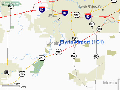
Location & QuickFacts
| FAA Information Effective: | 2008-09-25 |
| Airport Identifier: | 1G1 |
| Airport Status: | Operational |
| Longitude/Latitude: | 082-06-00.9000W/41-19-53.5000N
-82.100250/41.331528 (Estimated) |
| Elevation: | 758 ft / 231.04 m (Surveyed) |
| Land: | 66 acres |
| From nearest city: | 2 nautical miles S of Elyria, OH |
| Location: | Lorain County, OH |
| Magnetic Variation: | 06W (1985) |
Owner & Manager
| Ownership: | Privately owned |
| Owner: | Angelo A. Gousios |
| Address: | 2440 Se Federal Hwy, Suite V
Stuart, FL 34994 |
| Phone number: | 772-288-0700 |
| Manager: | Angelo Gousios |
| Address: | 10800 Middle Ave
Elyria, OH 44035 |
| Phone number: | 440-343-4943 |
Airport Operations and Facilities
| Airport Use: | Open to public |
| Wind indicator: | Yes |
| Segmented Circle: | No |
| Control Tower: | No |
| Lighting Schedule: | DUSK-DAWN |
| Beacon Color: | Clear-Green (lighted land airport) |
| Landing fee charge: | No |
| Sectional chart: | Detroit |
| Region: | AGL - Great Lakes |
| Boundary ARTCC: | ZOB - Cleveland |
| Tie-in FSS: | CLE - Cleveland |
| FSS on Airport: | No |
| FSS Toll Free: | 1-800-WX-BRIEF |
| NOTAMs Facility: | CLE (NOTAM-d service avaliable) |
Airport Communications
| CTAF: | 122.800 |
| Unicom: | 122.800 |
Airport Services
| Fuel available: | 100LL
FUEL AVBL 24 HRS WITH CREDIT CARD. |
Runway Information
Runway 09/27
| Dimension: | 3053 x 48 ft / 930.6 x 14.6 m |
| Surface: | ASPH, Good Condition |
| Edge Lights: | Low |
| |
Runway 09 |
Runway 27 |
| Longitude: | 082-06-20.8260W | 082-05-40.9540W |
| Latitude: | 41-19-52.1780N | 41-19-54.7610N |
| Elevation: | 756.00 ft | 758.00 ft |
| Alignment: | 85 | 127 |
| Traffic Pattern: | Left | Left |
| Markings: | Nonstandard, Fair Condition | Nonstandard, Fair Condition |
| Runway End Identifier: | No | No |
| Obstruction: | 71 ft tree, 201.0 ft from runway, 105 ft right of centerline
RWY 09 +64-75 FT TREE 125-200 FT FM 105-125 FT R. | 81 ft tree, 201.0 ft from runway, 96 ft right of centerline
RWY 27 +84 FT TREES 0-180 FT FM THLD 115-125 FT L; +81 FT TREE 180-200 FT FM THLD 96 FT R. |
|
Radio Navigation Aids
| ID |
Type |
Name |
Ch |
Freq |
Var |
Dist |
| CL | NDB | Harri | | 344.00 | 07W | 6.1 nm |
| EZE | NDB | Engel | | 226.00 | 07W | 19.5 nm |
| BKL | NDB | Burke Lakefront | | 416.00 | 07W | 23.0 nm |
| AAU | NDB | Ashland | | 329.00 | 07W | 23.2 nm |
| AK | NDB | Akron | | 362.00 | 07W | 35.9 nm |
| PCW | NDB | Port Clinton | | 423.00 | 06W | 36.4 nm |
| PT | NDB | Pelee Island | | 283.00 | 05W | 37.2 nm |
| MF | NDB | Manns | | 372.00 | 06W | 37.4 nm |
| LQL | NDB | Lakeland | | 263.00 | 08W | 38.7 nm |
| MLR | NDB | Millersburg/dcmsnd | | 382.00 | 06W | 48.6 nm |
| DJB | VOR/DME | Dryer | 083X | 113.60 | 05W | 3.2 nm |
| SKY | VOR/DME | Sandusky | 029X | 109.20 | 04W | 25.8 nm |
| LNN | VOR/DME | Lost Nation | 039X | 110.20 | 08W | 38.4 nm |
| ACO | VOR/DME | Akron | 091X | 114.40 | 04W | 42.8 nm |
| CXR | VOR/DME | Chardon | 074X | 112.70 | 05W | 43.7 nm |
| BSV | VOR/DME | Briggs | 071X | 112.40 | 04W | 46.7 nm |
| MFD | VORTAC | Mansfield | 025X | 108.80 | 03W | 35.6 nm |
| CLE | VOT | Cleveland | | 110.40 | | 12.3 nm |
| CAK | VOT | Akron/canton Regional | | 110.60 | | 38.9 nm |
Remarks
Images and information placed above are from
http://www.airport-data.com/airport/1G1/
We thank them for the data!
| General Info
|
| Country |
United States
|
| State |
OHIO
|
| FAA ID |
1G1
|
| Latitude |
41-19-53.500N
|
| Longitude |
082-06-00.900W
|
| Elevation |
758 feet
|
| Near City |
ELYRIA
|
We don't guarantee the information is fresh and accurate. The data may
be wrong or outdated.
For more up-to-date information please refer to other sources.
|
|


