|
|
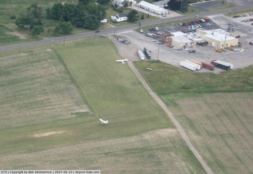 |
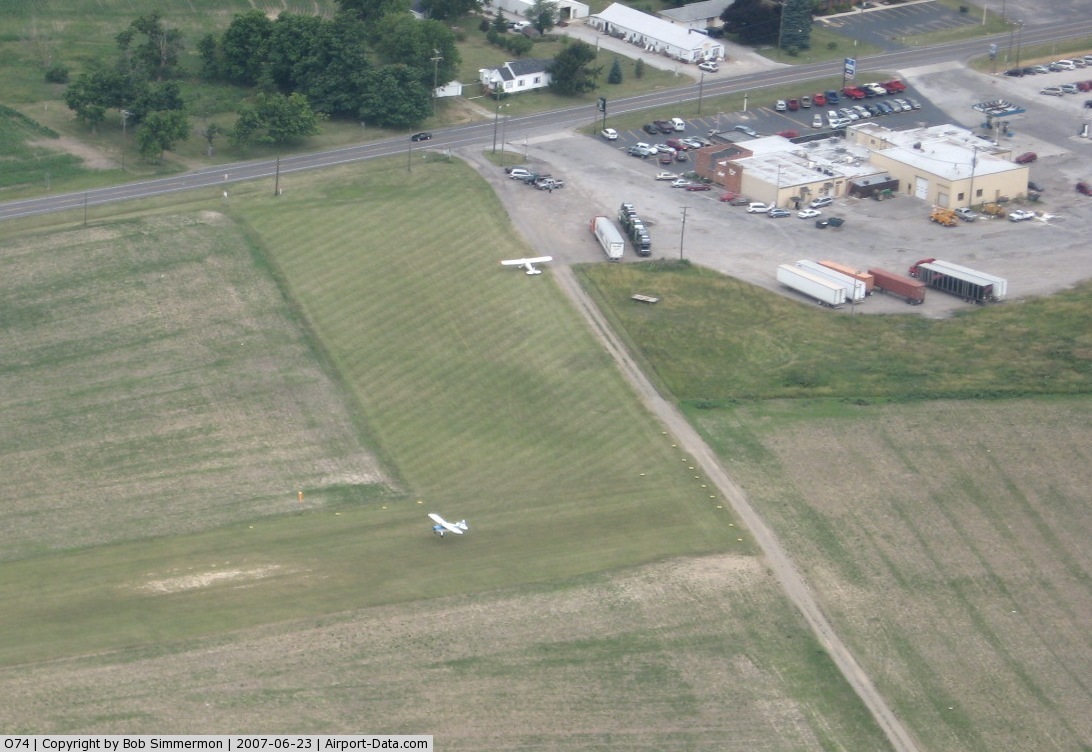
(Click on the photo to enlarge) |
Location & QuickFacts
| FAA Information Effective: | 2008-09-25 |
| Airport Identifier: | O74 |
| Airport Status: | Operational |
| Longitude/Latitude: | 083-30-42.0000W/40-31-29.0000N
-83.511667/40.524722 (Estimated) |
| Elevation: | 1045 ft / 318.52 m (Estimated) |
| Land: | 10 acres |
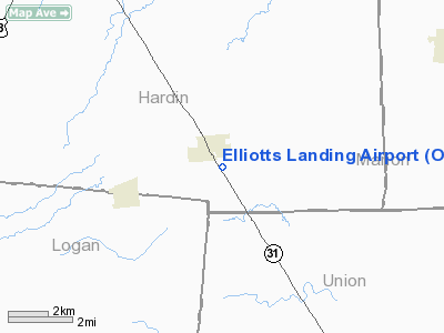
| From nearest city: | 1 nautical miles SE of Mount Victory, OH |
| Location: | Hardin County, OH |
| Magnetic Variation: | 05W (1995) |
Owner & Manager
| Ownership: | Privately owned |
| Owner: | Elliot & Elliott Inc |
| Address: | Box 257 491 S Main St
Mt Victory, OH 43340-0257 |
| Phone number: | 937-354-2851 |
| Manager: | Edward Elliott Ii |
| Address: | Box 257 491 S Main St
Mt Victory, OH 43340-0257 |
| Phone number: | 937-354-2851 |
Airport Operations and Facilities
| Airport Use: | Open to public |
| Wind indicator: | Yes |
| Segmented Circle: | No |
| Control Tower: | No |
| Sectional chart: | Detroit |
| Region: | AGL - Great Lakes |
| Boundary ARTCC: | ZID - Indianapolis |
| Tie-in FSS: | DAY - Dayton |
| FSS on Airport: | No |
| FSS Toll Free: | 1-800-WX-BRIEF |
| NOTAMs Facility: | DAY (NOTAM-d service avaliable) |
Airport Communications
Airport Services
Runway Information
Runway 15/33
| Dimension: | 2750 x 110 ft / 838.2 x 33.5 m |
| Surface: | TURF, Fair Condition |
| |
Runway 15 |
Runway 33 |
| Traffic Pattern: | Left | Left |
| Obstruction: | 58 ft trees, 850.0 ft from runway, 82 ft left of centerline, 14:1 slope to clear | 28 ft pline, 400.0 ft from runway, 162 ft left of centerline, 14:1 slope to clear |
|
Radio Navigation Aids
| ID |
Type |
Name |
Ch |
Freq |
Var |
Dist |
| RUV | NDB | Rushsylvania | | 326.00 | 05W | 8.2 nm |
| EDJ | NDB | Bellefontaine | | 242.00 | 05W | 16.6 nm |
| MRT | NDB | Marysville | | 403.00 | 05W | 19.4 nm |
| MNN | NDB | Marion | | 201.00 | 05W | 20.9 nm |
| DLZ | NDB | Delaware | | 215.00 | 06W | 23.9 nm |
| LYL | NDB | Lima | | 362.00 | 04W | 25.7 nm |
| BNR | NDB | Benton Ridge | | 334.00 | 05W | 30.7 nm |
| OS | NDB | Fuler | | 515.00 | 05W | 30.7 nm |
| DKG | NDB | Don Scott | | 348.00 | 05W | 33.3 nm |
| UYF | NDB | London | | 263.00 | 06W | 35.6 nm |
| PDR | NDB | Ottawa | | 233.00 | 05W | 37.0 nm |
| TII | NDB | Tiffin | | 269.00 | 05W | 37.1 nm |
| CHC | NDB | Grens | | 272.00 | 04W | 38.0 nm |
| FZI | NDB | Fostoria | | 379.00 | 05W | 40.3 nm |
| CCJ | NDB | Clark County | | 341.00 | 04W | 41.0 nm |
| BU | NDB | Boutn | | 230.00 | 05W | 44.7 nm |
| CM | NDB | Sumie | | 391.00 | 05W | 47.5 nm |
| CQA | NDB | Lakefield | | 205.00 | 04W | 48.2 nm |
| XSF | TACAN | Springfield | 065X | | 04W | 43.9 nm |
| FFO | TACAN | Patterson | 099X | | 04W | 49.2 nm |
| BUD | VOR | Buckeye | | 109.80 | 05W | 21.2 nm |
| AOH | VOR | Allen County | | 108.40 | 04W | 23.5 nm |
| MAH | VOR | Marathon | | 114.90 | 05W | 30.3 nm |
| SGH | VOR/DME | Springfield | 079X | 113.20 | 04W | 44.1 nm |
| FDY | VORTAC | Findlay | 019X | 108.20 | 02W | 28.2 nm |
| ROD | VORTAC | Rosewood | 122X | 117.50 | 05W | 28.2 nm |
| MFD | VORTAC | Mansfield | 025X | 108.80 | 03W | 46.8 nm |
| APE | VORTAC | Appleton | 114X | 116.70 | 06W | 47.9 nm |
| CMH | VOT | Port Columbus | | 111.00 | | 42.9 nm |
| DAY | VOT | Dayton J M Cox-day | | 111.00 | | 49.6 nm |
Remarks
- PRVDD AREA 125 FT EITHER SIDE RY CNTRLN & 200 FT OFF RY ENDS IS CLEAR' OBSTN IN RY APCH CLEARED OR THLD DSPLCD TO PRVD A CLEAR 20:1 APCH.
Images and information placed above are from
http://www.airport-data.com/airport/O74/
We thank them for the data!
| General Info
|
| Country |
United States
|
| State |
OHIO
|
| FAA ID |
O74
|
| Latitude |
40-31-29.000N
|
| Longitude |
083-30-42.000W
|
| Elevation |
1045 feet
|
| Near City |
MOUNT VICTORY
|
We don't guarantee the information is fresh and accurate. The data may
be wrong or outdated.
For more up-to-date information please refer to other sources.
|
|