 |
|
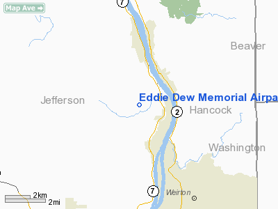
Eddie Dew Memorial Airpark Airport |
Location & QuickFacts
| FAA Information Effective: | 2008-09-25 |
| Airport Identifier: | 1G8 |
| Airport Status: | Operational |
| Longitude/Latitude: | 080-37-41.2650W/40-28-33.2380N
-80.628129/40.475899 (Estimated) |
| Elevation: | 1084 ft / 330.40 m (Surveyed) |
| Land: | 22 acres |
| From nearest city: | 2 nautical miles NW of Toronto, OH |
| Location: | Jefferson County, OH |
| Magnetic Variation: | 07W (1985) |
Owner & Manager
| Ownership: | Privately owned |
| Owner: | Eddie Dew Mem Airpark |
| Address: | Box 159a Rd 2
Toronto, OH 43964 |
| Phone number: | 740-512-3138 |
| Manager: | Rich Jeffers |
| Address: | 1108 Hyland Ave
Brilliant, OH 43913 |
| Phone number: | 740-598-4884 |
Airport Operations and Facilities
| Airport Use: | Open to public |
| Wind indicator: | Yes |
| Segmented Circle: | No |
| Control Tower: | No |
| Lighting Schedule: | RDO-CTL
ACTVT LIRL RY 16/34 - CTAF. |
| Landing fee charge: | No |
| Sectional chart: | Detroit |
| Region: | AGL - Great Lakes |
| Boundary ARTCC: | ZOB - Cleveland |
| Tie-in FSS: | CLE - Cleveland |
| FSS on Airport: | No |
| FSS Toll Free: | 1-800-WX-BRIEF |
| NOTAMs Facility: | CLE (NOTAM-d service avaliable) |
Airport Communications
Airport Services
| Airframe Repair: | NONE |
| Power Plant Repair: | NONE |
| Bottled Oxygen: | NONE |
| Bulk Oxygen: | NONE |
Runway Information
Runway 16/34
| Dimension: | 2268 x 145 ft / 691.3 x 44.2 m |
| Surface: | TURF, Good Condition |
| Edge Lights: | Non-standard lighting system
NSTD LIRL; RY ENDS MKD WITH 360 DEG GREEN LGTS. |
| |
Runway 16 |
Runway 34 |
| Longitude: | 080-37-35.2600W | 080-37-25.3100W |
| Latitude: | 40-28-22.2300N | 40-28-01.3400N |
| Elevation: | 1084.00 ft | 1084.00 ft |
| Traffic Pattern: | Left | Left |
| Runway End Identifier: | No | No |
| Centerline Lights: | No | No |
| Touchdown Lights: | No | No |
| Obstruction: | 68 ft trees, 102 ft left of centerline | 42 ft trees, 0.0 ft from runway, 100 ft right of centerline |
|
Radio Navigation Aids
| ID |
Type |
Name |
Ch |
Freq |
Var |
Dist |
| TSO | NDB | Tolson | | 395.00 | 07W | 21.2 nm |
| CFX | NDB | Cadiz | | 239.00 | 07W | 22.8 nm |
| PNU | NDB | Washington County | | 255.00 | 08W | 29.2 nm |
| UCP | NDB | Castle | | 272.00 | 09W | 34.3 nm |
| MKP | NDB | Mc Keesport | | 287.00 | 07W | 39.4 nm |
| HBD | NDB | Hubbard | | 408.00 | 08W | 40.9 nm |
| AK | NDB | Akron | | 362.00 | 07W | 49.7 nm |
| HLG | VOR/DME | Wheeling | 059X | 112.20 | 07W | 13.3 nm |
| AIR | VOR/DME | Bellaire | 118X | 117.10 | 07W | 28.9 nm |
| AGC | VOR/DME | Allegheny | 037X | 110.00 | 09W | 29.4 nm |
| BSV | VOR/DME | Briggs | 071X | 112.40 | 04W | 40.0 nm |
| CTW | VOR/DME | Newcomerstown | 055X | 111.80 | 07W | 41.6 nm |
| ACO | VOR/DME | Akron | 091X | 114.40 | 04W | 46.1 nm |
| MMJ | VORTAC | Montour | 057X | 112.00 | 08W | 19.9 nm |
| EWC | VORTAC | Ellwood City | 105X | 115.80 | 08W | 28.3 nm |
| CAK | VOT | Akron/canton Regional | | 110.60 | | 45.6 nm |
Remarks
- RY 16 ADDITIONAL OBSTN +10 FT RD 0 FT FR.
- RY 34 ADDITIONAL OBSTN +220 WOODED HILL 2000 FT FR.
- IN OPERN PRIOR TO 1959
Images and information placed above are from
http://www.airport-data.com/airport/1G8/
We thank them for the data!
| General Info
|
| Country |
United States
|
| State |
OHIO
|
| FAA ID |
1G8
|
| Latitude |
40-28-33.238N
|
| Longitude |
080-37-41.265W
|
| Elevation |
1084 feet
|
| Near City |
TORONTO
|
We don't guarantee the information is fresh and accurate. The data may
be wrong or outdated.
For more up-to-date information please refer to other sources.
|
|


