 |
|
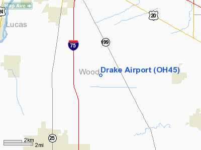
Location & QuickFacts
| FAA Information Effective: | 2008-09-25 |
| Airport Identifier: | OH45 |
| Airport Status: | Operational |
| Longitude/Latitude: | 083-35-10.7580W/41-27-15.1880N
-83.586322/41.454219 (Estimated) |
| Elevation: | 655 ft / 199.64 m (Estimated) |
| Land: | 4 acres |
| From nearest city: | 5 nautical miles NE of Bowling Green, OH |
| Location: | Wood County, OH |
| Magnetic Variation: | 05W (1985) |
Owner & Manager
| Ownership: | Privately owned |
| Owner: | Lawrence A. Drake |
| Address: | 20301 Mc Cutcheonville Road
Bowling Green, OH 43402 |
| Phone number: | 419-833-7962 |
| Address: |
|
Airport Operations and Facilities
| Airport Use: | Private
PERSONAL USE. |
| Segmented Circle: | No |
| Control Tower: | No |
| Sectional chart: | Detroit |
| Region: | AGL - Great Lakes |
| Boundary ARTCC: | ZOB - Cleveland |
| Tie-in FSS: | CLE - Cleveland |
| FSS on Airport: | No |
| FSS Toll Free: | 1-800-WX-BRIEF |
Runway Information
Runway 09/27
| Dimension: | 1900 x 60 ft / 579.1 x 18.3 m |
| Surface: | TURF, |
| |
Runway 09 |
Runway 27 |
| Traffic Pattern: | Left | Left |
| Obstruction: | 50 ft pline | |
|
Radio Navigation Aids
| ID |
Type |
Name |
Ch |
Freq |
Var |
Dist |
| FZI | NDB | Fostoria | | 379.00 | 05W | 18.1 nm |
| USE | NDB | Fulton | | 375.00 | 05W | 26.3 nm |
| BNR | NDB | Benton Ridge | | 334.00 | 05W | 26.3 nm |
| TII | NDB | Tiffin | | 269.00 | 05W | 27.4 nm |
| PDR | NDB | Ottawa | | 233.00 | 05W | 30.9 nm |
| PCW | NDB | Port Clinton | | 423.00 | 06W | 32.5 nm |
| ADG | NDB | Adrian | | 278.00 | 06W | 33.3 nm |
| TCU | NDB | Tecumseh | | 239.00 | 04W | 37.4 nm |
| DFI | NDB | Defiance | | 246.00 | 05W | 38.6 nm |
| BYN | NDB | Bryan | | 260.00 | 04W | 39.7 nm |
| RYS | NDB | Grosse Ile | | 419.00 | 06W | 43.5 nm |
| PT | NDB | Pelee Island | | 283.00 | 05W | 45.6 nm |
| LYL | NDB | Lima | | 362.00 | 04W | 49.2 nm |
| TOL | TACAN | Toledo | 072X | | 05W | 12.7 nm |
| MAH | VOR | Marathon | | 114.90 | 05W | 26.6 nm |
| AOH | VOR | Allen County | | 108.40 | 04W | 48.1 nm |
| VWV | VOR/DME | Waterville | 078X | 113.10 | 02W | 2.4 nm |
| SKY | VOR/DME | Sandusky | 029X | 109.20 | 04W | 42.0 nm |
| DXO | VOR/DME | Detroit | 081X | 113.40 | 06W | 46.7 nm |
| FDY | VORTAC | Findlay | 019X | 108.20 | 02W | 31.0 nm |
| CRL | VORTAC | Carleton | 104X | 115.70 | 03W | 36.2 nm |
| YIP | VOT | Willow Run | | 112.00 | | 47.0 nm |
| DTW | VOT | Detroit Met Wayne | | 109.80 | | 47.5 nm |
Remarks
- RY 09 USED FOR DEPARTURE; RY 27 USED FOR LANDING.
- PROVIDED 20:1 APCH SFC AND 7:1 TRANSITIONAL SFC MAINTAINED OVER NEARBY OBSTRUCTIONS.
Images and information placed above are from
http://www.airport-data.com/airport/OH45/
We thank them for the data!
| General Info
|
| Country |
United States
|
| State |
OHIO
|
| FAA ID |
OH45
|
| Latitude |
41-27-15.188N
|
| Longitude |
083-35-10.758W
|
| Elevation |
655 feet
|
| Near City |
BOWLING GREEN
|
We don't guarantee the information is fresh and accurate. The data may
be wrong or outdated.
For more up-to-date information please refer to other sources.
|
|


