 |
|
Location & QuickFacts
| FAA Information Effective: | 2008-09-25 |
| Airport Identifier: | 56OI |
| Airport Status: | Operational |
| Longitude/Latitude: | 082-19-52.5880W/41-12-20.1890N
-82.331274/41.205608 (Estimated) |
| Elevation: | 898 ft / 273.71 m (Estimated) |
| Land: | 0 acres |
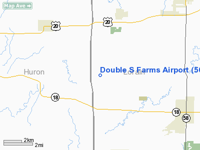
| From nearest city: | 4 nautical miles S of Kipton, OH |
| Location: | Lorain County, OH |
| Magnetic Variation: | 06W (1980) |
Owner & Manager
| Ownership: | Privately owned |
| Owner: | Double S Farms |
| Address: | Rd 3
Wakeman, OH 44889 |
| Phone number: | 216-839-2075 |
| Manager: | Tom V. Sumpter |
| Address: | Rd 3
Wakeman, OH 44889 |
| Phone number: | 216-839-2075 |
Airport Operations and Facilities
| Airport Use: | Private |
| Wind indicator: | Yes |
| Segmented Circle: | No |
| Control Tower: | No |
| Sectional chart: | Detroit |
| Region: | AGL - Great Lakes |
| Boundary ARTCC: | ZOB - Cleveland |
| Tie-in FSS: | CLE - Cleveland |
| FSS Toll Free: | 1-800-WX-BRIEF |
Runway Information
Runway 09/27
| Dimension: | 1200 x 150 ft / 365.8 x 45.7 m |
| Surface: | TURF, |
| |
Runway 09 |
Runway 27 |
| Traffic Pattern: | Left | Right |
|
Radio Navigation Aids
| ID |
Type |
Name |
Ch |
Freq |
Var |
Dist |
| AAU | NDB | Ashland | | 329.00 | 07W | 15.0 nm |
| CL | NDB | Harri | | 344.00 | 07W | 18.4 nm |
| MF | NDB | Manns | | 372.00 | 06W | 26.9 nm |
| PCW | NDB | Port Clinton | | 423.00 | 06W | 30.7 nm |
| EZE | NDB | Engel | | 226.00 | 07W | 32.3 nm |
| BKL | NDB | Burke Lakefront | | 416.00 | 07W | 35.8 nm |
| PT | NDB | Pelee Island | | 283.00 | 05W | 37.7 nm |
| TII | NDB | Tiffin | | 269.00 | 05W | 40.2 nm |
| AK | NDB | Akron | | 362.00 | 07W | 43.5 nm |
| MLR | NDB | Millersburg/dcmsnd | | 382.00 | 06W | 45.0 nm |
| FZI | NDB | Fostoria | | 379.00 | 05W | 48.2 nm |
| MNN | NDB | Marion | | 201.00 | 05W | 48.8 nm |
| BUD | VOR | Buckeye | | 109.80 | 05W | 48.6 nm |
| DJB | VOR/DME | Dryer | 083X | 113.60 | 05W | 11.9 nm |
| SKY | VOR/DME | Sandusky | 029X | 109.20 | 04W | 20.1 nm |
| TVT | VOR/DME | Tiverton | 112X | 116.50 | 03W | 45.9 nm |
| BSV | VOR/DME | Briggs | 071X | 112.40 | 04W | 49.5 nm |
| MFD | VORTAC | Mansfield | 025X | 108.80 | 03W | 23.4 nm |
| CLE | VOT | Cleveland | | 110.40 | | 25.0 nm |
| CAK | VOT | Akron/canton Regional | | 110.60 | | 43.9 nm |
Remarks
Images and information placed above are from
http://www.airport-data.com/airport/56OI/
We thank them for the data!
| General Info
|
| Country |
United States
|
| State |
OHIO
|
| FAA ID |
56OI
|
| Latitude |
41-12-20.189N
|
| Longitude |
082-19-52.588W
|
| Elevation |
898 feet
|
| Near City |
KIPTON
|
We don't guarantee the information is fresh and accurate. The data may
be wrong or outdated.
For more up-to-date information please refer to other sources.
|
|


