 |
|
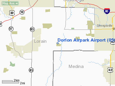
Location & QuickFacts
| FAA Information Effective: | 2008-09-25 |
| Airport Identifier: | 05OI |
| Airport Status: | Operational |
| Longitude/Latitude: | 081-57-45.5020W/41-17-18.1870N
-81.962639/41.288385 (Estimated) |
| Elevation: | 830 ft / 252.98 m (Estimated) |
| Land: | 50 acres |
| From nearest city: | 2 nautical miles S of Columbia Station, OH |
| Location: | Lorain County, OH |
| Magnetic Variation: | 07W (1990) |
Owner & Manager
| Ownership: | Privately owned |
| Owner: | John Lontor |
| Address: | 18000 Station Rd
Columbia Station, OH 44028 |
| Phone number: | 216-236-3058 |
| Manager: | John Lontor |
| Address: | 18000 Station Rd
Columbia Station, OH 44028 |
Airport Operations and Facilities
| Airport Use: | Private
PERSONAL USE. |
| Wind indicator: | Yes |
| Segmented Circle: | No |
| Control Tower: | No |
| Sectional chart: | Detroit |
| Region: | AGL - Great Lakes |
| Boundary ARTCC: | ZOB - Cleveland |
| Tie-in FSS: | CLE - Cleveland |
| FSS on Airport: | No |
| FSS Toll Free: | 1-800-WX-BRIEF |
Airport Communications
Runway Information
Runway 09/27
| Dimension: | 2000 x 100 ft / 609.6 x 30.5 m |
| Surface: | TURF, |
| |
Runway 09 |
Runway 27 |
| Traffic Pattern: | Left | Left |
| Displaced threshold: | 0.00 ft | 500.00 ft |
| Obstruction: | | 30 ft pline, 500.0 ft from runway |
|
Radio Navigation Aids
| ID |
Type |
Name |
Ch |
Freq |
Var |
Dist |
| CL | NDB | Harri | | 344.00 | 07W | 3.0 nm |
| EZE | NDB | Engel | | 226.00 | 07W | 16.2 nm |
| BKL | NDB | Burke Lakefront | | 416.00 | 07W | 19.8 nm |
| AAU | NDB | Ashland | | 329.00 | 07W | 23.6 nm |
| AK | NDB | Akron | | 362.00 | 07W | 29.2 nm |
| LQL | NDB | Lakeland | | 263.00 | 08W | 35.4 nm |
| MF | NDB | Manns | | 372.00 | 06W | 38.3 nm |
| PCW | NDB | Port Clinton | | 423.00 | 06W | 43.1 nm |
| PT | NDB | Pelee Island | | 283.00 | 05W | 43.4 nm |
| MLR | NDB | Millersburg/dcmsnd | | 382.00 | 06W | 45.1 nm |
| DJB | VOR/DME | Dryer | 083X | 113.60 | 05W | 9.9 nm |
| SKY | VOR/DME | Sandusky | 029X | 109.20 | 04W | 32.4 nm |
| LNN | VOR/DME | Lost Nation | 039X | 110.20 | 08W | 35.1 nm |
| ACO | VOR/DME | Akron | 091X | 114.40 | 04W | 36.1 nm |
| CXR | VOR/DME | Chardon | 074X | 112.70 | 05W | 38.6 nm |
| BSV | VOR/DME | Briggs | 071X | 112.40 | 04W | 40.8 nm |
| MFD | VORTAC | Mansfield | 025X | 108.80 | 03W | 38.0 nm |
| CLE | VOT | Cleveland | | 110.40 | | 9.0 nm |
| CAK | VOT | Akron/canton Regional | | 110.60 | | 32.5 nm |
Remarks
- OBJECTS EXIST WITHIN THE AIRSPACE TO INSURE SAFETY IN LANDING & TAKEOFF OPNS.
Images and information placed above are from
http://www.airport-data.com/airport/05OI/
We thank them for the data!
| General Info
|
| Country |
United States
|
| State |
OHIO
|
| FAA ID |
05OI
|
| Latitude |
41-17-18.187N
|
| Longitude |
081-57-45.502W
|
| Elevation |
830 feet
|
| Near City |
COLUMBIA STATION
|
We don't guarantee the information is fresh and accurate. The data may
be wrong or outdated.
For more up-to-date information please refer to other sources.
|
|


