 |
|
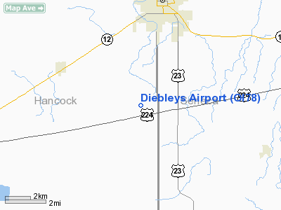
Location & QuickFacts
| FAA Information Effective: | 2008-09-25 |
| Airport Identifier: | OI78 |
| Airport Status: | Operational |
| Longitude/Latitude: | 083-26-10.7330W/41-05-05.1940N
-83.436315/41.084776 (Estimated) |
| Elevation: | 823 ft / 250.85 m (Estimated) |
| Land: | 0 acres |
| From nearest city: | 5 nautical miles S of Fostoria, OH |
| Location: | Hancock County, OH |
| Magnetic Variation: | 05W (1985) |
Owner & Manager
| Ownership: | Privately owned |
| Owner: | Joe A. Diebley |
| Address: | 5861 County Rd 23
Fostoria, OH 44830 |
| Phone number: | 419-894-6619 |
| Manager: | Joe A. Diebley |
| Address: | 5861 County Rd 23
Fostoria, OH 44830 |
| Phone number: | 419-894-6619 |
Airport Operations and Facilities
| Airport Use: | Private |
| Segmented Circle: | No |
| Control Tower: | No |
| Sectional chart: | Detroit |
| Region: | AGL - Great Lakes |
| Boundary ARTCC: | ZOB - Cleveland |
| Tie-in FSS: | CLE - Cleveland |
| FSS on Airport: | No |
| FSS Toll Free: | 1-800-WX-BRIEF |
Runway Information
Runway 09/27
| Dimension: | 2000 x 100 ft / 609.6 x 30.5 m |
| Surface: | TURF, |
| |
Runway 09 |
Runway 27 |
| Traffic Pattern: | Left | Left |
|
Radio Navigation Aids
| ID |
Type |
Name |
Ch |
Freq |
Var |
Dist |
| FZI | NDB | Fostoria | | 379.00 | 05W | 6.5 nm |
| TII | NDB | Tiffin | | 269.00 | 05W | 10.4 nm |
| BNR | NDB | Benton Ridge | | 334.00 | 05W | 11.2 nm |
| PDR | NDB | Ottawa | | 233.00 | 05W | 24.6 nm |
| MNN | NDB | Marion | | 201.00 | 05W | 32.7 nm |
| LYL | NDB | Lima | | 362.00 | 04W | 35.1 nm |
| PCW | NDB | Port Clinton | | 423.00 | 06W | 36.6 nm |
| RUV | NDB | Rushsylvania | | 326.00 | 05W | 39.1 nm |
| USE | NDB | Fulton | | 375.00 | 05W | 44.5 nm |
| EDJ | NDB | Bellefontaine | | 242.00 | 05W | 46.2 nm |
| DFI | NDB | Defiance | | 246.00 | 05W | 47.2 nm |
| MF | NDB | Manns | | 372.00 | 06W | 48.9 nm |
| TOL | TACAN | Toledo | 072X | | 05W | 34.7 nm |
| MAH | VOR | Marathon | | 114.90 | 05W | 11.2 nm |
| BUD | VOR | Buckeye | | 109.80 | 05W | 32.8 nm |
| AOH | VOR | Allen County | | 108.40 | 04W | 33.2 nm |
| VWV | VOR/DME | Waterville | 078X | 113.10 | 02W | 23.9 nm |
| SKY | VOR/DME | Sandusky | 029X | 109.20 | 04W | 41.1 nm |
| FDY | VORTAC | Findlay | 019X | 108.20 | 02W | 16.5 nm |
| MFD | VORTAC | Mansfield | 025X | 108.80 | 03W | 40.5 nm |
Remarks
- E111: AVBL DATA INDICATES THE USBL RWY LENGTH & OBSTN CLNCS DO NOT OFFER AN ACCEPTABLE LEVEL OF SAFETY FOR ACFT OPNS.
Images and information placed above are from
http://www.airport-data.com/airport/OI78/
We thank them for the data!
| General Info
|
| Country |
United States
|
| State |
OHIO
|
| FAA ID |
OI78
|
| Latitude |
41-05-05.194N
|
| Longitude |
083-26-10.733W
|
| Elevation |
823 feet
|
| Near City |
FOSTORIA
|
We don't guarantee the information is fresh and accurate. The data may
be wrong or outdated.
For more up-to-date information please refer to other sources.
|
|


