 |
|
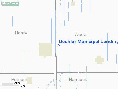
Deshler Muni Landing Strip Airport |
Location & QuickFacts
| FAA Information Effective: | 2008-09-25 |
| Airport Identifier: | 6D7 |
| Airport Status: | Operational |
| Longitude/Latitude: | 083-52-27.7820W/41-12-57.1830N
-83.874384/41.215884 (Estimated) |
| Elevation: | 706 ft / 215.19 m (Estimated) |
| Land: | 0 acres |
| From nearest city: | 2 nautical miles NE of Deshler, OH |
| Location: | Wood County, OH |
| Magnetic Variation: | 05W (1985) |
Owner & Manager
| Ownership: | Publicly owned |
| Owner: | Village Of Deshler |
| Address: | One 276 County Rd 'd'
Deshler, OH 43516 |
| Phone number: | 419-278-1353 |
| Manager: | Gary Myers |
| Address: | One 276 County Rd 'd'
Deshler, OH 43516 |
| Phone number: | 419-278-1353
ALSO 419-278-1065 WORK |
Airport Operations and Facilities
| Airport Use: | Open to public |
| Wind indicator: | Yes |
| Segmented Circle: | No |
| Control Tower: | No |
| Landing fee charge: | No |
| Sectional chart: | Detroit |
| Region: | AGL - Great Lakes |
| Boundary ARTCC: | ZOB - Cleveland |
| Tie-in FSS: | CLE - Cleveland |
| FSS on Airport: | No |
| FSS Toll Free: | 1-800-WX-BRIEF |
| NOTAMs Facility: | CLE (NOTAM-d service avaliable) |
Airport Communications
Airport Services
| Airframe Repair: | NONE |
| Power Plant Repair: | NONE |
Runway Information
Runway 05/23
| Dimension: | 1725 x 60 ft / 525.8 x 18.3 m |
| Surface: | TURF, Good Condition |
| |
Runway 05 |
Runway 23 |
| Longitude: | 083-52-41.7800W | 083-52-24.3700W |
| Latitude: | 41-13-01.1800N | 41-13-12.2200N |
| Elevation: | 706.00 ft | 706.00 ft |
| Traffic Pattern: | Left | Left |
| Displaced threshold: | 410.00 ft | 90.00 ft |
| Obstruction: | 19 ft bldg, 78 ft left of centerline
APCH RATIO 21:1 TO DSPLCD THLD. | 6 ft fence, 0.0 ft from runway, 30 ft left of centerline
APCH RATIO 0:1 TO DSPLCD THLD DUE TO +20 FT DIRT MOUND 0 FT FM 125 FT R. |
|
Runway 09/27
| Dimension: | 2480 x 70 ft / 755.9 x 21.3 m |
| Surface: | TURF, Good Condition |
| |
Runway 09 |
Runway 27 |
| Longitude: | 083-52-39.4100W | 083-52-06.9600W |
| Latitude: | 41-12-55.7800N | 41-12-55.7800N |
| Elevation: | 706.00 ft | 706.00 ft |
| Traffic Pattern: | Left | Left |
| Displaced threshold: | 740.00 ft | 0.00 ft |
| Obstruction: | 42 ft trees, 78 ft left of centerline
APCH SLOPE 16:1 TO DSPLD THLD DUE TO +40 FT TREES 640 FT FM DSPLCD THLD 187 FT L. | 68 ft trees, 0.0 ft from runway, 125 ft right of centerline |
|
Radio Navigation Aids
| ID |
Type |
Name |
Ch |
Freq |
Var |
Dist |
| PDR | NDB | Ottawa | | 233.00 | 05W | 12.0 nm |
| BNR | NDB | Benton Ridge | | 334.00 | 05W | 14.9 nm |
| FZI | NDB | Fostoria | | 379.00 | 05W | 21.7 nm |
| DFI | NDB | Defiance | | 246.00 | 05W | 26.0 nm |
| USE | NDB | Fulton | | 375.00 | 05W | 26.4 nm |
| TII | NDB | Tiffin | | 269.00 | 05W | 31.0 nm |
| BYN | NDB | Bryan | | 260.00 | 04W | 31.1 nm |
| LYL | NDB | Lima | | 362.00 | 04W | 31.5 nm |
| VFU | NDB | Stanley | | 411.00 | 05W | 39.7 nm |
| ADG | NDB | Adrian | | 278.00 | 06W | 40.4 nm |
| RUV | NDB | Rushsylvania | | 326.00 | 05W | 46.5 nm |
| PCW | NDB | Port Clinton | | 423.00 | 06W | 48.9 nm |
| TCU | NDB | Tecumseh | | 239.00 | 04W | 49.3 nm |
| TOL | TACAN | Toledo | 072X | | 05W | 23.0 nm |
| MAH | VOR | Marathon | | 114.90 | 05W | 15.4 nm |
| AOH | VOR | Allen County | | 108.40 | 04W | 30.9 nm |
| VWV | VOR/DME | Waterville | 078X | 113.10 | 02W | 17.7 nm |
| FDY | VORTAC | Findlay | 019X | 108.20 | 02W | 16.6 nm |
Remarks
- RY 09 HAS +40 FT TREES 130 FT FM RY END ON CNTRLN; RY 23 HAS +7 FT DIKE 30 FT FM RY END 68 FT L.
- BIRDS & DEER ON & INVOF ARPT.
Images and information placed above are from
http://www.airport-data.com/airport/6D7/
We thank them for the data!
| General Info
|
| Country |
United States
|
| State |
OHIO
|
| FAA ID |
6D7
|
| Latitude |
41-12-57.183N
|
| Longitude |
083-52-27.782W
|
| Elevation |
706 feet
|
| Near City |
DESHLER
|
We don't guarantee the information is fresh and accurate. The data may
be wrong or outdated.
For more up-to-date information please refer to other sources.
|
|


