 |
|
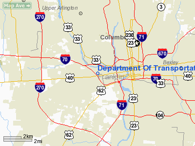
Department Of Transportation Heliport |
Location & QuickFacts
| FAA Information Effective: | 2008-09-25 |
| Airport Identifier: | 2A7 |
| Airport Status: | Operational |
| Longitude/Latitude: | 083-02-38.6650W/39-57-35.2300N
-83.044074/39.959786 (Estimated) |
| Elevation: | 715 ft / 217.93 m (Estimated) |
| Land: | 2 acres |
| From nearest city: | 0 nautical miles W of Columbus, OH |
| Location: | Franklin County, OH |
| Magnetic Variation: | 05W (1985) |
Owner & Manager
| Ownership: | Publicly owned |
| Owner: | Ohio Dept Of Transportation |
| Address: | 1600 W. Broad St.
Columbus, OH 43223 |
| Phone number: | 614-752-0416 |
| Manager: | Tim Thompson
BLDG MAINT SUPER. |
| Address: | 1600 W. Broad St.
Columbus, OH 43223 |
| Phone number: | 614-752-0416 |
Airport Operations and Facilities
| Airport Use: | Open to public |
| Wind indicator: | Yes |
| Segmented Circle: | No |
| Control Tower: | No |
| Sectional chart: | Cincinnati |
| Region: | AGL - Great Lakes |
| Boundary ARTCC: | ZID - Indianapolis |
| Tie-in FSS: | DAY - Dayton |
| FSS on Airport: | No |
| FSS Toll Free: | 1-800-WX-BRIEF |
| NOTAMs Facility: | DAY (NOTAM-d service avaliable) |
Airport Communications
Airport Services
| Airframe Repair: | NONE |
| Power Plant Repair: | NONE |
| Bottled Oxygen: | NONE |
| Bulk Oxygen: | NONE |
Runway Information
Helipad H1
| Dimension: | 40 x 40 ft / 12.2 x 12.2 m |
| Surface: | ASPH, Good Condition |
| |
Runway H1 |
Runway |
| Traffic Pattern: | Left | Left |
|
Radio Navigation Aids
| ID |
Type |
Name |
Ch |
Freq |
Var |
Dist |
| CHC | NDB | Grens | | 272.00 | 04W | 3.1 nm |
| DKG | NDB | Don Scott | | 348.00 | 05W | 7.4 nm |
| OS | NDB | Fuler | | 515.00 | 05W | 9.9 nm |
| BU | NDB | Boutn | | 230.00 | 05W | 11.2 nm |
| CM | NDB | Sumie | | 391.00 | 05W | 13.4 nm |
| DLZ | NDB | Delaware | | 215.00 | 06W | 19.3 nm |
| UYF | NDB | London | | 263.00 | 06W | 19.5 nm |
| MRT | NDB | Marysville | | 403.00 | 05W | 21.3 nm |
| CYO | NDB | Circleville | | 366.00 | 05W | 26.4 nm |
| CSS | NDB | Court House | | 414.00 | 05W | 26.9 nm |
| HEH | NDB | Newark | | 524.00 | 06W | 27.0 nm |
| RZT | NDB | Ross County | | 236.00 | 05W | 31.4 nm |
| CCJ | NDB | Clark County | | 341.00 | 04W | 34.3 nm |
| MNN | NDB | Marion | | 201.00 | 05W | 39.5 nm |
| RUV | NDB | Rushsylvania | | 326.00 | 05W | 41.5 nm |
| IL | NDB | Airbo | | 407.00 | 04W | 42.6 nm |
| EDJ | NDB | Bellefontaine | | 242.00 | 05W | 43.1 nm |
| XEN | NDB | Xenia | | 395.00 | 03W | 43.4 nm |
| EOP | NDB | Waverly | | 385.00 | 06W | 47.9 nm |
| LCK | TACAN | Rickenbacker | 069X | | 05W | 10.5 nm |
| XSF | TACAN | Springfield | 065X | | 04W | 37.5 nm |
| FFO | TACAN | Patterson | 099X | | 04W | 47.4 nm |
| XUB | VOR | Yellow Bud | | 112.50 | 05W | 26.2 nm |
| BUD | VOR | Buckeye | | 109.80 | 05W | 39.5 nm |
| SGH | VOR/DME | Springfield | 079X | 113.20 | 04W | 37.7 nm |
| MXQ | VOR/DME | Midwest | 076X | 112.90 | 04W | 47.3 nm |
| APE | VORTAC | Appleton | 114X | 116.70 | 06W | 23.9 nm |
| ROD | VORTAC | Rosewood | 122X | 117.50 | 05W | 50.0 nm |
| CMH | VOT | Port Columbus | | 111.00 | | 7.6 nm |
Remarks
- PARKING AVBL OFF PAD.
- FIRE EXTNGUISHER & PHONE AVBL 24 HRS IN SVC STN.
- (E111-1) NO NGT HELI OPNS CONDD UNLESS TKOF//LNDG AREA & WIND INDCR LGTD & HELI IDENT BCN INSTLD. FIRE PROTECTION PRVDD IN ACCORDANCE WITH LCL FIRE CODE AND/OR AC 150/5390-1B.
- ASP ANALYSIS DTRMN CONDS: INGRESS/EGRESS CONDUCTED IN AREA FM 110-040 DEG CLKWS USING TD PAD AS CNTR OF COMPASS ROSE. TKOF/LNDG AREA APROP MKD. NON-OBSTG WIND INDCR MAINTD ADJ TO TKOF/LNDG AREA.
Images and information placed above are from
http://www.airport-data.com/airport/2A7/
We thank them for the data!
| General Info
|
| Country |
United States
|
| State |
OHIO
|
| FAA ID |
2A7
|
| Latitude |
39-57-35.230N
|
| Longitude |
083-02-38.665W
|
| Elevation |
715 feet
|
| Near City |
COLUMBUS
|
We don't guarantee the information is fresh and accurate. The data may
be wrong or outdated.
For more up-to-date information please refer to other sources.
|
|


