|
|
 |
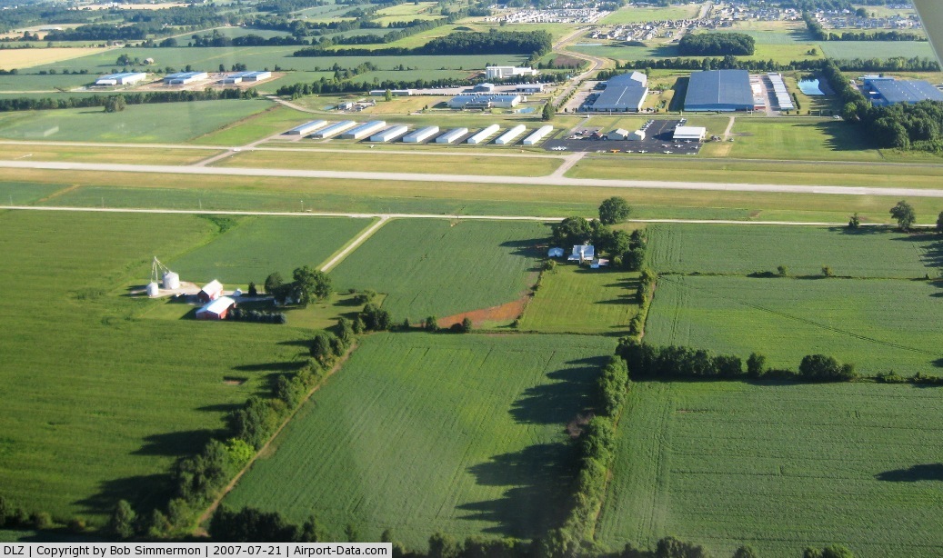
(Click on the photo to enlarge) |
 |
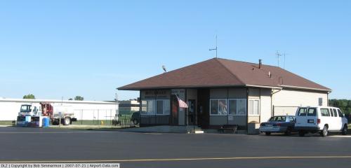
(Click on the photo to enlarge) |
Location & QuickFacts
| FAA Information Effective: | 2008-09-25 |
| Airport Identifier: | DLZ |
| Airport Status: | Operational |
| Longitude/Latitude: | 083-06-53.3000W/40-16-46.9000N
-83.114806/40.279694 (Estimated) |
| Elevation: | 945 ft / 288.04 m (Surveyed) |
| Land: | 315 acres |
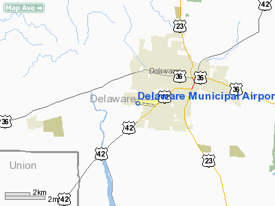
| From nearest city: | 3 nautical miles SW of Delaware, OH |
| Location: | Delaware County, OH |
| Magnetic Variation: | 06W (2000) |
Owner & Manager
| Ownership: | Publicly owned |
| Owner: | City Of Delaware |
| Address: | 1 South Sandusky St
Delaware, OH 43015 |
| Phone number: | 740-203-1800 |
| Manager: | Kevin Piatt |
| Address: | 1075 Pittsburg Dr
Delaware, OH 43015 |
| Phone number: | 740-203-1870 |
Airport Operations and Facilities
| Airport Use: | Open to public |
| Wind indicator: | Yes |
| Segmented Circle: | No |
| Control Tower: | No |
| Lighting Schedule: | DUSK-DAWN
ACTVT MIRL RY 10/28 - CTAF. |
| Beacon Color: | Clear-Green (lighted land airport) |
| Landing fee charge: | No |
| Sectional chart: | Detroit |
| Region: | AGL - Great Lakes |
| Boundary ARTCC: | ZID - Indianapolis |
| Tie-in FSS: | DAY - Dayton |
| FSS on Airport: | No |
| FSS Toll Free: | 1-800-WX-BRIEF |
| NOTAMs Facility: | DAY (NOTAM-d service avaliable) |
| Federal Agreements: | NGY |
Airport Communications
| CTAF: | 122.700 |
| Unicom: | 122.700 |
Airport Services
| Fuel available: | 100LLA |
| Airframe Repair: | MAJOR |
| Power Plant Repair: | MAJOR |
Runway Information
Runway 10/28
| Dimension: | 5000 x 100 ft / 1524.0 x 30.5 m |
| Surface: | ASPH, Good Condition |
| Weight Limit: | Single wheel: 30000 lbs.
Dual wheel: 55000 lbs. |
| Edge Lights: | Medium |
| |
Runway 10 |
Runway 28 |
| Longitude: | 083-07-25.1971W | 083-06-21.3732W |
| Latitude: | 40-16-50.5112N | 40-16-43.3432N |
| Elevation: | 944.00 ft | 945.00 ft |
| Alignment: | 98 | 127 |
| Traffic Pattern: | Left | Left |
| Markings: | Non-precision instrument, Good Condition | Non-precision instrument, Good Condition |
| VASI: | 4-light PAPI on left side | 4-light PAPI on left side
PAPI OTS INDEFLY. |
| Visual Glide Angle: | 3.00° | 3.00° |
| Runway End Identifier: | Yes
RY 10 REIL OTS INDEFLY. | Yes |
| Centerline Lights: | No | No |
| Touchdown Lights: | No | No |
| Obstruction: | , 50:1 slope to clear | 75 ft trees, 2177.0 ft from runway, 159 ft left of centerline, 26:1 slope to clear |
|
Radio Navigation Aids
| ID |
Type |
Name |
Ch |
Freq |
Var |
Dist |
| DLZ | NDB | Delaware | | 215.00 | 06W | 0.6 nm |
| MRT | NDB | Marysville | | 403.00 | 05W | 11.2 nm |
| DKG | NDB | Don Scott | | 348.00 | 05W | 12.1 nm |
| OS | NDB | Fuler | | 515.00 | 05W | 13.0 nm |
| CHC | NDB | Grens | | 272.00 | 04W | 16.7 nm |
| MNN | NDB | Marion | | 201.00 | 05W | 20.4 nm |
| CM | NDB | Sumie | | 391.00 | 05W | 24.2 nm |
| UYF | NDB | London | | 263.00 | 06W | 26.3 nm |
| RUV | NDB | Rushsylvania | | 326.00 | 05W | 27.5 nm |
| BU | NDB | Boutn | | 230.00 | 05W | 28.0 nm |
| EDJ | NDB | Bellefontaine | | 242.00 | 05W | 32.5 nm |
| HEH | NDB | Newark | | 524.00 | 06W | 33.6 nm |
| CCJ | NDB | Clark County | | 341.00 | 04W | 39.1 nm |
| MF | NDB | Manns | | 372.00 | 06W | 42.3 nm |
| CSS | NDB | Court House | | 414.00 | 05W | 42.8 nm |
| CYO | NDB | Circleville | | 366.00 | 05W | 45.9 nm |
| LYL | NDB | Lima | | 362.00 | 04W | 48.7 nm |
| TII | NDB | Tiffin | | 269.00 | 05W | 49.4 nm |
| LCK | TACAN | Rickenbacker | 069X | | 05W | 29.6 nm |
| XSF | TACAN | Springfield | 065X | | 04W | 42.7 nm |
| BUD | VOR | Buckeye | | 109.80 | 05W | 20.4 nm |
| XUB | VOR | Yellow Bud | | 112.50 | 05W | 45.7 nm |
| AOH | VOR | Allen County | | 108.40 | 04W | 46.7 nm |
| SGH | VOR/DME | Springfield | 079X | 113.20 | 04W | 42.9 nm |
| TVT | VOR/DME | Tiverton | 112X | 116.50 | 03W | 46.5 nm |
| APE | VORTAC | Appleton | 114X | 116.70 | 06W | 25.4 nm |
| ROD | VORTAC | Rosewood | 122X | 117.50 | 05W | 42.6 nm |
| MFD | VORTAC | Mansfield | 025X | 108.80 | 03W | 42.7 nm |
| CMH | VOT | Port Columbus | | 111.00 | | 20.1 nm |
Remarks
- DEER ON & INVOF ARPT.
- VFR ONLY
Images and information placed above are from
http://www.airport-data.com/airport/DLZ/
We thank them for the data!
| General Info
|
| Country |
United States
|
| State |
OHIO
|
| FAA ID |
DLZ
|
| Latitude |
40-16-46.925N
|
| Longitude |
083-06-53.286W
|
| Elevation |
945 feet
|
| Near City |
DELAWARE
|
We don't guarantee the information is fresh and accurate. The data may
be wrong or outdated.
For more up-to-date information please refer to other sources.
|
|