 |
|
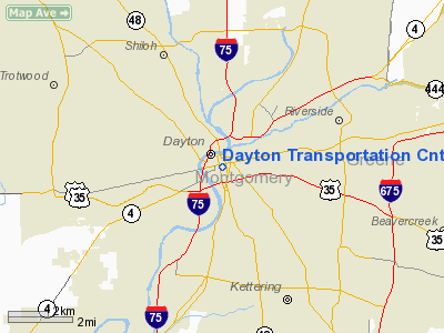
Dayton Transportation Cntr Heliport |
Location & QuickFacts
| FAA Information Effective: | 2008-09-25 |
| Airport Identifier: | 5D7 |
| Airport Status: | Operational |
| Longitude/Latitude: | 084-11-29.7840W/39-45-30.2110N
-84.191607/39.758392 (Estimated) |
| Elevation: | 800 ft / 243.84 m (Estimated) |
| Land: | 1 acres |
| From nearest city: | 0 nautical miles N of Dayton, OH |
| Location: | Montgomery County, OH |
| Magnetic Variation: | 04W (1985) |
Owner & Manager
| Ownership: | Publicly owned |
| Owner: | City Of Dayton |
| Address: | 101 W Third St
Dayton, OH 45402 |
| Phone number: | 937-454-8299 |
| Manager: | Department Of Aviation |
| Address: | 101 W. Third St.
Vandalia, OH 45377
ROOM 304; TERMINAL BLDG; 3600 TERMINAL DRIVE DAYTON INTL ARPT. |
| Phone number: | 937-454-8299 |
Airport Operations and Facilities
| Airport Use: | Open to public |
| Wind indicator: | Yes |
| Segmented Circle: | No |
| Control Tower: | No |
| Lighting Schedule: | PHONE REQ
FOR PERIMETER LGTS & BCN CALL SUPT OF ACFT OPNS AT 937-454-8299. 24-HR ADVANCE NOTICE FOR USE REQUIRED. |
| Beacon Color: | Clear-Green-Yellow (heliport) |
| Landing fee charge: | No |
| Sectional chart: | Cincinnati |
| Region: | AGL - Great Lakes |
| Boundary ARTCC: | ZID - Indianapolis |
| Tie-in FSS: | DAY - Dayton |
| FSS on Airport: | No |
| FSS Toll Free: | 1-800-WX-BRIEF |
| NOTAMs Facility: | DAY (NOTAM-d service avaliable) |
Airport Communications
Runway Information
Helipad H1
| Dimension: | 40 x 40 ft / 12.2 x 12.2 m |
| Surface: | CONC, Good Condition
ROOFTOP: 40 FT BY 40 FT CONCRETE PAD WITHIN 80 FT BY 60 FT LANDING/TAKEOFF AREA. |
| |
Runway H1 |
Runway |
| Traffic Pattern: | Left | Left |
|
Radio Navigation Aids
| ID |
Type |
Name |
Ch |
Freq |
Var |
Dist |
| XEN | NDB | Xenia | | 395.00 | 03W | 12.4 nm |
| HKF | NDB | Hook Field | | 239.00 | 04W | 19.6 nm |
| CCJ | NDB | Clark County | | 341.00 | 04W | 20.3 nm |
| IL | NDB | Airbo | | 407.00 | 04W | 26.5 nm |
| HW | NDB | Cubla | | 299.00 | 04W | 28.4 nm |
| HAO | NDB | Hamilton | | 260.00 | 04W | 29.1 nm |
| VES | NDB | Versailles | | 356.00 | 04W | 30.9 nm |
| OXD | NDB | Oxford | | 282.00 | 04W | 31.2 nm |
| ISZ | NDB | Cincinnati-blue Ash | | 388.00 | 04W | 32.0 nm |
| MDE | NDB | Madeira | | 379.00 | 04W | 33.1 nm |
| UYF | NDB | London | | 263.00 | 06W | 35.1 nm |
| LUK | NDB | Cincinnati | | 335.00 | 04W | 36.7 nm |
| CSS | NDB | Court House | | 414.00 | 05W | 38.2 nm |
| EDJ | NDB | Bellefontaine | | 242.00 | 05W | 40.7 nm |
| PWF | NDB | Sportys | | 245.00 | 04W | 41.0 nm |
| BU | NDB | Boutn | | 230.00 | 05W | 45.7 nm |
| HOC | NDB | Hillsboro | | 278.00 | 05W | 45.8 nm |
| CQA | NDB | Lakefield | | 205.00 | 04W | 46.7 nm |
| MRT | NDB | Marysville | | 403.00 | 05W | 47.9 nm |
| RUV | NDB | Rushsylvania | | 326.00 | 05W | 48.5 nm |
| OS | NDB | Fuler | | 515.00 | 05W | 49.6 nm |
| FFO | TACAN | Patterson | 099X | | 04W | 7.3 nm |
| XSF | TACAN | Springfield | 065X | | 04W | 16.9 nm |
| SGH | VOR/DME | Springfield | 079X | 113.20 | 04W | 16.7 nm |
| DQN | VOR/DME | Dayton | 092X | 114.50 | 01W | 18.2 nm |
| MXQ | VOR/DME | Midwest | 076X | 112.90 | 04W | 26.8 nm |
| RID | VORTAC | Richmond | 043X | 110.60 | 03W | 29.9 nm |
| ROD | VORTAC | Rosewood | 122X | 117.50 | 05W | 32.5 nm |
| DAY | VOT | Dayton J M Cox-day | | 111.00 | | 8.7 nm |
| LUK | VOT | Cincinnati Muni/lunken | | 108.40 | | 39.8 nm |
Remarks
Images and information placed above are from
http://www.airport-data.com/airport/5D7/
We thank them for the data!
| General Info
|
| Country |
United States
|
| State |
OHIO
|
| FAA ID |
5D7
|
| Latitude |
39-45-30.211N
|
| Longitude |
084-11-29.784W
|
| Elevation |
800 feet
|
| Near City |
DAYTON
|
We don't guarantee the information is fresh and accurate. The data may
be wrong or outdated.
For more up-to-date information please refer to other sources.
|
|


