 |
|
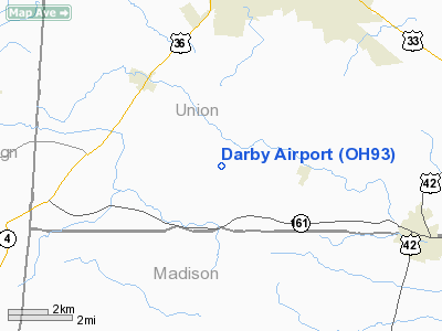
Location & QuickFacts
| FAA Information Effective: | 2008-09-25 |
| Airport Identifier: | OH93 |
| Airport Status: | Operational |
| Longitude/Latitude: | 083-23-24.7140W/40-08-25.2160N
-83.390198/40.140338 (Estimated) |
| Elevation: | 972 ft / 296.27 m (Surveyed) |
| Land: | 0 acres |
| From nearest city: | 3 nautical miles SE of Milford Center, OH |
| Location: | Union County, OH |
| Magnetic Variation: | 05W (1985) |
Owner & Manager
| Ownership: | Privately owned |
| Owner: | Triple T. Enterprises, Inc. |
| Address: | 2479 Sherwood Villa
Columbus, OH 43221 |
| Phone number: | 614-457-1597 |
| Manager: | Dennis Thiergartner |
| Address: | 5801 Chatterfield Dr
Dublin, OH 43017 |
| Phone number: | 614-792-1777 |
Airport Operations and Facilities
| Airport Use: | Private |
| Wind indicator: | No |
| Segmented Circle: | No |
| Control Tower: | No |
| Landing fee charge: | No |
| Sectional chart: | Detroit |
| Region: | AGL - Great Lakes |
| Boundary ARTCC: | ZID - Indianapolis |
| Tie-in FSS: | DAY - Dayton |
| FSS on Airport: | No |
| FSS Toll Free: | 1-800-WX-BRIEF |
Airport Services
| Airframe Repair: | NONE |
| Power Plant Repair: | NONE |
Runway Information
Runway 04/22
| Dimension: | 1750 x 150 ft / 533.4 x 45.7 m |
| Surface: | TURF, |
| |
Runway 04 |
Runway 22 |
| Traffic Pattern: | Left | Left |
|
Radio Navigation Aids
| ID |
Type |
Name |
Ch |
Freq |
Var |
Dist |
| MRT | NDB | Marysville | | 403.00 | 05W | 5.5 nm |
| OS | NDB | Fuler | | 515.00 | 05W | 9.7 nm |
| UYF | NDB | London | | 263.00 | 06W | 12.9 nm |
| DKG | NDB | Don Scott | | 348.00 | 05W | 14.8 nm |
| DLZ | NDB | Delaware | | 215.00 | 06W | 15.5 nm |
| CHC | NDB | Grens | | 272.00 | 04W | 18.4 nm |
| BU | NDB | Boutn | | 230.00 | 05W | 21.1 nm |
| RUV | NDB | Rushsylvania | | 326.00 | 05W | 23.0 nm |
| EDJ | NDB | Bellefontaine | | 242.00 | 05W | 23.9 nm |
| CCJ | NDB | Clark County | | 341.00 | 04W | 24.0 nm |
| CM | NDB | Sumie | | 391.00 | 05W | 30.7 nm |
| MNN | NDB | Marion | | 201.00 | 05W | 32.2 nm |
| CSS | NDB | Court House | | 414.00 | 05W | 32.4 nm |
| XEN | NDB | Xenia | | 395.00 | 03W | 35.7 nm |
| CYO | NDB | Circleville | | 366.00 | 05W | 41.7 nm |
| IL | NDB | Airbo | | 407.00 | 04W | 42.1 nm |
| HEH | NDB | Newark | | 524.00 | 06W | 43.2 nm |
| LYL | NDB | Lima | | 362.00 | 04W | 44.6 nm |
| RZT | NDB | Ross County | | 236.00 | 05W | 45.4 nm |
| XSF | TACAN | Springfield | 065X | | 04W | 27.6 nm |
| LCK | TACAN | Rickenbacker | 069X | | 05W | 29.2 nm |
| FFO | TACAN | Patterson | 099X | | 04W | 36.2 nm |
| BUD | VOR | Buckeye | | 109.80 | 05W | 32.3 nm |
| XUB | VOR | Yellow Bud | | 112.50 | 05W | 41.5 nm |
| AOH | VOR | Allen County | | 108.40 | 04W | 43.1 nm |
| SGH | VOR/DME | Springfield | 079X | 113.20 | 04W | 27.8 nm |
| MXQ | VOR/DME | Midwest | 076X | 112.90 | 04W | 46.7 nm |
| DQN | VOR/DME | Dayton | 092X | 114.50 | 01W | 46.9 nm |
| ROD | VORTAC | Rosewood | 122X | 117.50 | 05W | 31.3 nm |
| APE | VORTAC | Appleton | 114X | 116.70 | 06W | 36.9 nm |
| CMH | VOT | Port Columbus | | 111.00 | | 24.8 nm |
| DAY | VOT | Dayton J M Cox-day | | 111.00 | | 40.8 nm |
Remarks
Images and information placed above are from
http://www.airport-data.com/airport/OH93/
We thank them for the data!
| General Info
|
| Country |
United States
|
| State |
OHIO
|
| FAA ID |
OH93
|
| Latitude |
40-08-25.216N
|
| Longitude |
083-23-24.714W
|
| Elevation |
972 feet
|
| Near City |
MILFORD CENTER
|
We don't guarantee the information is fresh and accurate. The data may
be wrong or outdated.
For more up-to-date information please refer to other sources.
|
|


