 |
|
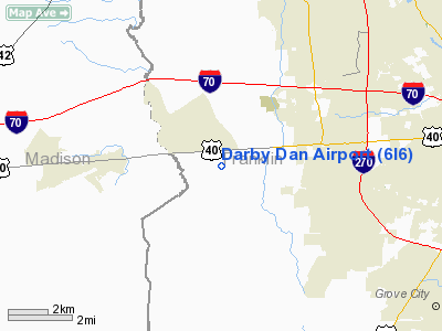
Location & QuickFacts
| FAA Information Effective: | 2008-09-25 |
| Airport Identifier: | 6I6 |
| Airport Status: | Operational |
| Longitude/Latitude: | 083-12-17.6400W/39-56-31.1000N
-83.204900/39.941972 (Estimated) |
| Elevation: | 928 ft / 282.85 m (Estimated) |
| Land: | 50 acres |
| From nearest city: | 10 nautical miles W of Columbus, OH |
| Location: | Franklin County, OH |
| Magnetic Variation: | 06W (2000) |
Owner & Manager
| Ownership: | Privately owned |
| Owner: | Darby Dan Holdings |
| Address: | 180 E Broad St
Columbus, OH 43215
AIRPORT ADDRESS: 7535 W BROAD ST, GALLOWAY OH 43119. |
| Phone number: | 614-460-4444 |
| Manager: | Bruce Goodman |
| Address: | 7535 W Broad St
Galloway, OH 43119 |
| Phone number: | 614-853-2400 |
Airport Operations and Facilities
| Airport Use: | Open to public |
| Wind indicator: | Yes |
| Segmented Circle: | No |
| Control Tower: | No |
| Lighting Schedule: | RDO-CTL
ACTVT ROTG BCN - CTAF. |
| Beacon Color: | Clear-Green (lighted land airport) |
| Landing fee charge: | Yes |
| Sectional chart: | Cincinnati |
| Region: | AGL - Great Lakes |
| Boundary ARTCC: | ZID - Indianapolis |
| Tie-in FSS: | DAY - Dayton |
| FSS on Airport: | No |
| FSS Toll Free: | 1-800-WX-BRIEF |
| NOTAMs Facility: | DAY (NOTAM-d service avaliable) |
Airport Communications
| CTAF: | 122.700 |
| Unicom: | 122.700 |
Airport Services
Runway Information
Runway 09/27
| Dimension: | 5892 x 75 ft / 1795.9 x 22.9 m |
| Surface: | ASPH, Fair Condition |
| Edge Lights: | Medium |
| |
Runway 09 |
Runway 27 |
| Longitude: | 083-12-55.4230W | 083-11-39.8580W |
| Latitude: | 39-56-29.7540N | 39-56-32.4430N |
| Elevation: | 928.00 ft | 923.00 ft |
| Alignment: | 87 | 127 |
| Traffic Pattern: | Left | Right |
| Markings: | Non-precision instrument, Fair Condition | Non-precision instrument, Fair Condition |
| Displaced threshold: | 1343.00 ft | 543.00 ft |
| VASI: | 4-light PAPI on left side
PAPI OTS INDEFLY. | 4-light PAPI on left side
PAPI OTS INDEFLY. |
| Runway End Identifier: | Yes
REIL OTS INDEFLY. | Yes
REIL OTS INDEFLY. |
| Obstruction: | 95 ft tree, 569.0 ft from runway, 192 ft right of centerline, 3:1 slope to clear
RWY 09 APCH RATIO 20:1 TO DSPLCD THR. DUE TO 95 FT TREES 1912 FT FM DSPLCD THLD 192 FT L. | 22 ft tree, 390.0 ft from runway, 140 ft left of centerline, 8:1 slope to clear
APCH RATIO 34:1 OVER +145 FT PLINE 4500 FT FM 0B. |
|
Radio Navigation Aids
| ID |
Type |
Name |
Ch |
Freq |
Var |
Dist |
| BU | NDB | Boutn | | 230.00 | 05W | 7.4 nm |
| OS | NDB | Fuler | | 515.00 | 05W | 7.9 nm |
| CHC | NDB | Grens | | 272.00 | 04W | 9.1 nm |
| DKG | NDB | Don Scott | | 348.00 | 05W | 10.1 nm |
| UYF | NDB | London | | 263.00 | 06W | 12.1 nm |
| MRT | NDB | Marysville | | 403.00 | 05W | 18.4 nm |
| DLZ | NDB | Delaware | | 215.00 | 06W | 20.7 nm |
| CM | NDB | Sumie | | 391.00 | 05W | 20.9 nm |
| CSS | NDB | Court House | | 414.00 | 05W | 22.2 nm |
| CCJ | NDB | Clark County | | 341.00 | 04W | 26.8 nm |
| CYO | NDB | Circleville | | 366.00 | 05W | 27.2 nm |
| RZT | NDB | Ross County | | 236.00 | 05W | 31.4 nm |
| HEH | NDB | Newark | | 524.00 | 06W | 34.5 nm |
| XEN | NDB | Xenia | | 395.00 | 03W | 36.1 nm |
| IL | NDB | Airbo | | 407.00 | 04W | 36.6 nm |
| RUV | NDB | Rushsylvania | | 326.00 | 05W | 37.7 nm |
| EDJ | NDB | Bellefontaine | | 242.00 | 05W | 38.0 nm |
| MNN | NDB | Marion | | 201.00 | 05W | 41.1 nm |
| HW | NDB | Cubla | | 299.00 | 04W | 47.1 nm |
| HOC | NDB | Hillsboro | | 278.00 | 05W | 48.1 nm |
| EOP | NDB | Waverly | | 385.00 | 06W | 48.3 nm |
| LCK | TACAN | Rickenbacker | 069X | | 05W | 15.1 nm |
| XSF | TACAN | Springfield | 065X | | 04W | 30.0 nm |
| FFO | TACAN | Patterson | 099X | | 04W | 39.9 nm |
| XUB | VOR | Yellow Bud | | 112.50 | 05W | 27.1 nm |
| BUD | VOR | Buckeye | | 109.80 | 05W | 41.1 nm |
| SGH | VOR/DME | Springfield | 079X | 113.20 | 04W | 30.2 nm |
| MXQ | VOR/DME | Midwest | 076X | 112.90 | 04W | 41.3 nm |
| APE | VORTAC | Appleton | 114X | 116.70 | 06W | 31.0 nm |
| ROD | VORTAC | Rosewood | 122X | 117.50 | 05W | 43.8 nm |
| CMH | VOT | Port Columbus | | 111.00 | | 15.1 nm |
| DAY | VOT | Dayton J M Cox-day | | 111.00 | | 46.9 nm |
Remarks
- (E111-1) THR RELOCATED TO MEET DESIGN CRITERIA FOR ACFT DESIGN GROUPS & CATEGORY EXPECTED TO USE ARPT; TFC PATTERNS IN ACCORDANCE WITH L.O.A. DATED 10/15/92.
- PRVDD ANY OBSTRUCTIONS IN RY APCH SLOPE SFC BE REMOVED/LOWERED OR RY THR DSPLCD & MARKED SO AS TO PRVD MIN 20:1 APCH CLNC OVER OBSTN; AREA 125 FT EITHER SIDE OF CNTRLN & 200 FT OFF RY END CLEAR OF ANY OBSTNS;
Images and information placed above are from
http://www.airport-data.com/airport/6I6/
We thank them for the data!
| General Info
|
| Country |
United States
|
| State |
OHIO
|
| FAA ID |
6I6
|
| Latitude |
39-56-31.100N
|
| Longitude |
083-12-17.640W
|
| Elevation |
928 feet
|
| Near City |
COLUMBUS
|
We don't guarantee the information is fresh and accurate. The data may
be wrong or outdated.
For more up-to-date information please refer to other sources.
|
|


