 |
|
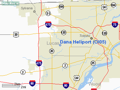
Location & QuickFacts
| FAA Information Effective: | 2008-09-25 |
| Airport Identifier: | OI05 |
| Airport Status: | Operational |
| Longitude/Latitude: | 083-38-47.7700W/41-39-21.1810N
-83.646603/41.655884 (Estimated) |
| Elevation: | 625 ft / 190.50 m (Estimated) |
| Land: | 0 acres |
| From nearest city: | 4 nautical miles W of Toledo, OH |
| Location: | Lucas County, OH |
| Magnetic Variation: | 05W (1985) |
Owner & Manager
| Ownership: | Privately owned |
| Owner: | Dana Corp. |
| Address: | 4500 Dorr Street
Toledo, OH 43697 |
| Manager: | E. C. Ramsey |
| Address: | Rte 4, Box 297a
Swanton, OH 43558 |
| Phone number: | 419-867-3360 |
Airport Operations and Facilities
| Airport Use: | Private |
| Wind indicator: | Yes |
| Segmented Circle: | No |
| Control Tower: | No |
| Landing fee charge: | No |
| Sectional chart: | Detroit |
| Region: | AGL - Great Lakes |
| Boundary ARTCC: | ZOB - Cleveland |
| Tie-in FSS: | CLE - Cleveland |
| FSS on Airport: | No |
| FSS Toll Free: | 1-800-WX-BRIEF |
Runway Information
Helipad H1
| Dimension: | 100 x 100 ft / 30.5 x 30.5 m |
| Surface: | BRICK, |
| |
Runway H1 |
Runway |
| Traffic Pattern: | Left | Left |
|
Radio Navigation Aids
| ID |
Type |
Name |
Ch |
Freq |
Var |
Dist |
| USE | NDB | Fulton | | 375.00 | 05W | 22.0 nm |
| ADG | NDB | Adrian | | 278.00 | 06W | 23.2 nm |
| TCU | NDB | Tecumseh | | 239.00 | 04W | 25.1 nm |
| FZI | NDB | Fostoria | | 379.00 | 05W | 30.2 nm |
| RYS | NDB | Grosse Ile | | 419.00 | 06W | 34.7 nm |
| PCW | NDB | Port Clinton | | 423.00 | 06W | 35.9 nm |
| BNR | NDB | Benton Ridge | | 334.00 | 05W | 38.2 nm |
| BYN | NDB | Bryan | | 260.00 | 04W | 38.3 nm |
| TII | NDB | Tiffin | | 269.00 | 05W | 38.9 nm |
| DFI | NDB | Defiance | | 246.00 | 05W | 40.1 nm |
| PDR | NDB | Ottawa | | 233.00 | 05W | 40.4 nm |
| G | NDB | Golf | | 398.00 | 05W | 44.3 nm |
| PT | NDB | Pelee Island | | 283.00 | 05W | 44.4 nm |
| TOL | TACAN | Toledo | 072X | | 05W | 7.8 nm |
| MAH | VOR | Marathon | | 114.90 | 05W | 38.5 nm |
| VWV | VOR/DME | Waterville | 078X | 113.10 | 02W | 12.3 nm |
| DXO | VOR/DME | Detroit | 081X | 113.40 | 06W | 35.8 nm |
| SKY | VOR/DME | Sandusky | 029X | 109.20 | 04W | 46.6 nm |
| CRL | VORTAC | Carleton | 104X | 115.70 | 03W | 25.0 nm |
| FDY | VORTAC | Findlay | 019X | 108.20 | 02W | 42.4 nm |
| SVM | VORTAC | Salem | 090X | 114.30 | 03W | 45.3 nm |
| YIP | VOT | Willow Run | | 112.00 | | 35.2 nm |
| DTW | VOT | Detroit Met Wayne | | 109.80 | | 36.6 nm |
Remarks
- PRVDD INGRESS/EGRESS OPNS CONDUCTED IN AREA FM 090 DEG CLKWS TO 250 DEG AND FM 300 DEG CLKWS TO 320 DEG FM LNDG PAD USING PAD AS CNTR OF COMPASS ROSE.
Images and information placed above are from
http://www.airport-data.com/airport/OI05/
We thank them for the data!
| General Info
|
| Country |
United States
|
| State |
OHIO
|
| FAA ID |
OI05
|
| Latitude |
41-39-21.181N
|
| Longitude |
083-38-47.770W
|
| Elevation |
625 feet
|
| Near City |
TOLEDO
|
We don't guarantee the information is fresh and accurate. The data may
be wrong or outdated.
For more up-to-date information please refer to other sources.
|
|


