 |
|
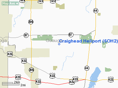
Location & QuickFacts
| FAA Information Effective: | 2008-09-25 |
| Airport Identifier: | 6OH2 |
| Airport Status: | Operational |
| Longitude/Latitude: | 081-16-32.3780W/41-26-50.1890N
-81.275661/41.447275 (Estimated) |
| Elevation: | 1125 ft / 342.90 m (Estimated) |
| Land: | 150 acres |
| From nearest city: | 4 nautical miles SE of Novelty, OH |
| Location: | Geauga County, OH |
| Magnetic Variation: | 07W (1985) |
Owner & Manager
| Ownership: | Privately owned |
| Owner: | Arthur D. & Billie H. Steffee |
| Address: | 9994 Music Street
Novelty, OH 44072 |
| Phone number: | 216-338-5085 |
| Manager: | Billie Steffee
ALSO JOHN KOCHEE 216-632-5136. |
| Address: | 9994 Music Street
Novelty, OH 44072 |
| Phone number: | 216-338-5085 |
Airport Operations and Facilities
| Airport Use: | Private |
| Wind indicator: | No |
| Segmented Circle: | No |
| Control Tower: | No |
| Sectional chart: | Detroit |
| Region: | AGL - Great Lakes |
| Boundary ARTCC: | ZOB - Cleveland |
| Tie-in FSS: | CLE - Cleveland |
| FSS on Airport: | No |
| FSS Toll Free: | 1-800-WX-BRIEF |
Airport Services
Runway Information
Helipad H1
| Dimension: | 25 x 25 ft / 7.6 x 7.6 m |
| Surface: | TURF, |
| |
Runway H1 |
Runway |
| Traffic Pattern: | Left | Left |
|
Radio Navigation Aids
| ID |
Type |
Name |
Ch |
Freq |
Var |
Dist |
| LQL | NDB | Lakeland | | 263.00 | 08W | 14.9 nm |
| BKL | NDB | Burke Lakefront | | 416.00 | 07W | 18.1 nm |
| EZE | NDB | Engel | | 226.00 | 07W | 20.3 nm |
| AK | NDB | Akron | | 362.00 | 07W | 23.2 nm |
| CL | NDB | Harri | | 344.00 | 07W | 31.7 nm |
| HBD | NDB | Hubbard | | 408.00 | 08W | 38.0 nm |
| UCP | NDB | Castle | | 272.00 | 09W | 46.5 nm |
| CXR | VOR/DME | Chardon | 074X | 112.70 | 05W | 6.6 nm |
| LNN | VOR/DME | Lost Nation | 039X | 110.20 | 08W | 15.1 nm |
| ACO | VOR/DME | Akron | 091X | 114.40 | 04W | 20.7 nm |
| JFN | VOR/DME | Jefferson | 099X | 115.20 | 05W | 30.3 nm |
| DJB | VOR/DME | Dryer | 083X | 113.60 | 05W | 40.3 nm |
| BSV | VOR/DME | Briggs | 071X | 112.40 | 04W | 43.1 nm |
| YNG | VORTAC | Youngstown | 027X | 109.00 | 05W | 28.0 nm |
| CLE | VOT | Cleveland | | 110.40 | | 25.9 nm |
| CAK | VOT | Akron/canton Regional | | 110.60 | | 32.8 nm |
Remarks
- PROVIDED APCH/DEP OPNS ARE CONDUCTED FROM 80 TO 100 DEG & FROM 250 TO 290 DEG; AREA IS MARKED; WIND INDICATOR IS MAINTAINED; NO NIGHT OPNS; UNAUTHORIZED PERSONS BE RESTRAINED; FIRE PROTECTION BE PROVIDED; REFERENCE TO FAA AC'S TO ESTABLISH ACCEPTABLE LEVEL OF SAFETY.
Images and information placed above are from
http://www.airport-data.com/airport/6OH2/
We thank them for the data!
| General Info
|
| Country |
United States
|
| State |
OHIO
|
| FAA ID |
6OH2
|
| Latitude |
41-26-50.189N
|
| Longitude |
081-16-32.378W
|
| Elevation |
1125 feet
|
| Near City |
NOVELTY
|
We don't guarantee the information is fresh and accurate. The data may
be wrong or outdated.
For more up-to-date information please refer to other sources.
|
|


