 |
|
Location & QuickFacts
| FAA Information Effective: | 2008-09-25 |
| Airport Identifier: | 78OI |
| Airport Status: | Operational |
| Longitude/Latitude: | 081-46-19.4790W/41-24-44.1830N
-81.772077/41.412273 (Estimated) |
| Elevation: | 800 ft / 243.84 m (Estimated) |
| Land: | 0 acres |
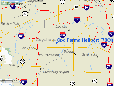
| From nearest city: | 2 nautical miles NW of Parma, OH |
| Location: | Cuyahoga County, OH |
| Magnetic Variation: | 06W (1985) |
Owner & Manager
| Ownership: | Privately owned |
| Owner: | C-p-c- Parma General Motors |
| Address: | 5400 Chevrolet Blvd
Parma, OH 44130 |
| Phone number: | 216-265-5361 |
| Manager: | R. L. Lintz |
| Address: | 5400 Chevrolet Blvd
Parma, OH 44130 |
| Phone number: | 216-265-5280 |
Airport Operations and Facilities
| Airport Use: | Private |
| Wind indicator: | Yes |
| Segmented Circle: | No |
| Control Tower: | No |
| Sectional chart: | Detroit |
| Region: | AGL - Great Lakes |
| Boundary ARTCC: | ZOB - Cleveland |
| Tie-in FSS: | CLE - Cleveland |
| FSS Toll Free: | 1-800-WX-BRIEF |
Runway Information
Helipad H1
| Dimension: | 23 x 23 ft / 7.0 x 7.0 m |
| Surface: | CONC, |
| |
Runway H1 |
Runway |
| Traffic Pattern: | Left | Left |
|
Radio Navigation Aids
| ID |
Type |
Name |
Ch |
Freq |
Var |
Dist |
| EZE | NDB | Engel | | 226.00 | 07W | 5.1 nm |
| BKL | NDB | Burke Lakefront | | 416.00 | 07W | 8.5 nm |
| CL | NDB | Harri | | 344.00 | 07W | 9.7 nm |
| LQL | NDB | Lakeland | | 263.00 | 08W | 24.0 nm |
| AK | NDB | Akron | | 362.00 | 07W | 26.9 nm |
| AAU | NDB | Ashland | | 329.00 | 07W | 34.7 nm |
| PT | NDB | Pelee Island | | 283.00 | 05W | 46.0 nm |
| MF | NDB | Manns | | 372.00 | 06W | 49.4 nm |
| PCW | NDB | Port Clinton | | 423.00 | 06W | 49.8 nm |
| DJB | VOR/DME | Dryer | 083X | 113.60 | 05W | 17.9 nm |
| LNN | VOR/DME | Lost Nation | 039X | 110.20 | 08W | 23.7 nm |
| CXR | VOR/DME | Chardon | 074X | 112.70 | 05W | 28.1 nm |
| ACO | VOR/DME | Akron | 091X | 114.40 | 04W | 31.6 nm |
| SKY | VOR/DME | Sandusky | 029X | 109.20 | 04W | 39.8 nm |
| BSV | VOR/DME | Briggs | 071X | 112.40 | 04W | 43.2 nm |
| MFD | VORTAC | Mansfield | 025X | 108.80 | 03W | 49.4 nm |
| YNG | VORTAC | Youngstown | 027X | 109.00 | 05W | 49.7 nm |
| CLE | VOT | Cleveland | | 110.40 | | 3.5 nm |
| CAK | VOT | Akron/canton Regional | | 110.60 | | 33.3 nm |
Remarks
- PRVDD APCH/DEP OPNS ARE COND FM 020 TO 060 DEGS, FM 090 TO 280 DEGS & FM 300 TO 350 DEGS; AREA IS MKD; WND IND IS MAINT; LTR OF AGREEMENT WITH CLE ATCT CONCERNING OPERATING IN THE TCA.
Images and information placed above are from
http://www.airport-data.com/airport/78OI/
We thank them for the data!
| General Info
|
| Country |
United States
|
| State |
OHIO
|
| FAA ID |
78OI
|
| Latitude |
41-24-44.183N
|
| Longitude |
081-46-19.479W
|
| Elevation |
800 feet
|
| Near City |
PARMA
|
We don't guarantee the information is fresh and accurate. The data may
be wrong or outdated.
For more up-to-date information please refer to other sources.
|
|


