 |
|
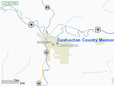
Coshocton County Memorial Hospital Heliport |
Location & QuickFacts
| FAA Information Effective: | 2008-09-25 |
| Airport Identifier: | 52OH |
| Airport Status: | Operational |
| Longitude/Latitude: | 081-50-53.4700W/40-16-14.2550N
-81.848186/40.270626 (Estimated) |
| Elevation: | 800 ft / 243.84 m (Estimated) |
| Land: | 0 acres |
| From nearest city: | 0 nautical miles SE of Coshocton, OH |
| Location: | Coshocton County, OH |
| Magnetic Variation: | 06W (1990) |
Owner & Manager
| Ownership: | Privately owned |
| Owner: | Coshocton County Meml Hosp |
| Address: | 1460 Orange Street
Coshocton, OH 43812 |
| Phone number: | 614-622-6411 |
| Manager: | Jack Countryman |
| Address: | 1460 Orange Street
Coshocton, OH 43812 |
| Phone number: | 614-622-6411 |
Airport Operations and Facilities
| Airport Use: | Private
MEDICAL USE. |
| Segmented Circle: | No |
| Control Tower: | No |
| Lighting Schedule: | PHONE REQ
FOR PERIMETER LIGHTS - CALL 614-622-6411/X285. |
| Sectional chart: | Detroit |
| Region: | AGL - Great Lakes |
| Boundary ARTCC: | ZID - Indianapolis |
| Tie-in FSS: | CLE - Cleveland |
| FSS on Airport: | No |
| FSS Toll Free: | 1-800-WX-BRIEF |
Runway Information
Helipad H1
| Dimension: | 30 x 30 ft / 9.1 x 9.1 m |
| Surface: | ASPH, |
| |
Runway H1 |
Runway |
| Traffic Pattern: | Left | Left |
|
Radio Navigation Aids
| ID |
Type |
Name |
Ch |
Freq |
Var |
Dist |
| MLR | NDB | Millersburg/dcmsnd | | 382.00 | 06W | 16.3 nm |
| HRA | NDB | Zanesville | | 204.00 | 06W | 22.1 nm |
| HEH | NDB | Newark | | 524.00 | 06W | 31.9 nm |
| CFX | NDB | Cadiz | | 239.00 | 07W | 38.4 nm |
| TSO | NDB | Tolson | | 395.00 | 07W | 39.4 nm |
| MF | NDB | Manns | | 372.00 | 06W | 40.4 nm |
| CM | NDB | Sumie | | 391.00 | 05W | 45.0 nm |
| AAU | NDB | Ashland | | 329.00 | 07W | 45.6 nm |
| TVT | VOR/DME | Tiverton | 112X | 116.50 | 03W | 17.0 nm |
| CTW | VOR/DME | Newcomerstown | 055X | 111.80 | 07W | 17.2 nm |
| ZZV | VOR/DME | Zanesville | 051X | 111.40 | 06W | 19.9 nm |
| BSV | VOR/DME | Briggs | 071X | 112.40 | 04W | 34.1 nm |
| AIR | VOR/DME | Bellaire | 118X | 117.10 | 07W | 49.8 nm |
| APE | VORTAC | Appleton | 114X | 116.70 | 06W | 34.7 nm |
| MFD | VORTAC | Mansfield | 025X | 108.80 | 03W | 49.4 nm |
| CAK | VOT | Akron/canton Regional | | 110.60 | | 43.0 nm |
Remarks
- PRVDD ALL APCH/DEP ROUTE OPS ARE CONDUCTED 155 DEG TO 035 DEG; TAKEOFF/LANDING AREA IS APPROPRIATELY MARKED AND A NON-OBSTRUCTING WIND INDICATOR IS MAINTAINED.
Images and information placed above are from
http://www.airport-data.com/airport/52OH/
We thank them for the data!
| General Info
|
| Country |
United States
|
| State |
OHIO
|
| FAA ID |
52OH
|
| Latitude |
40-16-14.255N
|
| Longitude |
081-50-53.470W
|
| Elevation |
800 feet
|
| Near City |
COSHOCTON
|
We don't guarantee the information is fresh and accurate. The data may
be wrong or outdated.
For more up-to-date information please refer to other sources.
|
|


