 |
|
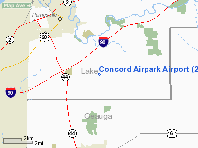
Location & QuickFacts
| FAA Information Effective: | 2008-09-25 |
| Airport Identifier: | 2G1 |
| Airport Status: | Operational |
| Longitude/Latitude: | 081-11-49.8601W/41-40-01.3566N
-81.197183/41.667043 (Estimated) |
| Elevation: | 999 ft / 304.50 m (Surveyed) |
| Land: | 87 acres |
| From nearest city: | 3 nautical miles SE of Painesville, OH |
| Location: | Lake County, OH |
| Magnetic Variation: | 07W (1985) |
Owner & Manager
| Ownership: | Privately owned |
| Owner: | Concord Airpark Inc. |
| Address: | 12253 Concord-hambden Rd
Painesville, OH 44077 |
| Phone number: | 440-354-9815 |
| Manager: | Connie Luhta |
| Address: | 12361 Concord-hambden Rd
Painesville, OH 44077 |
| Phone number: | 440-352-3228
OR HOME: 216-352-3228. |
Airport Operations and Facilities
| Airport Use: | Open to public |
| Wind indicator: | Yes |
| Segmented Circle: | No |
| Control Tower: | No |
| Lighting Schedule: | PHONE REQ
FOR RWY LGTS CALL 440-352-3228. |
| Landing fee charge: | No |
| Sectional chart: | Detroit |
| Region: | AGL - Great Lakes |
| Boundary ARTCC: | ZOB - Cleveland |
| Tie-in FSS: | CLE - Cleveland |
| FSS on Airport: | No |
| FSS Toll Free: | 1-800-WX-BRIEF |
| NOTAMs Facility: | CLE (NOTAM-d service avaliable) |
Airport Communications
| CTAF: | 122.800 |
| Unicom: | 122.800 |
Airport Services
| Fuel available: | 100LL |
| Bottled Oxygen: | NONE |
| Bulk Oxygen: | NONE |
Runway Information
Runway 02/20
| Dimension: | 2181 x 38 ft / 664.8 x 11.6 m |
| Surface: | ASPH, Fair Condition |
| Weight Limit: | Single wheel: 12500 lbs. |
| Edge Lights: | Low |
| |
Runway 02 |
Runway 20 |
| Longitude: | 081-11-55.1667W | 081-11-44.5521W |
| Latitude: | 41-39-51.3440N | 41-40-11.3691N |
| Elevation: | 994.00 ft | 968.00 ft |
| Alignment: | 22 | 127 |
| Traffic Pattern: | Left | Left |
| Runway End Identifier: | No | No |
| Centerline Lights: | No | No |
| Touchdown Lights: | No | No |
| Obstruction: | 58 ft trees, 201.0 ft from runway
RWY 02 36 FT TREES 90-130 FT FM THLD; 125 FT L & R; +45 FT TREES 40-105 FT FM THLD 120-125 FT R. | 18 ft brush, 201.0 ft from runway, 28 ft left of centerline
RWY 20 3 - 20 FT BRUSH 0 FT FM THLD 40 FT L TO 0 FT FM THLD 125 FT L TO 200 FT FM THLD OB TO 200 FT FM THLD 48 FT L. |
|
Radio Navigation Aids
| ID |
Type |
Name |
Ch |
Freq |
Var |
Dist |
| LQL | NDB | Lakeland | | 263.00 | 08W | 8.2 nm |
| BKL | NDB | Burke Lakefront | | 416.00 | 07W | 22.5 nm |
| EZE | NDB | Engel | | 226.00 | 07W | 25.9 nm |
| AK | NDB | Akron | | 362.00 | 07W | 36.9 nm |
| CL | NDB | Harri | | 344.00 | 07W | 39.8 nm |
| HBD | NDB | Hubbard | | 408.00 | 08W | 43.1 nm |
| LNN | VOR/DME | Lost Nation | 039X | 110.20 | 08W | 8.7 nm |
| CXR | VOR/DME | Chardon | 074X | 112.70 | 05W | 9.2 nm |
| JFN | VOR/DME | Jefferson | 099X | 115.20 | 05W | 20.9 nm |
| ACO | VOR/DME | Akron | 091X | 114.40 | 04W | 33.6 nm |
| DJB | VOR/DME | Dryer | 083X | 113.60 | 05W | 47.2 nm |
| YNG | VORTAC | Youngstown | 027X | 109.00 | 05W | 31.0 nm |
| ERI | VORTAC | Erie | 031X | 109.40 | 06W | 45.7 nm |
| CLE | VOT | Cleveland | | 110.40 | | 33.1 nm |
| CAK | VOT | Akron/canton Regional | | 110.60 | | 46.5 nm |
Remarks
- BIRDS ON & INVOF ARPT.
- ARPT EXISTED PRIOR TO FAA ACT.
Images and information placed above are from
http://www.airport-data.com/airport/2G1/
We thank them for the data!
| General Info
|
| Country |
United States
|
| State |
OHIO
|
| FAA ID |
2G1
|
| Latitude |
41-40-01.372N
|
| Longitude |
081-11-49.862W
|
| Elevation |
995 feet
|
| Near City |
PAINESVILLE
|
We don't guarantee the information is fresh and accurate. The data may
be wrong or outdated.
For more up-to-date information please refer to other sources.
|
|


