 |
|
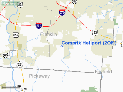
Location & QuickFacts
| FAA Information Effective: | 2008-09-25 |
| Airport Identifier: | 2OI9 |
| Airport Status: | Operational |
| Longitude/Latitude: | 082-54-27.6430W/39-50-22.2280N
-82.907679/39.839508 (Estimated) |
| Elevation: | 725 ft / 220.98 m (Estimated) |
| Land: | 0 acres |
| From nearest city: | 4 nautical miles W of Groveport, OH |
| Location: | Franklin County, OH |
| Magnetic Variation: | 05W (1985) |
Owner & Manager
| Ownership: | Privately owned |
| Owner: | Hans Comprix |
| Address: | 3509 Rohr Road
Groveport, OH 43125 |
| Phone number: | 614-491-0049 |
| Manager: | Hans Comprix |
| Address: | 3509 Rohr Road
Groveport, OH 43125 |
| Phone number: | 614-491-0049 |
Airport Operations and Facilities
| Airport Use: | Private |
| Wind indicator: | Yes |
| Segmented Circle: | Yes |
| Control Tower: | No |
| Landing fee charge: | No |
| Sectional chart: | Cincinnati |
| Region: | AGL - Great Lakes |
| Boundary ARTCC: | ZID - Indianapolis |
| Tie-in FSS: | DAY - Dayton |
| FSS on Airport: | No |
| FSS Toll Free: | 1-800-WX-BRIEF |
Airport Communications
Runway Information
Helipad H1
| Dimension: | 100 x 100 ft / 30.5 x 30.5 m |
| Surface: | TURF, |
| |
Runway H1 |
Runway |
| Traffic Pattern: | Left | Left |
|
Radio Navigation Aids
| ID |
Type |
Name |
Ch |
Freq |
Var |
Dist |
| CM | NDB | Sumie | | 391.00 | 05W | 11.3 nm |
| CHC | NDB | Grens | | 272.00 | 04W | 11.7 nm |
| BU | NDB | Boutn | | 230.00 | 05W | 13.8 nm |
| DKG | NDB | Don Scott | | 348.00 | 05W | 16.5 nm |
| CYO | NDB | Circleville | | 366.00 | 05W | 19.3 nm |
| OS | NDB | Fuler | | 515.00 | 05W | 19.4 nm |
| HEH | NDB | Newark | | 524.00 | 06W | 23.3 nm |
| RZT | NDB | Ross County | | 236.00 | 05W | 24.8 nm |
| UYF | NDB | London | | 263.00 | 06W | 26.4 nm |
| CSS | NDB | Court House | | 414.00 | 05W | 26.6 nm |
| DLZ | NDB | Delaware | | 215.00 | 06W | 27.8 nm |
| MRT | NDB | Marysville | | 403.00 | 05W | 30.9 nm |
| CCJ | NDB | Clark County | | 341.00 | 04W | 40.3 nm |
| EOP | NDB | Waverly | | 385.00 | 06W | 40.4 nm |
| IL | NDB | Airbo | | 407.00 | 04W | 43.7 nm |
| HRA | NDB | Zanesville | | 204.00 | 06W | 45.8 nm |
| MNN | NDB | Marion | | 201.00 | 05W | 47.3 nm |
| XEN | NDB | Xenia | | 395.00 | 03W | 47.8 nm |
| HOC | NDB | Hillsboro | | 278.00 | 05W | 49.2 nm |
| LCK | TACAN | Rickenbacker | 069X | | 05W | 2.1 nm |
| XSF | TACAN | Springfield | 065X | | 04W | 43.1 nm |
| XUB | VOR | Yellow Bud | | 112.50 | 05W | 19.1 nm |
| BUD | VOR | Buckeye | | 109.80 | 05W | 47.3 nm |
| SGH | VOR/DME | Springfield | 079X | 113.20 | 04W | 43.3 nm |
| ZZV | VOR/DME | Zanesville | 051X | 111.40 | 06W | 47.2 nm |
| MXQ | VOR/DME | Midwest | 076X | 112.90 | 04W | 48.1 nm |
| APE | VORTAC | Appleton | 114X | 116.70 | 06W | 23.8 nm |
| CMH | VOT | Port Columbus | | 111.00 | | 9.4 nm |
Remarks
- PVDD APCH/DEP RTE HEL OPNS CONDUCTED ACCORD LTR OF AGRMT; TKOF/LNDG AREA APROPLY MARKED; NON-OBSTRUCTG WIND INDCR MAINTD ADJ TKOF/LNDG AREA.
Images and information placed above are from
http://www.airport-data.com/airport/2OI9/
We thank them for the data!
| General Info
|
| Country |
United States
|
| State |
OHIO
|
| FAA ID |
2OI9
|
| Latitude |
39-50-22.228N
|
| Longitude |
082-54-27.643W
|
| Elevation |
725 feet
|
| Near City |
GROVEPORT
|
We don't guarantee the information is fresh and accurate. The data may
be wrong or outdated.
For more up-to-date information please refer to other sources.
|
|


