 |
|
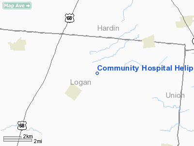
Community Hospital Heliport |
Location & QuickFacts
| FAA Information Effective: | 2008-09-25 |
| Airport Identifier: | 54OI |
| Airport Status: | Operational |
| Longitude/Latitude: | 083-38-18.7480W/40-28-49.1920N
-83.638541/40.480331 (Estimated) |
| Elevation: | 9 ft / 2.74 m (Estimated) |
| Land: | 0 acres |
| From nearest city: | 0 nautical miles W of Coldwater, OH |
| Location: | Mercer County, OH |
| Magnetic Variation: | 05W (1980) |
Owner & Manager
| Ownership: | Publicly owned |
| Owner: | Mercer Community Hospital |
| Address: | 800 W Main St
Coldwater, OH 45828 |
| Phone number: | 419-678-2341 |
| Manager: | Jim Wermert |
| Address: | 800 W Main St
Coldwater, OH 45828 |
| Phone number: | 419-678-2341 |
Airport Operations and Facilities
| Airport Use: | Private
MEDICAL USE. |
| Wind indicator: | Yes |
| Segmented Circle: | No |
| Control Tower: | No |
| Sectional chart: | Detroit |
| Region: | AGL - Great Lakes |
| Boundary ARTCC: | ZID - Indianapolis |
| Tie-in FSS: | DAY - Dayton |
| FSS Toll Free: | 1-800-WX-BRIEF |
Runway Information
Helipad H1
| Dimension: | 30 x 30 ft / 9.1 x 9.1 m |
| Surface: | CONC, |
| |
Runway H1 |
Runway |
| Traffic Pattern: | Left | Left |
|
Radio Navigation Aids
| ID |
Type |
Name |
Ch |
Freq |
Var |
Dist |
| RUV | NDB | Rushsylvania | | 326.00 | 05W | 1.9 nm |
| EDJ | NDB | Bellefontaine | | 242.00 | 05W | 10.4 nm |
| MRT | NDB | Marysville | | 403.00 | 05W | 20.2 nm |
| LYL | NDB | Lima | | 362.00 | 04W | 22.1 nm |
| MNN | NDB | Marion | | 201.00 | 05W | 27.2 nm |
| DLZ | NDB | Delaware | | 215.00 | 06W | 27.4 nm |
| OS | NDB | Fuler | | 515.00 | 05W | 31.7 nm |
| BNR | NDB | Benton Ridge | | 334.00 | 05W | 32.5 nm |
| UYF | NDB | London | | 263.00 | 06W | 33.8 nm |
| DKG | NDB | Don Scott | | 348.00 | 05W | 35.2 nm |
| PDR | NDB | Ottawa | | 233.00 | 05W | 36.5 nm |
| CCJ | NDB | Clark County | | 341.00 | 04W | 37.0 nm |
| CHC | NDB | Grens | | 272.00 | 04W | 39.8 nm |
| TII | NDB | Tiffin | | 269.00 | 05W | 42.0 nm |
| CQA | NDB | Lakefield | | 205.00 | 04W | 42.3 nm |
| VES | NDB | Versailles | | 356.00 | 04W | 43.7 nm |
| FZI | NDB | Fostoria | | 379.00 | 05W | 44.0 nm |
| BU | NDB | Boutn | | 230.00 | 05W | 44.5 nm |
| XEN | NDB | Xenia | | 395.00 | 03W | 47.9 nm |
| XSF | TACAN | Springfield | 065X | | 04W | 39.7 nm |
| FFO | TACAN | Patterson | 099X | | 04W | 44.1 nm |
| AOH | VOR | Allen County | | 108.40 | 04W | 20.3 nm |
| BUD | VOR | Buckeye | | 109.80 | 05W | 27.5 nm |
| MAH | VOR | Marathon | | 114.90 | 05W | 32.2 nm |
| SGH | VOR/DME | Springfield | 079X | 113.20 | 04W | 39.8 nm |
| DQN | VOR/DME | Dayton | 092X | 114.50 | 01W | 44.6 nm |
| ROD | VORTAC | Rosewood | 122X | 117.50 | 05W | 21.8 nm |
| FDY | VORTAC | Findlay | 019X | 108.20 | 02W | 29.0 nm |
| DAY | VOT | Dayton J M Cox-day | | 111.00 | | 43.8 nm |
| CMH | VOT | Port Columbus | | 111.00 | | 45.2 nm |
Remarks
Images and information placed above are from
http://www.airport-data.com/airport/54OI/
We thank them for the data!
| General Info
|
| Country |
United States
|
| State |
OHIO
|
| FAA ID |
54OI
|
| Latitude |
40-28-49.192N
|
| Longitude |
083-38-18.748W
|
| Elevation |
9 feet
|
| Near City |
COLDWATER
|
We don't guarantee the information is fresh and accurate. The data may
be wrong or outdated.
For more up-to-date information please refer to other sources.
|
|


