|
|
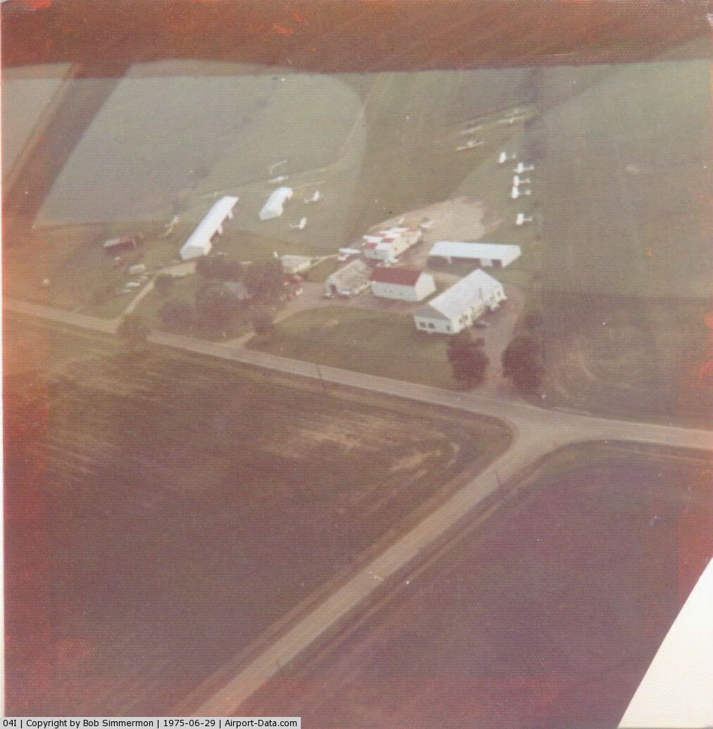
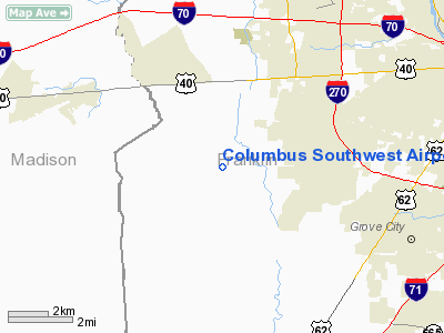
Columbus Southwest Airport |
 |
(Click on the photo to enlarge) |
Location & QuickFacts
| FAA Information Effective: | 2008-09-25 |
| Airport Identifier: | 04I |
| Airport Status: | Operational |
| Longitude/Latitude: | 083-11-19.6850W/39-54-40.2240N
-83.188801/39.911173 (Estimated) |
| Elevation: | 920 ft / 280.42 m (Surveyed) |
| Land: | 14 acres |
| From nearest city: | 11 nautical miles SW of Columbus, OH |
| Location: | Franklin County, OH |
| Magnetic Variation: | 05W (1985) |
Owner & Manager
| Ownership: | Privately owned |
| Owner: | James Edward Bowers |
| Address: | 1751 Alton Road
Galloway, OH 43119 |
| Phone number: | 614-878-4080 |
| Manager: | James Edward Bowers |
| Address: | 1751 Alton Road
Galloway, OH 43119 |
| Phone number: | 614-878-4080 |
Airport Operations and Facilities
| Airport Use: | Open to public |
| Wind indicator: | Yes |
| Segmented Circle: | No |
| Control Tower: | No |
| Lighting Schedule: | PHONE REQ
FOR LIRL RY 06/24 & ROTG BCN CALL 614-878-4080. |
| Beacon Color: | Clear-Green (lighted land airport) |
| Sectional chart: | Cincinnati |
| Region: | AGL - Great Lakes |
| Boundary ARTCC: | ZID - Indianapolis |
| Tie-in FSS: | DAY - Dayton |
| FSS Toll Free: | 1-800-WX-BRIEF |
| NOTAMs Facility: | DAY (NOTAM-d service avaliable) |
Airport Communications
Airport Services
Runway Information
Runway 06/24
| Dimension: | 2382 x 120 ft / 726.0 x 36.6 m |
| Surface: | TURF, Good Condition
UNDULATING SFC; RY SOFT WHEN WET; CHECK NOTAMS OR CALL AMGR AT (614) 878-4080. |
| Edge Lights: | Low |
| |
Runway 06 |
Runway 24 |
| Longitude: | 083-11-34.2000W | 083-11-04.9800W |
| Latitude: | 39-54-32.9500N | 39-54-47.2800N |
| Elevation: | 920.00 ft | 920.00 ft |
| Traffic Pattern: | Left | Left |
| Obstruction: | 37 ft trees, 100 ft left of centerline | 16 ft bldg, 0.0 ft from runway, 126 ft right of centerline |
|
Radio Navigation Aids
| ID |
Type |
Name |
Ch |
Freq |
Var |
Dist |
| BU | NDB | Boutn | | 230.00 | 05W | 5.6 nm |
| CHC | NDB | Grens | | 272.00 | 04W | 9.5 nm |
| OS | NDB | Fuler | | 515.00 | 05W | 9.8 nm |
| DKG | NDB | Don Scott | | 348.00 | 05W | 11.4 nm |
| UYF | NDB | London | | 263.00 | 06W | 12.9 nm |
| MRT | NDB | Marysville | | 403.00 | 05W | 20.4 nm |
| CM | NDB | Sumie | | 391.00 | 05W | 20.5 nm |
| CSS | NDB | Court House | | 414.00 | 05W | 20.9 nm |
| DLZ | NDB | Delaware | | 215.00 | 06W | 22.3 nm |
| CYO | NDB | Circleville | | 366.00 | 05W | 25.2 nm |
| CCJ | NDB | Clark County | | 341.00 | 04W | 27.3 nm |
| RZT | NDB | Ross County | | 236.00 | 05W | 29.4 nm |
| HEH | NDB | Newark | | 524.00 | 06W | 34.1 nm |
| IL | NDB | Airbo | | 407.00 | 04W | 35.7 nm |
| XEN | NDB | Xenia | | 395.00 | 03W | 36.2 nm |
| RUV | NDB | Rushsylvania | | 326.00 | 05W | 39.6 nm |
| EDJ | NDB | Bellefontaine | | 242.00 | 05W | 39.8 nm |
| MNN | NDB | Marion | | 201.00 | 05W | 42.8 nm |
| HW | NDB | Cubla | | 299.00 | 04W | 46.2 nm |
| EOP | NDB | Waverly | | 385.00 | 06W | 46.3 nm |
| HOC | NDB | Hillsboro | | 278.00 | 05W | 46.6 nm |
| LCK | TACAN | Rickenbacker | 069X | | 05W | 13.5 nm |
| XSF | TACAN | Springfield | 065X | | 04W | 30.4 nm |
| FFO | TACAN | Patterson | 099X | | 04W | 40.4 nm |
| XUB | VOR | Yellow Bud | | 112.50 | 05W | 25.1 nm |
| BUD | VOR | Buckeye | | 109.80 | 05W | 42.8 nm |
| SGH | VOR/DME | Springfield | 079X | 113.20 | 04W | 30.6 nm |
| MXQ | VOR/DME | Midwest | 076X | 112.90 | 04W | 40.5 nm |
| APE | VORTAC | Appleton | 114X | 116.70 | 06W | 31.2 nm |
| ROD | VORTAC | Rosewood | 122X | 117.50 | 05W | 45.3 nm |
| CMH | VOT | Port Columbus | | 111.00 | | 14.9 nm |
| DAY | VOT | Dayton J M Cox-day | | 111.00 | | 47.6 nm |
Remarks
Images and information placed above are from
http://www.airport-data.com/airport/04I/
We thank them for the data!
| General Info
|
| Country |
United States
|
| State |
OHIO
|
| FAA ID |
04I
|
| Latitude |
39-54-40.224N
|
| Longitude |
083-11-19.685W
|
| Elevation |
920 feet
|
| Near City |
COLUMBUS
|
We don't guarantee the information is fresh and accurate. The data may
be wrong or outdated.
For more up-to-date information please refer to other sources.
|
|