 |
|
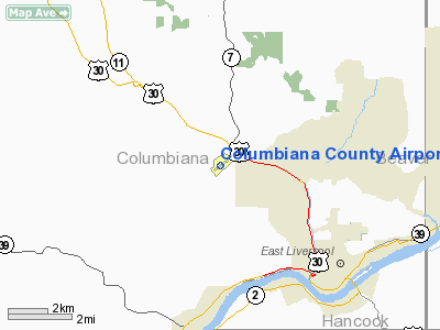
Columbiana County Airport |
Location & QuickFacts
| FAA Information Effective: | 2008-09-25 |
| Airport Identifier: | 02G |
| Airport Status: | Operational |
| Longitude/Latitude: | 080-38-29.0630W/40-40-23.9260N
-80.641406/40.673313 (Estimated) |
| Elevation: | 1160 ft / 353.57 m (Surveyed) |
| Land: | 142 acres |
| From nearest city: | 4 nautical miles NW of East Liverpool, OH |
| Location: | Columbiana County, OH |
| Magnetic Variation: | 08W (2000) |
Owner & Manager
| Ownership: | Publicly owned |
| Owner: | Columbiana Co Arpt Auth |
| Address: | Po Box 81
East Liverpool, OH 43920 |
| Phone number: | 330-386-3200 |
| Manager: | Jim Burcham |
| Address: | 15606 County Airport Road
East Liverpool, OH 43920 |
| Phone number: | 330-386-3200 |
Airport Operations and Facilities
| Airport Use: | Open to public |
| Wind indicator: | Yes |
| Segmented Circle: | Yes |
| Control Tower: | No |
| Lighting Schedule: | DUSK-DAWN
ACTVT MIRL RY 07/25 PAPI RY 25 & REIL RY 25 - CTAF. |
| Beacon Color: | Clear-Green (lighted land airport) |
| Landing fee charge: | No |
| Sectional chart: | Detroit |
| Region: | AGL - Great Lakes |
| Boundary ARTCC: | ZOB - Cleveland |
| Tie-in FSS: | CLE - Cleveland |
| FSS on Airport: | No |
| FSS Toll Free: | 1-800-WX-BRIEF |
| NOTAMs Facility: | CLE (NOTAM-d service avaliable) |
| Federal Agreements: | NGVY |
Airport Communications
| CTAF: | 123.000 |
| Unicom: | 123.000 |
Airport Services
| Fuel available: | 100LL |
| Airframe Repair: | MAJOR |
| Power Plant Repair: | MINOR |
| Bottled Oxygen: | NONE |
| Bulk Oxygen: | NONE |
Runway Information
Runway 07/25
| Dimension: | 3503 x 75 ft / 1067.7 x 22.9 m |
| Surface: | ASPH, Good Condition |
| Weight Limit: | Single wheel: 12500 lbs. |
| Edge Lights: | Medium |
| |
Runway 07 |
Runway 25 |
| Longitude: | 080-38-48.9440W | 080-38-09.3290W |
| Latitude: | 40-40-15.4540N | 40-40-32.4320N |
| Elevation: | 1142.00 ft | 1160.00 ft |
| Alignment: | 61 | 127 |
| Traffic Pattern: | Left | Left |
| Markings: | Non-precision instrument, Fair Condition | Non-precision instrument, Fair Condition |
| Crossing Height: | 0.00 ft | 26.00 ft |
| VASI: | | 4-light PAPI on left side |
| Visual Glide Angle: | 0.00° | 3.00° |
| Runway End Identifier: | | Yes |
| Centerline Lights: | No | No |
| Touchdown Lights: | No | No |
| Obstruction: | 35 ft trees, 584.0 ft from runway, 197 ft left of centerline, 10:1 slope to clear | 42 ft trees, 201.0 ft from runway, 250 ft left of centerline
42 FT TREES 160-200 FT FM RY 220-250 L. |
|
Radio Navigation Aids
| ID |
Type |
Name |
Ch |
Freq |
Var |
Dist |
| TSO | NDB | Tolson | | 395.00 | 07W | 21.0 nm |
| UCP | NDB | Castle | | 272.00 | 09W | 23.4 nm |
| HBD | NDB | Hubbard | | 408.00 | 08W | 29.3 nm |
| CFX | NDB | Cadiz | | 239.00 | 07W | 31.3 nm |
| PNU | NDB | Washington County | | 255.00 | 08W | 38.6 nm |
| AK | NDB | Akron | | 362.00 | 07W | 41.4 nm |
| MKP | NDB | Mc Keesport | | 287.00 | 07W | 43.7 nm |
| HLG | VOR/DME | Wheeling | 059X | 112.20 | 07W | 25.1 nm |
| BSV | VOR/DME | Briggs | 071X | 112.40 | 04W | 36.3 nm |
| AGC | VOR/DME | Allegheny | 037X | 110.00 | 09W | 36.3 nm |
| ACO | VOR/DME | Akron | 091X | 114.40 | 04W | 36.5 nm |
| AIR | VOR/DME | Bellaire | 118X | 117.10 | 07W | 40.3 nm |
| CTW | VOR/DME | Newcomerstown | 055X | 111.80 | 07W | 46.6 nm |
| EWC | VORTAC | Ellwood City | 105X | 115.80 | 08W | 21.6 nm |
| MMJ | VORTAC | Montour | 057X | 112.00 | 08W | 23.3 nm |
| YNG | VORTAC | Youngstown | 027X | 109.00 | 05W | 39.6 nm |
| CAK | VOT | Akron/canton Regional | | 110.60 | | 39.3 nm |
Remarks
- HI TENSION LINE 1.5NW OBSTN LGTD.
- TWY MARKED WITH REFLECTORS.
- PAEW BETWEEN TWY & RY. PAEW INVOF TWY & RAMP.
Images and information placed above are from
http://www.airport-data.com/airport/02G/
We thank them for the data!
| General Info
|
| Country |
United States
|
| State |
OHIO
|
| FAA ID |
02G
|
| Latitude |
40-40-23.926N
|
| Longitude |
080-38-29.063W
|
| Elevation |
1160 feet
|
| Near City |
EAST LIVERPOOL
|
We don't guarantee the information is fresh and accurate. The data may
be wrong or outdated.
For more up-to-date information please refer to other sources.
|
|


