 |
|
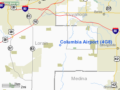
Location & QuickFacts
| FAA Information Effective: | 2008-09-25 |
| Airport Identifier: | 4G8 |
| Airport Status: | Operational |
| Longitude/Latitude: | 081-57-36.6000W/41-19-07.7000N
-81.960167/41.318806 (Estimated) |
| Elevation: | 813 ft / 247.80 m (Surveyed) |
| Land: | 87 acres |
| From nearest city: | 1 nautical miles NW of Columbia Station, OH |
| Location: | Lorain County, OH |
| Magnetic Variation: | 06W (1985) |
Owner & Manager
| Ownership: | Privately owned |
| Owner: | Columbia Enterprises Inc |
| Address: | 27410 Royalton Rd
Columbia Station, OH 44028 |
| Phone number: | 440-236-8800 |
| Manager: | Joe Kenik |
| Address: | P.o. Box 599
Columbia Station, OH 44028 |
| Phone number: | 440-236-8800 |
Airport Operations and Facilities
| Airport Use: | Open to public |
| Wind indicator: | Yes |
| Segmented Circle: | No |
| Control Tower: | No |
| Lighting Schedule: | RDO-CTL
ACRVT LIRL RY 18R.36L - CTAF. |
| Landing fee charge: | No |
| Sectional chart: | Detroit |
| Region: | AGL - Great Lakes |
| Boundary ARTCC: | ZOB - Cleveland |
| Tie-in FSS: | CLE - Cleveland |
| FSS on Airport: | No |
| FSS Toll Free: | 1-800-WX-BRIEF |
| NOTAMs Facility: | CLE (NOTAM-d service avaliable) |
Airport Communications
| CTAF: | 122.800 |
| Unicom: | 122.800 |
Airport Services
Runway Information
Runway 02/20
| Dimension: | 2580 x 85 ft / 786.4 x 25.9 m |
| Surface: | TURF, Poor Condition
SFC ROUGH.
RWY 18L/36R SFC ROUGH.
PAVEMENT POOR - WEATHERED |
| |
Runway 02 |
Runway 20 |
| Traffic Pattern: | Left | Left |
| Obstruction: | 30 ft brush, 42 ft left of centerline | 80 ft trees, 0.0 ft from runway, 42 ft left of centerline |
|
Runway 18L/36R
| Dimension: | 2947 x 65 ft / 898.2 x 19.8 m |
| Surface: | TURF, Fair Condition
SFC ROUGH.
RWY 18L/36R SFC ROUGH.
PAVEMENT POOR - WEATHERED |
| |
Runway 18L |
Runway 36R |
| Longitude: | 081-57-34.9045W | 081-57-35.9937W |
| Latitude: | 41-19-22.7581N | 41-18-53.6581N |
| Elevation: | 806.00 ft | 810.00 ft |
| Alignment: | 127 | 2 |
| Traffic Pattern: | Left | Left |
| Obstruction: | 25 ft trees | 64 ft tree, 680.0 ft from runway, 10:1 slope to clear |
|
Runway 18R/36L
| Dimension: | 3152 x 40 ft / 960.7 x 12.2 m |
| Surface: | ASPH, Poor Condition
SFC ROUGH.
RWY 18L/36R SFC ROUGH.
PAVEMENT POOR - WEATHERED |
| Edge Lights: | Non-standard lighting system
NSTD LIRL; NO THLD LGTS. |
| |
Runway 18R |
Runway 36L |
| Longitude: | 081-57-37.1477W | 081-57-38.0335W |
| Latitude: | 41-19-22.8168N | 41-18-51.6806N |
| Elevation: | 810.00 ft | 810.00 ft |
| Alignment: | 127 | 2 |
| Traffic Pattern: | Left | Left |
| Markings: | Numbers only, Fair Condition
RWY 18R RY N18R NSTD DSPLCD THLD MARKINGS, NO ARROWHEADS. | Numbers only, Fair Condition
RY N36L NSTD DSPLCD THLD MARKINGS, NO ARROWHEADS. |
| Displaced threshold: | 300.00 ft | 209.00 ft |
| Obstruction: | 35 ft trees, 201.0 ft from runway
RY 18R APCH RATIO 3:1 TO DSPLCD THLD DUE TO +35 FT TREES AND BRUSH 130 FT FR THLD 100R
RWY 18R +20 FT TREES AND BRUSH, 0 FT FROM RWY END 0B | 48 ft tree, 311.0 ft from runway, 151 ft left of centerline, 2:1 slope to clear
RWY 36L APPROACH RATIO 10:1 TO DSPLCD THLD DUE TO +48 FT TREE 520 FT FR THLD 151L |
|
Radio Navigation Aids
| ID |
Type |
Name |
Ch |
Freq |
Var |
Dist |
| CL | NDB | Harri | | 344.00 | 07W | 1.2 nm |
| EZE | NDB | Engel | | 226.00 | 07W | 14.8 nm |
| BKL | NDB | Burke Lakefront | | 416.00 | 07W | 18.4 nm |
| AAU | NDB | Ashland | | 329.00 | 07W | 25.2 nm |
| AK | NDB | Akron | | 362.00 | 07W | 29.9 nm |
| LQL | NDB | Lakeland | | 263.00 | 08W | 34.1 nm |
| MF | NDB | Manns | | 372.00 | 06W | 39.8 nm |
| PT | NDB | Pelee Island | | 283.00 | 05W | 42.3 nm |
| PCW | NDB | Port Clinton | | 423.00 | 06W | 42.7 nm |
| MLR | NDB | Millersburg/dcmsnd | | 382.00 | 06W | 46.9 nm |
| DJB | VOR/DME | Dryer | 083X | 113.60 | 05W | 9.4 nm |
| SKY | VOR/DME | Sandusky | 029X | 109.20 | 04W | 32.1 nm |
| LNN | VOR/DME | Lost Nation | 039X | 110.20 | 08W | 33.8 nm |
| ACO | VOR/DME | Akron | 091X | 114.40 | 04W | 36.6 nm |
| CXR | VOR/DME | Chardon | 074X | 112.70 | 05W | 37.8 nm |
| BSV | VOR/DME | Briggs | 071X | 112.40 | 04W | 42.2 nm |
| MFD | VORTAC | Mansfield | 025X | 108.80 | 03W | 39.4 nm |
| CLE | VOT | Cleveland | | 110.40 | | 7.5 nm |
| CAK | VOT | Akron/canton Regional | | 110.60 | | 33.7 nm |
Remarks
- USE HARD SFC RY WHEN WET.
- EXISTED PRIOR TO 1959
Images and information placed above are from
http://www.airport-data.com/airport/4G8/
We thank them for the data!
| General Info
|
| Country |
United States
|
| State |
OHIO
|
| FAA ID |
4G8
|
| Latitude |
41-19-07.700N
|
| Longitude |
081-57-36.600W
|
| Elevation |
813 feet
|
| Near City |
COLUMBIA STATION
|
We don't guarantee the information is fresh and accurate. The data may
be wrong or outdated.
For more up-to-date information please refer to other sources.
|
|


