 |
|
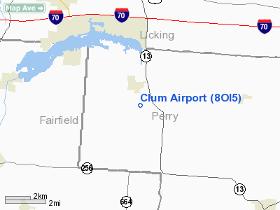
Location & QuickFacts
| FAA Information Effective: | 2008-09-25 |
| Airport Identifier: | 8OI5 |
| Airport Status: | Operational |
| Longitude/Latitude: | 082-24-52.5530W/39-52-54.2350N
-82.414598/39.881732 (Estimated) |
| Elevation: | 1115 ft / 339.85 m (Estimated) |
| Land: | 80 acres |
| From nearest city: | 1 nautical miles SE of Thornville, OH |
| Location: | Perry County, OH |
| Magnetic Variation: | 05W (1985) |
Owner & Manager
| Ownership: | Privately owned |
| Owner: | David L. Clum |
| Address: | 12705 Bruno Rd. N.w.
Thornville, OH 43076 |
| Phone number: | 740-246-6464 |
| Manager: | David L. Clum |
| Address: | 12705 Bruno Rd. N.w.
Thornville, OH 43076 |
| Phone number: | 740-246-6464 |
Airport Operations and Facilities
| Airport Use: | Private |
| Wind indicator: | Yes |
| Segmented Circle: | No |
| Control Tower: | No |
| Landing fee charge: | No |
| Sectional chart: | Cincinnati |
| Region: | AGL - Great Lakes |
| Boundary ARTCC: | ZID - Indianapolis |
| Tie-in FSS: | CLE - Cleveland |
| FSS on Airport: | No |
| FSS Toll Free: | 1-800-WX-BRIEF |
Runway Information
Runway 01/19
| Dimension: | 1600 x 80 ft / 487.7 x 24.4 m |
| Surface: | TURF, |
| |
Runway 01 |
Runway 19 |
| Traffic Pattern: | Left | Left |
| Obstruction: | 70 ft trees | |
|
Radio Navigation Aids
| ID |
Type |
Name |
Ch |
Freq |
Var |
Dist |
| HEH | NDB | Newark | | 524.00 | 06W | 9.0 nm |
| CM | NDB | Sumie | | 391.00 | 05W | 16.9 nm |
| HRA | NDB | Zanesville | | 204.00 | 06W | 22.9 nm |
| CHC | NDB | Grens | | 272.00 | 04W | 29.3 nm |
| DKG | NDB | Don Scott | | 348.00 | 05W | 32.8 nm |
| CYO | NDB | Circleville | | 366.00 | 05W | 33.9 nm |
| BU | NDB | Boutn | | 230.00 | 05W | 36.7 nm |
| OS | NDB | Fuler | | 515.00 | 05W | 37.9 nm |
| RZT | NDB | Ross County | | 236.00 | 05W | 39.0 nm |
| DLZ | NDB | Delaware | | 215.00 | 06W | 39.6 nm |
| UGS | NDB | University | | 250.00 | 06W | 39.8 nm |
| MLR | NDB | Millersburg/dcmsnd | | 382.00 | 06W | 46.8 nm |
| MRT | NDB | Marysville | | 403.00 | 05W | 47.8 nm |
| CSS | NDB | Court House | | 414.00 | 05W | 48.2 nm |
| UYF | NDB | London | | 263.00 | 06W | 48.6 nm |
| EOP | NDB | Waverly | | 385.00 | 06W | 49.2 nm |
| LCK | TACAN | Rickenbacker | 069X | | 05W | 24.1 nm |
| XUB | VOR | Yellow Bud | | 112.50 | 05W | 33.7 nm |
| ZZV | VOR/DME | Zanesville | 051X | 111.40 | 06W | 24.3 nm |
| TVT | VOR/DME | Tiverton | 112X | 116.50 | 03W | 37.1 nm |
| CTW | VOR/DME | Newcomerstown | 055X | 111.80 | 07W | 47.9 nm |
| APE | VORTAC | Appleton | 114X | 116.70 | 06W | 18.1 nm |
| CMH | VOT | Port Columbus | | 111.00 | | 22.7 nm |
Remarks
- SAFE OPNS CANNOT BE CONDD DUE TO OBJECTS IN THE IMMEDIATE VCNTY OF THE RWY.
Images and information placed above are from
http://www.airport-data.com/airport/8OI5/
We thank them for the data!
| General Info
|
| Country |
United States
|
| State |
OHIO
|
| FAA ID |
8OI5
|
| Latitude |
39-52-54.235N
|
| Longitude |
082-24-52.553W
|
| Elevation |
1115 feet
|
| Near City |
THORNVILLE
|
We don't guarantee the information is fresh and accurate. The data may
be wrong or outdated.
For more up-to-date information please refer to other sources.
|
|


