|
|
| Clinton Field |
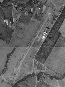 |
| USGS aerial image as of 22 March 1994 |
| IATA: none – ICAO: none – FAA LID: I66 |
| Summary |
| Airport type |
Public |
| Owner |
Clinton County Board of Commissioners |
| Serves |
Clinton County, Ohio |
| Location |
Wilmington, Ohio |
| Elevation AMSL |
1,033 ft / 315 m |
| Coordinates |
39°30′09″N 083°51′48″W / 39.5025°N 83.86333°W / 39.5025; -83.86333 |
| Runways |
| Direction |
Length |
Surface |
| ft |
m |
| 3/21 |
3,579 |
1,091 |
Asphalt |
| Statistics (2006) |
| Aircraft operations |
27,860 |
| Based aircraft |
28 |
| Source: Federal Aviation Administration |
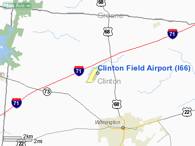
Clinton Field (FAA LID: I66) is a public use airport located four nautical miles (7 km) northwest of the central business district of Wilmington, a city in Clinton County, Ohio, United States. It is owned by the Clinton County Board of Commissioners. This airport is included in the FAA's National Plan of Integrated Airport Systems (2009-2013), which categorizes it as a general aviation facility.
Facilities and aircraft
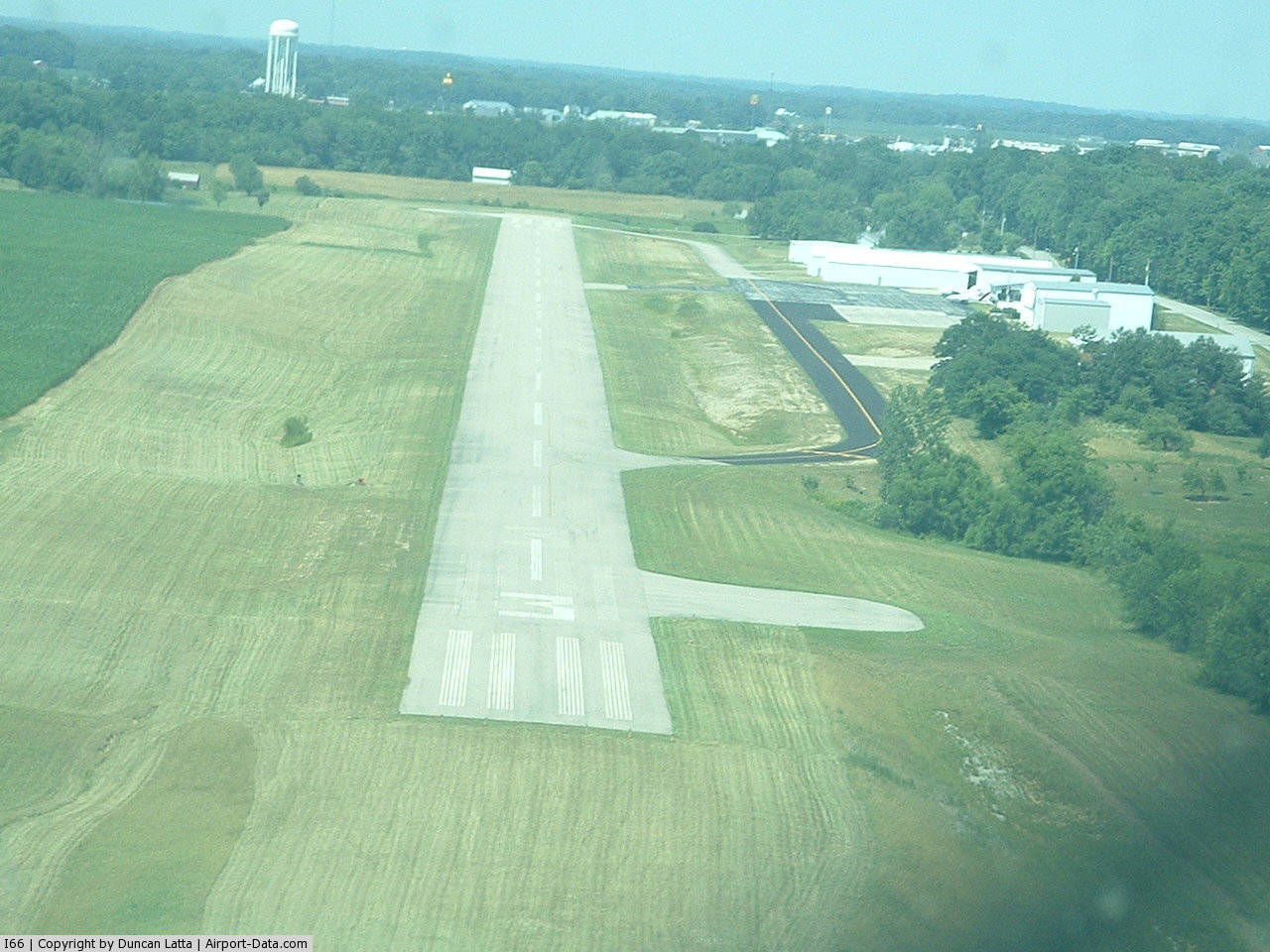
Clinton Field covers an area of 47 acres (19 ha) at an elevation of 1,033 feet (315 m) above mean sea level. It has one runway designated 3/21 with an asphalt surface measuring 3,579 by 65 feet (1,091 x 20 m). During May through September the airport is attended from 08:00 to 20:00. During October through April it is attended from 08:00 to 17:00. The fixed base operator (FBO) is closed Thanksgiving, Christmas and Easter.
For the 12-month period ending October 31, 2006, the airport had 27,860 aircraft operations, an average of 76 per day: 95% general aviation, 4% air taxi and 1% military. At that time there were 28 aircraft based at this airport: 86% single-engine, 11% multi-engine and 3% helicopter.
The above content comes from Wikipedia and is published under free licenses – click here to read more.
 |
(Click on the photo to enlarge) |
Location & QuickFacts
| FAA Information Effective: | 2008-09-25 |
| Airport Identifier: | I66 |
| Airport Status: | Operational |
| Longitude/Latitude: | 083-51-47.9000W/39-30-08.9000N
-83.863306/39.502472 (Estimated) |
| Elevation: | 1033 ft / 314.86 m (Surveyed) |
| Land: | 47 acres |
| From nearest city: | 4 nautical miles NW of Wilmington, OH |
| Location: | Clinton County, OH |
| Magnetic Variation: | 05W (2000) |
Owner & Manager
| Ownership: | Publicly owned |
| Owner: | Clinton Co Board Of Comm |
| Address: | 46 S. South Street
Wilmington, OH 45177 |
| Phone number: | 937-382-5361 |
| Manager: | Don Rauch |
| Address: | 1581 N Curry Rd
Wilmington, OH 45177 |
| Phone number: | 937-725-3822 |
Airport Operations and Facilities
| Airport Use: | Open to public |
| Wind indicator: | Yes |
| Segmented Circle: | No |
| Control Tower: | No |
| Lighting Schedule: | DUSK-DAWN
ACTVT MIRL RY 03/21 & PAPI RYS 03 & 21 - CTAF. |
| Beacon Color: | Clear-Green (lighted land airport) |
| Landing fee charge: | No |
| Sectional chart: | Cincinnati |
| Region: | AGL - Great Lakes |
| Boundary ARTCC: | ZID - Indianapolis |
| Tie-in FSS: | DAY - Dayton |
| FSS on Airport: | No |
| FSS Toll Free: | 1-800-WX-BRIEF |
| NOTAMs Facility: | DAY (NOTAM-d service avaliable) |
| Federal Agreements: | N |
Airport Communications
| CTAF: | 123.000 |
| Unicom: | 123.000 |
Airport Services
| Fuel available: | 100LLA
A FUEL UNAVBL INDEFLY. |
| Airframe Repair: | MAJOR |
| Power Plant Repair: | MAJOR |
Runway Information
Runway 03/21
| Dimension: | 3579 x 65 ft / 1090.9 x 19.8 m |
| Surface: | ASPH, Good Condition |
| Weight Limit: | Single wheel: 12500 lbs. |
| Edge Lights: | Medium |
| |
Runway 03 |
Runway 21 |
| Longitude: | 083-51-58.7376W | 083-51-37.1015W |
| Latitude: | 39-29-53.3475N | 39-30-24.4987N |
| Elevation: | 1026.00 ft | 1031.00 ft |
| Alignment: | 28 | 127 |
| Traffic Pattern: | Left | Left |
| Markings: | Non-precision instrument, Good Condition | Non-precision instrument, Good Condition |
| Crossing Height: | 20.00 ft | 20.00 ft |
| VASI: | 2-light PAPI on left side | 2-light PAPI on left side |
| Visual Glide Angle: | 3.00° | 3.75° |
| Runway End Identifier: | No | No |
| Centerline Lights: | No | No |
| Touchdown Lights: | No | No |
| Obstruction: | 18 ft trees, 201.0 ft from runway, 185 ft right of centerline
RY 03 +12 FT BRUSH 0 FT FM 200 FT R. | 34 ft trees, 325.0 ft from runway, 220 ft left of centerline, 3:1 slope to clear
RY 21 + 34 FT TREE 100 FT FM 220 FT L. |
|
Radio Navigation Aids
| ID |
Type |
Name |
Ch |
Freq |
Var |
Dist |
| IL | NDB | Airbo | | 407.00 | 04W | 5.9 nm |
| HW | NDB | Cubla | | 299.00 | 04W | 9.0 nm |
| XEN | NDB | Xenia | | 395.00 | 03W | 13.2 nm |
| CCJ | NDB | Clark County | | 341.00 | 04W | 22.6 nm |
| CSS | NDB | Court House | | 414.00 | 05W | 22.6 nm |
| HOC | NDB | Hillsboro | | 278.00 | 05W | 24.2 nm |
| HKF | NDB | Hook Field | | 239.00 | 04W | 27.1 nm |
| MDE | NDB | Madeira | | 379.00 | 04W | 28.4 nm |
| ISZ | NDB | Cincinnati-blue Ash | | 388.00 | 04W | 28.8 nm |
| LUK | NDB | Cincinnati | | 335.00 | 04W | 30.3 nm |
| PWF | NDB | Sportys | | 245.00 | 04W | 30.4 nm |
| UYF | NDB | London | | 263.00 | 06W | 31.8 nm |
| HAO | NDB | Hamilton | | 260.00 | 04W | 33.8 nm |
| BU | NDB | Boutn | | 230.00 | 05W | 35.9 nm |
| RZT | NDB | Ross County | | 236.00 | 05W | 38.9 nm |
| CYO | NDB | Circleville | | 366.00 | 05W | 41.0 nm |
| AMT | NDB | West Union | | 359.00 | 04W | 41.3 nm |
| OXD | NDB | Oxford | | 282.00 | 04W | 42.5 nm |
| PZO | NDB | Peebles | | 329.00 | 02W | 43.0 nm |
| OS | NDB | Fuler | | 515.00 | 05W | 46.1 nm |
| EOP | NDB | Waverly | | 385.00 | 06W | 47.8 nm |
| CHC | NDB | Grens | | 272.00 | 04W | 49.2 nm |
| MRT | NDB | Marysville | | 403.00 | 05W | 49.6 nm |
| XSF | TACAN | Springfield | 065X | | 04W | 20.2 nm |
| FFO | TACAN | Patterson | 099X | | 04W | 21.0 nm |
| LCK | TACAN | Rickenbacker | 069X | | 05W | 47.0 nm |
| XUB | VOR | Yellow Bud | | 112.50 | 05W | 41.1 nm |
| MXQ | VOR/DME | Midwest | 076X | 112.90 | 04W | 5.2 nm |
| SGH | VOR/DME | Springfield | 079X | 113.20 | 04W | 20.1 nm |
| DQN | VOR/DME | Dayton | 092X | 114.50 | 01W | 39.5 nm |
| RID | VORTAC | Richmond | 043X | 110.60 | 03W | 47.6 nm |
| ROD | VORTAC | Rosewood | 122X | 117.50 | 05W | 47.9 nm |
| CVG | VORTAC | Cincinnati | 120X | 117.30 | 04W | 48.8 nm |
| DAY | VOT | Dayton J M Cox-day | | 111.00 | | 29.1 nm |
| LUK | VOT | Cincinnati Muni/lunken | | 108.40 | | 34.1 nm |
Remarks
- DO NOT TAXI OFF HARD SURFACE.
- DEER & BIRDS ON AND INVOF ARPT.
- VFR OPERNS ONLY.
Images and information placed above are from
http://www.airport-data.com/airport/I66/
We thank them for the data!
| General Info
|
| Country |
United States
|
| State |
OHIO
|
| FAA ID |
I66
|
| Latitude |
39-30-10.300N
|
| Longitude |
083-51-47.000W
|
| Elevation |
1033 feet
|
| Near City |
WILMINGTON
|
We don't guarantee the information is fresh and accurate. The data may
be wrong or outdated.
For more up-to-date information please refer to other sources.
|
|