 |
|
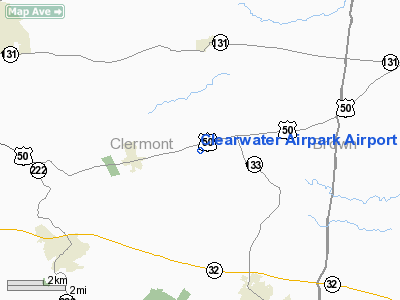
Clearwater Airpark Airport |
Location & QuickFacts
| FAA Information Effective: | 2008-09-25 |
| Airport Identifier: | 21OI |
| Airport Status: | Operational |
| Longitude/Latitude: | 084-05-33.7610W/39-07-41.2260N
-84.092711/39.128118 (Estimated) |
| Elevation: | 905 ft / 275.84 m (Estimated) |
| Land: | 87 acres |
| From nearest city: | 2 nautical miles E of Owensville, OH |
| Location: | Clermont County, OH |
| Magnetic Variation: | 04W (1985) |
Owner & Manager
| Ownership: | Privately owned |
| Owner: | Clearwater Airpark, Inc. |
| Address: | 2845 Us 50
Batavia, OH 45103 |
| Phone number: | 513-625-9653 |
| Manager: | C. W. Standring |
| Address: | 5101 Monterey Road
Batavia, OH 45103 |
| Phone number: | 513-625-9653 |
Airport Operations and Facilities
| Airport Use: | Private |
| Wind indicator: | Yes |
| Segmented Circle: | No |
| Control Tower: | No |
| Landing fee charge: | No |
| Sectional chart: | Cincinnati |
| Region: | AGL - Great Lakes |
| Boundary ARTCC: | ZID - Indianapolis |
| Tie-in FSS: | DAY - Dayton |
| FSS on Airport: | No |
| FSS Toll Free: | 1-800-WX-BRIEF |
Airport Communications
Runway Information
Runway 07/25
| Dimension: | 2650 x 30 ft / 807.7 x 9.1 m |
| Surface: | TURF, |
| |
Runway 07 |
Runway 25 |
| Traffic Pattern: | Left | Left |
| Obstruction: | 34 ft pline | |
|
Runway 17/35
| Dimension: | 1860 x 50 ft / 566.9 x 15.2 m |
| Surface: | TURF, |
| |
Runway 17 |
Runway 35 |
| Traffic Pattern: | Left | Left |
| Obstruction: | 30 ft pline, 200.0 ft from runway | |
|
Helipad H1
| Dimension: | 100 x 100 ft / 30.5 x 30.5 m |
| Surface: | TURF, |
| |
Runway H1 |
Runway |
| Traffic Pattern: | Left | Left |
|
Radio Navigation Aids
| ID |
Type |
Name |
Ch |
Freq |
Var |
Dist |
| PWF | NDB | Sportys | | 245.00 | 04W | 6.5 nm |
| LUK | NDB | Cincinnati | | 335.00 | 04W | 11.7 nm |
| MDE | NDB | Madeira | | 379.00 | 04W | 13.5 nm |
| ISZ | NDB | Cincinnati-blue Ash | | 388.00 | 04W | 15.6 nm |
| HW | NDB | Cubla | | 299.00 | 04W | 16.9 nm |
| HOC | NDB | Hillsboro | | 278.00 | 05W | 25.8 nm |
| HAO | NDB | Hamilton | | 260.00 | 04W | 26.7 nm |
| IL | NDB | Airbo | | 407.00 | 04W | 27.4 nm |
| HKF | NDB | Hook Field | | 239.00 | 04W | 27.7 nm |
| AMT | NDB | West Union | | 359.00 | 04W | 29.6 nm |
| UR | NDB | Burln | | 321.00 | 04W | 32.1 nm |
| XEN | NDB | Xenia | | 395.00 | 03W | 36.1 nm |
| PZO | NDB | Peebles | | 329.00 | 02W | 37.9 nm |
| OXD | NDB | Oxford | | 282.00 | 04W | 39.3 nm |
| XW | NDB | Flmng | | 400.00 | 05W | 39.3 nm |
| CSS | NDB | Court House | | 414.00 | 05W | 43.2 nm |
| CCJ | NDB | Clark County | | 341.00 | 04W | 47.1 nm |
| FFO | TACAN | Patterson | 099X | | 04W | 41.6 nm |
| XSF | TACAN | Springfield | 065X | | 04W | 44.3 nm |
| MXQ | VOR/DME | Midwest | 076X | 112.90 | 04W | 22.6 nm |
| FLM | VOR/DME | Falmouth | 117X | 117.00 | 04W | 30.5 nm |
| SGH | VOR/DME | Springfield | 079X | 113.20 | 04W | 44.1 nm |
| CVG | VORTAC | Cincinnati | 120X | 117.30 | 04W | 29.3 nm |
| LUK | VOT | Cincinnati Muni/lunken | | 108.40 | | 14.3 nm |
| DAY | VOT | Dayton J M Cox-day | | 111.00 | | 46.9 nm |
Remarks
- ULTRALIGHT ACTIVITY IN AREA.
- HELIPORT DETERMINATION; CONDITIONAL; APP/DEP TO HELIPAD IS IN AREA 60-270 DEGS; AREA IS APPROPRIATELY MARKED; WIND INDICATOR IS MAINTAINED.
Images and information placed above are from
http://www.airport-data.com/airport/21OI/
We thank them for the data!
| General Info
|
| Country |
United States
|
| State |
OHIO
|
| FAA ID |
21OI
|
| Latitude |
39-07-41.226N
|
| Longitude |
084-05-33.761W
|
| Elevation |
905 feet
|
| Near City |
OWENSVILLE
|
We don't guarantee the information is fresh and accurate. The data may
be wrong or outdated.
For more up-to-date information please refer to other sources.
|
|


