|
|
Cincinnati-blue Ash Airport |
| Cincinnati-Blue Ash Airport |
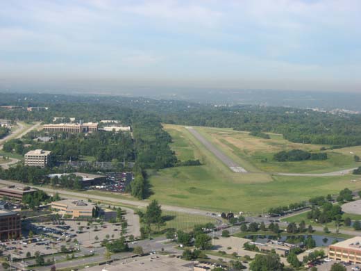 |
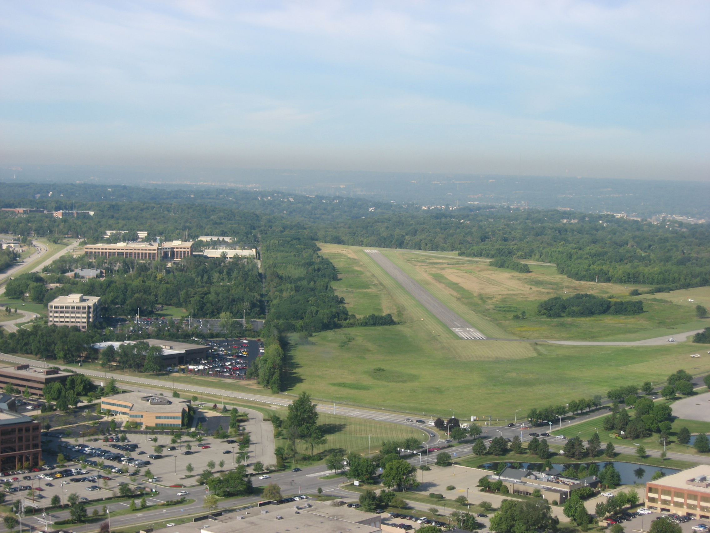
| Preparing to land on Runway 24 |
| IATA: none – ICAO: KISZ – FAA LID: ISZ |
| Summary |
| Airport type |
Public |
| Owner |
City of Cincinnati |
| Serves |
Cincinnati, Ohio |
| Location |
Blue Ash, Ohio |
| Elevation AMSL |
856 ft / 261 m |
| Coordinates |
39°14′48″N 084°23′20″W / 39.24667°N 84.38889°W / 39.24667; -84.38889 |
| Runways |
| Direction |
Length |
Surface |
| ft |
m |
| 6/24 |
3,499 |
1,066 |
Asphalt |
| Statistics (2006) |
| Aircraft operations |
35,000 |
| Based aircraft |
136 |
| Source: Federal Aviation Administration |
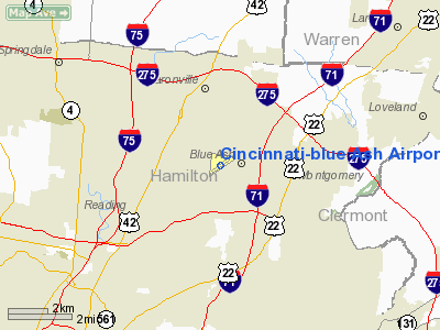
Blue Ash Airport (ICAO: KISZ, FAA LID: ISZ), also known as Cincinnati-Blue Ash Airport, is a public airport located in the city of Blue Ash in Hamilton County, Ohio, United States. It is 16.5 miles (26.5 km) northeast of downtown Cincinnati and is owned by the City of Cincinnati. Overview
Although most U.S. airports use the same three-letter location identifier for the FAA and IATA, Blue Ash Airport is assigned ISZ (formerly I77) by the FAA but has no designation from the IATA.
The City of Blue Ash completed a purchase of the airport and property from the City of Cincinnati in 2007. The current Master Airport plan specifies the retention (and improvement) of the current runway, but the removal and demolition of all facilities to the West of the runway (the current taxiways, hangers, and ramps), and the construction of a parallel taxiway, and new terminals and facilities on the East side of the runway. The reclaimed area to the West of the runway will be converted into a park, some light retail spaces, a museum, and additional space for three relocated holes from the Blue Ash Golf Course.
Facilities and aircraft
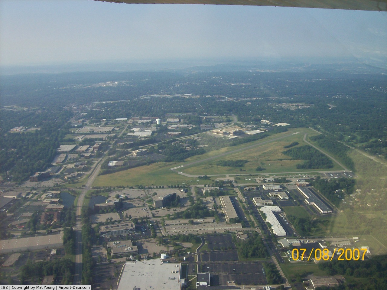
Cincinnati-Blue Ash Airport covers an area of 257 acres (104 ha) which contains one asphalt paved runway (6/24) measuring 3,499 x 75 ft (1,066 x 23 m).
For the 12-month period ending January 30, 2006, the airport had 35,000 aircraft operations, an average of 95 per day: 97% general aviation, 2% air taxi and 1% military. There are 136 aircraft based at this airport: 88% single-engine, 11% multi-engine and 1% helicopter.
Activities
Once a year, Cincinnati-Blue Ash Airport hosts an airshow known as Blue Ash Airport Days. This show is usually held in September and features aerobatic performers as well as numerous other types of static displays.
The above content comes from Wikipedia and is published under free licenses – click here to read more.
 |
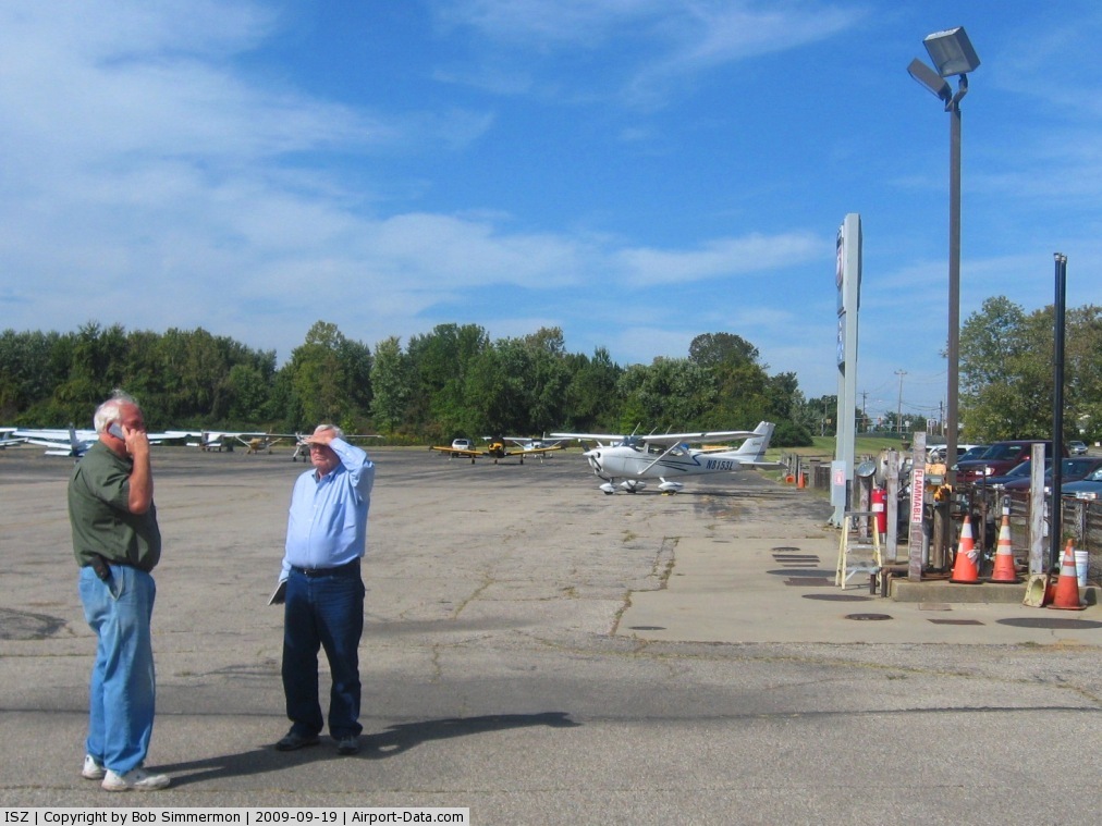
(Click on the photo to enlarge) |
 |
(Click on the photo to enlarge) |
 |
(Click on the photo to enlarge) |
Location & QuickFacts
| FAA Information Effective: | 2008-09-25 |
| Airport Identifier: | ISZ |
| Airport Status: | Operational |
| Longitude/Latitude: | 084-23-20.3000W/39-14-48.1000N
-84.388972/39.246694 (Estimated) |
| Elevation: | 856 ft / 260.91 m (Surveyed) |
| Land: | 257 acres |
| From nearest city: | 6 nautical miles NE of Cincinnati, OH |
| Location: | Hamilton County, OH |
| Magnetic Variation: | 04W (1995) |
Owner & Manager
| Ownership: | Publicly owned |
| Owner: | City Of Cincinnati |
| Address: | City Hall
Cincinnati, OH 45202 |
| Phone number: | 513-352-6340 |
| Manager: | Fred Anderton |
| Address: | Terminal Bldg-262 Wilmer Ave
Cincinnati, OH 45226 |
| Phone number: | 513-352-6340 |
Airport Operations and Facilities
| Airport Use: | Open to public |
| Wind indicator: | Yes |
| Segmented Circle: | Yes |
| Control Tower: | No |
| Lighting Schedule: | DUSK-DAWN
MIRL RY 06/24 PRESET ON LOW INTST DUSK-DAWN; TO INCR INTST & ACTVT TWY LGTS & WIND INDCR & REIL RYS 06 & 24 - CTAF. |
| Beacon Color: | Clear-Green (lighted land airport) |
| Landing fee charge: | No |
| Sectional chart: | Cincinnati |
| Region: | AGL - Great Lakes |
| Boundary ARTCC: | ZID - Indianapolis |
| Tie-in FSS: | DAY - Dayton |
| FSS on Airport: | No |
| FSS Toll Free: | 1-800-WX-BRIEF |
| NOTAMs Facility: | DAY (NOTAM-d service avaliable) |
| Federal Agreements: | NGY |
Airport Communications
| CTAF: | 123.000 |
| Unicom: | 123.000 |
Airport Services
| Fuel available: | 100LLA1+ |
| Airframe Repair: | MAJOR |
| Power Plant Repair: | MAJOR |
| Bottled Oxygen: | HIGH |
| Bulk Oxygen: | NONE |
Runway Information
Runway 06/24
| Dimension: | 3499 x 75 ft / 1066.5 x 22.9 m |
| Surface: | ASPH, Fair Condition |
| Weight Limit: | Single wheel: 12500 lbs. |
| Edge Lights: | Medium |
| |
Runway 06 |
Runway 24 |
| Longitude: | 084-23-38.4307W | 084-23-02.1523W |
| Latitude: | 39-14-38.0624N | 39-14-58.0663N |
| Elevation: | 856.00 ft | 830.00 ft |
| Alignment: | 55 | 127 |
| Traffic Pattern: | Left | Right |
| Markings: | Non-precision instrument, Good Condition | Non-precision instrument, Good Condition |
| Crossing Height: | 20.00 ft | 20.00 ft |
| VASI: | 2-box on left side | 2-box on left side |
| Visual Glide Angle: | 4.00° | 4.00° |
| Runway End Identifier: | Yes
OTS INDEFLY. | Yes |
| Centerline Lights: | No | No |
| Touchdown Lights: | No | No |
| Obstruction: | 41 ft trees, 490.0 ft from runway, 276 ft right of centerline, 7:1 slope to clear | 34 ft trees, 757.0 ft from runway, 310 ft right of centerline, 16:1 slope to clear |
|
Radio Navigation Aids
| ID |
Type |
Name |
Ch |
Freq |
Var |
Dist |
| ISZ | NDB | Cincinnati-blue Ash | | 388.00 | 04W | 0.1 nm |
| MDE | NDB | Madeira | | 379.00 | 04W | 2.1 nm |
| LUK | NDB | Cincinnati | | 335.00 | 04W | 5.7 nm |
| HAO | NDB | Hamilton | | 260.00 | 04W | 11.4 nm |
| PWF | NDB | Sportys | | 245.00 | 04W | 13.0 nm |
| HKF | NDB | Hook Field | | 239.00 | 04W | 15.4 nm |
| UR | NDB | Burln | | 321.00 | 04W | 21.6 nm |
| OXD | NDB | Oxford | | 282.00 | 04W | 24.0 nm |
| HW | NDB | Cubla | | 299.00 | 04W | 24.7 nm |
| IL | NDB | Airbo | | 407.00 | 04W | 33.7 nm |
| XEN | NDB | Xenia | | 395.00 | 03W | 35.3 nm |
| HOC | NDB | Hillsboro | | 278.00 | 05W | 39.6 nm |
| HLB | NDB | Batesville | | 254.00 | 02W | 40.9 nm |
| AMT | NDB | West Union | | 359.00 | 04W | 45.1 nm |
| CCJ | NDB | Clark County | | 341.00 | 04W | 47.1 nm |
| FFO | TACAN | Patterson | 099X | | 04W | 37.7 nm |
| XSF | TACAN | Springfield | 065X | | 04W | 43.7 nm |
| MXQ | VOR/DME | Midwest | 076X | 112.90 | 04W | 29.5 nm |
| FLM | VOR/DME | Falmouth | 117X | 117.00 | 04W | 36.1 nm |
| SGH | VOR/DME | Springfield | 079X | 113.20 | 04W | 43.5 nm |
| DQN | VOR/DME | Dayton | 092X | 114.50 | 01W | 46.3 nm |
| CVG | VORTAC | Cincinnati | 120X | 117.30 | 04W | 20.2 nm |
| RID | VORTAC | Richmond | 043X | 110.60 | 03W | 37.0 nm |
| LUK | VOT | Cincinnati Muni/lunken | | 108.40 | | 7.8 nm |
| DAY | VOT | Dayton J M Cox-day | | 111.00 | | 40.1 nm |
Remarks
- NOISE ABATEMENT PROCS: DEP RWY 24 TURN RGT HDG 270 DEG AFT TKOF, DEP RWY 6 TURN LFT HDG 360 DEG AFT TKOF.
- DEER AND WILDLIFE ON AND INVOF ARPT.
Images and information placed above are from
http://www.airport-data.com/airport/ISZ/
We thank them for the data!
| General Info
|
| Country |
United States
|
| State |
OHIO
|
| FAA ID |
ISZ
|
| Latitude |
39-14-48.100N
|
| Longitude |
084-23-20.300W
|
| Elevation |
856 feet
|
| Near City |
CINCINNATI
|
We don't guarantee the information is fresh and accurate. The data may
be wrong or outdated.
For more up-to-date information please refer to other sources.
|
|