 |
|
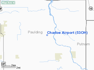
Location & QuickFacts
| FAA Information Effective: | 2008-09-25 |
| Airport Identifier: | 53OH |
| Airport Status: | Operational |
| Longitude/Latitude: | 084-27-02.8150W/41-08-04.1770N
-84.450782/41.134494 (Estimated) |
| Elevation: | 721 ft / 219.76 m (Estimated) |
| Land: | 0 acres |
| From nearest city: | 5 nautical miles E of Paulding, OH |
| Location: | Paulding County, OH |
| Magnetic Variation: | 04W (1985) |
Owner & Manager
| Ownership: | Privately owned |
| Owner: | H. J. Dobbelaere |
| Address: | Co. Rd. 138 19633
Oakwood, OH 45873 |
| Phone number: | 419-594-2416 |
| Address: |
|
Airport Operations and Facilities
| Airport Use: | Private |
| Wind indicator: | Yes |
| Segmented Circle: | No |
| Control Tower: | No |
| Landing fee charge: | No |
| Sectional chart: | Detroit |
| Region: | AGL - Great Lakes |
| Boundary ARTCC: | ZOB - Cleveland |
| Tie-in FSS: | CLE - Cleveland |
| FSS on Airport: | No |
| FSS Toll Free: | 1-800-WX-BRIEF |
Airport Services
| Airframe Repair: | MAJOR |
| Power Plant Repair: | MAJOR |
Runway Information
Runway 09/27
| Dimension: | 3400 x 100 ft / 1036.3 x 30.5 m |
| Surface: | TURF, |
| |
Runway 09 |
Runway 27 |
| Traffic Pattern: | Left | Left |
|
Radio Navigation Aids
| ID |
Type |
Name |
Ch |
Freq |
Var |
Dist |
| DFI | NDB | Defiance | | 246.00 | 05W | 12.1 nm |
| VFU | NDB | Stanley | | 411.00 | 05W | 17.9 nm |
| BYN | NDB | Bryan | | 260.00 | 04W | 20.8 nm |
| PDR | NDB | Ottawa | | 233.00 | 05W | 22.4 nm |
| USE | NDB | Fulton | | 375.00 | 05W | 31.9 nm |
| LYL | NDB | Lima | | 362.00 | 04W | 32.3 nm |
| BNR | NDB | Benton Ridge | | 334.00 | 05W | 36.1 nm |
| CQA | NDB | Lakefield | | 205.00 | 04W | 39.6 nm |
| ANQ | NDB | Angola | | 347.00 | 05W | 41.8 nm |
| ADG | NDB | Adrian | | 278.00 | 06W | 47.3 nm |
| PLD | NDB | Portland | | 257.00 | 03W | 47.6 nm |
| FZI | NDB | Fostoria | | 379.00 | 05W | 47.8 nm |
| HHG | NDB | Huntington | | 417.00 | 03W | 48.9 nm |
| TOL | TACAN | Toledo | 072X | | 05W | 40.3 nm |
| AOH | VOR | Allen County | | 108.40 | 04W | 33.8 nm |
| MAH | VOR | Marathon | | 114.90 | 05W | 36.4 nm |
| OLK | VOR | Wolf Lake | | 110.40 | 03W | 47.8 nm |
| VWV | VOR/DME | Waterville | 078X | 113.10 | 02W | 41.3 nm |
| FDY | VORTAC | Findlay | 019X | 108.20 | 02W | 33.3 nm |
| FWA | VORTAC | Fort Wayne | 125X | 117.80 | 00E | 34.7 nm |
| FWA | VOT | Fort Wayne Baer | | 111.00 | | 34.8 nm |
Remarks
Images and information placed above are from
http://www.airport-data.com/airport/53OH/
We thank them for the data!
| General Info
|
| Country |
United States
|
| State |
OHIO
|
| FAA ID |
53OH
|
| Latitude |
41-08-04.177N
|
| Longitude |
084-27-02.815W
|
| Elevation |
721 feet
|
| Near City |
PAULDING
|
We don't guarantee the information is fresh and accurate. The data may
be wrong or outdated.
For more up-to-date information please refer to other sources.
|
|


