 |
|
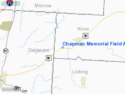
Chapman Memorial Field Airport |
Location & QuickFacts
| FAA Information Effective: | 2008-09-25 |
| Airport Identifier: | OH71 |
| Airport Status: | Operational |
| Longitude/Latitude: | 082-43-52.6240W/40-17-41.2230N
-82.731284/40.294784 (Estimated) |
| Elevation: | 1180 ft / 359.66 m (Estimated) |
| Land: | 40 acres |
| From nearest city: | 2 nautical miles SW of Centerburg, OH |
| Location: | Knox County, OH |
| Magnetic Variation: | 05W (1985) |
Owner & Manager
| Ownership: | Privately owned |
| Owner: | William See |
| Address: | Box 388 3275 Columbus Rd
Centerburg, OH 43011 |
| Phone number: | 740-625-6803 |
| Manager: | William See |
| Address: | Box 388 3275 Columbus Rd
Centerburg, OH 43011 |
| Phone number: | 740-625-6803 |
Airport Operations and Facilities
| Airport Use: | Private |
| Wind indicator: | Yes |
| Segmented Circle: | No |
| Control Tower: | No |
| Lighting Schedule: | PHONE REQ |
| Landing fee charge: | No |
| Sectional chart: | Detroit |
| Region: | AGL - Great Lakes |
| Boundary ARTCC: | ZID - Indianapolis |
| Tie-in FSS: | CLE - Cleveland |
| FSS on Airport: | No |
| FSS Toll Free: | 1-800-WX-BRIEF |
Airport Communications
Airport Services
Runway Information
Runway 09L/27R
| Dimension: | 3200 x 80 ft / 975.4 x 24.4 m |
| Surface: | TURF, Fair Condition |
| |
Runway 09L |
Runway 27R |
| Traffic Pattern: | Left | Right |
| Displaced threshold: | 100.00 ft | 0.00 ft |
| Obstruction: | 5 ft fence | 50 ft trees, 3000.0 ft from runway |
|
Runway 09R/27L
| Dimension: | 1900 x 100 ft / 579.1 x 30.5 m |
| Surface: | TURF, Good Condition |
| |
Runway 09R |
Runway 27L |
| Traffic Pattern: | Left | Right |
| Obstruction: | 5 ft fence | 30 ft bldg, 1000.0 ft from runway |
|
Radio Navigation Aids
| ID |
Type |
Name |
Ch |
Freq |
Var |
Dist |
| DLZ | NDB | Delaware | | 215.00 | 06W | 17.1 nm |
| CM | NDB | Sumie | | 391.00 | 05W | 18.6 nm |
| HEH | NDB | Newark | | 524.00 | 06W | 20.3 nm |
| DKG | NDB | Don Scott | | 348.00 | 05W | 20.5 nm |
| CHC | NDB | Grens | | 272.00 | 04W | 21.9 nm |
| MNN | NDB | Marion | | 201.00 | 05W | 24.8 nm |
| OS | NDB | Fuler | | 515.00 | 05W | 25.2 nm |
| MRT | NDB | Marysville | | 403.00 | 05W | 28.7 nm |
| MF | NDB | Manns | | 372.00 | 06W | 31.2 nm |
| BU | NDB | Boutn | | 230.00 | 05W | 35.9 nm |
| UYF | NDB | London | | 263.00 | 06W | 40.1 nm |
| MLR | NDB | Millersburg/dcmsnd | | 382.00 | 06W | 42.0 nm |
| RUV | NDB | Rushsylvania | | 326.00 | 05W | 44.0 nm |
| HRA | NDB | Zanesville | | 204.00 | 06W | 44.0 nm |
| AAU | NDB | Ashland | | 329.00 | 07W | 45.7 nm |
| CYO | NDB | Circleville | | 366.00 | 05W | 47.8 nm |
| EDJ | NDB | Bellefontaine | | 242.00 | 05W | 49.8 nm |
| LCK | TACAN | Rickenbacker | 069X | | 05W | 30.6 nm |
| BUD | VOR | Buckeye | | 109.80 | 05W | 24.6 nm |
| XUB | VOR | Yellow Bud | | 112.50 | 05W | 47.5 nm |
| TVT | VOR/DME | Tiverton | 112X | 116.50 | 03W | 29.4 nm |
| ZZV | VOR/DME | Zanesville | 051X | 111.40 | 06W | 44.0 nm |
| APE | VORTAC | Appleton | 114X | 116.70 | 06W | 10.8 nm |
| MFD | VORTAC | Mansfield | 025X | 108.80 | 03W | 35.1 nm |
| CMH | VOT | Port Columbus | | 111.00 | | 19.4 nm |
Remarks
- RDO CTL ACVTY DAILY.
- NO TFC PATTERN S OF ARPT.
- AUTO FUEL AVAILABLE. MECHANIC SERVICES AVAILABLE. ULTRA-LIGHTS WELCOME.
- NO TRI-CYCLE LANDING GEAR ACFT SHOULD USE ARPT.
- USE IN VFR CONDITIONS ONLY.
Images and information placed above are from
http://www.airport-data.com/airport/OH71/
We thank them for the data!
| General Info
|
| Country |
United States
|
| State |
OHIO
|
| FAA ID |
OH71
|
| Latitude |
40-17-41.223N
|
| Longitude |
082-43-52.624W
|
| Elevation |
1180 feet
|
| Near City |
CENTERBURG
|
We don't guarantee the information is fresh and accurate. The data may
be wrong or outdated.
For more up-to-date information please refer to other sources.
|
|


