 |
|
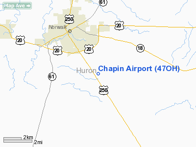
Location & QuickFacts
| FAA Information Effective: | 2008-09-25 |
| Airport Identifier: | 47OH |
| Airport Status: | Operational |
| Longitude/Latitude: | 082-34-24.6300W/41-12-00.1910N
-82.573508/41.200053 (Estimated) |
| Elevation: | 885 ft / 269.75 m (Estimated) |
| Land: | 17 acres |
| From nearest city: | 3 nautical miles SE of Norwalk, OH |
| Location: | Huron County, OH |
| Magnetic Variation: | 06W (1985) |
Owner & Manager
| Ownership: | Privately owned |
| Owner: | Robert F. Chapin |
| Address: | Rd 2,rt 250 S
Norwalk, OH 44857 |
| Phone number: | 419-668-1972 |
| Address: |
|
Airport Operations and Facilities
| Airport Use: | Private |
| Wind indicator: | Yes |
| Segmented Circle: | No |
| Control Tower: | No |
| Lighting Schedule: | PHONE REQ
|
| Landing fee charge: | No |
| Sectional chart: | Detroit |
| Region: | AGL - Great Lakes |
| Boundary ARTCC: | ZOB - Cleveland |
| Tie-in FSS: | CLE - Cleveland |
| FSS on Airport: | No |
| FSS Toll Free: | 1-800-WX-BRIEF |
Airport Services
| Fuel available: | 100 |
| Airframe Repair: | NONE |
| Power Plant Repair: | NONE |
Runway Information
Runway 09/27
| Dimension: | 3000 x 50 ft / 914.4 x 15.2 m |
| Surface: | ASPH, |
| Edge Lights: | Low |
| |
Runway 09 |
Runway 27 |
| Traffic Pattern: | Left | Left |
|
Radio Navigation Aids
| ID |
Type |
Name |
Ch |
Freq |
Var |
Dist |
| AAU | NDB | Ashland | | 329.00 | 07W | 20.3 nm |
| PCW | NDB | Port Clinton | | 423.00 | 06W | 23.3 nm |
| MF | NDB | Manns | | 372.00 | 06W | 26.7 nm |
| CL | NDB | Harri | | 344.00 | 07W | 28.7 nm |
| TII | NDB | Tiffin | | 269.00 | 05W | 29.4 nm |
| PT | NDB | Pelee Island | | 283.00 | 05W | 35.1 nm |
| FZI | NDB | Fostoria | | 379.00 | 05W | 37.2 nm |
| MNN | NDB | Marion | | 201.00 | 05W | 41.7 nm |
| EZE | NDB | Engel | | 226.00 | 07W | 42.1 nm |
| BKL | NDB | Burke Lakefront | | 416.00 | 07W | 45.6 nm |
| BUD | VOR | Buckeye | | 109.80 | 05W | 41.5 nm |
| SKY | VOR/DME | Sandusky | 029X | 109.20 | 04W | 14.6 nm |
| DJB | VOR/DME | Dryer | 083X | 113.60 | 05W | 20.9 nm |
| TVT | VOR/DME | Tiverton | 112X | 116.50 | 03W | 49.0 nm |
| MFD | VORTAC | Mansfield | 025X | 108.80 | 03W | 19.9 nm |
| CLE | VOT | Cleveland | | 110.40 | | 35.1 nm |
Remarks
- FENCE, TREES, PLINE AND HGR N OF RWY.
- VFR ONLY
Images and information placed above are from
http://www.airport-data.com/airport/47OH/
We thank them for the data!
| General Info
|
| Country |
United States
|
| State |
OHIO
|
| FAA ID |
47OH
|
| Latitude |
41-12-00.191N
|
| Longitude |
082-34-24.630W
|
| Elevation |
885 feet
|
| Near City |
NORWALK
|
We don't guarantee the information is fresh and accurate. The data may
be wrong or outdated.
For more up-to-date information please refer to other sources.
|
|


