 |
|
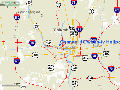
Channel 10/wbns-tv Heliport |
Location & QuickFacts
| FAA Information Effective: | 2008-09-25 |
| Airport Identifier: | OI47 |
| Airport Status: | Operational |
| Longitude/Latitude: | 083-01-37.6600W/39-58-17.2300N
-83.027128/39.971453 (Estimated) |
| Elevation: | 717 ft / 218.54 m (Estimated) |
| Land: | 0 acres |
| From nearest city: | 2 nautical miles E of Columbus, OH |
| Location: | Franklin County, OH |
| Magnetic Variation: | 05W (1990) |
Owner & Manager
| Ownership: | Privately owned |
| Owner: | Wbns-tv Inc. |
| Address: | 770 Twin Rivers Dr.
Columbus, OH 43215 |
| Phone number: | 614-460-3769 |
| Manager: | Robert T. Ault |
| Address: | 770 Twin Rivers Dr.
Columbus, OH 43215 |
| Phone number: | 614-460-3769 |
Airport Operations and Facilities
| Airport Use: | Private |
| Wind indicator: | Yes |
| Segmented Circle: | No |
| Control Tower: | No |
| Lighting Schedule: | PHONE REQ
FOR PERIMETER LGTS CALL 614-460-3769. |
| Sectional chart: | Cincinnati |
| Region: | AGL - Great Lakes |
| Boundary ARTCC: | ZID - Indianapolis |
| Tie-in FSS: | DAY - Dayton |
| FSS Toll Free: | 1-800-WX-BRIEF |
Runway Information
Helipad H1
| Dimension: | 35 x 35 ft / 10.7 x 10.7 m |
| Surface: | ASPH, |
| |
Runway H1 |
Runway |
| Traffic Pattern: | Left | Left |
|
Radio Navigation Aids
| ID |
Type |
Name |
Ch |
Freq |
Var |
Dist |
| CHC | NDB | Grens | | 272.00 | 04W | 2.3 nm |
| DKG | NDB | Don Scott | | 348.00 | 05W | 7.0 nm |
| OS | NDB | Fuler | | 515.00 | 05W | 10.0 nm |
| BU | NDB | Boutn | | 230.00 | 05W | 12.3 nm |
| CM | NDB | Sumie | | 391.00 | 05W | 12.6 nm |
| DLZ | NDB | Delaware | | 215.00 | 06W | 18.7 nm |
| UYF | NDB | London | | 263.00 | 06W | 20.4 nm |
| MRT | NDB | Marysville | | 403.00 | 05W | 21.3 nm |
| HEH | NDB | Newark | | 524.00 | 06W | 26.2 nm |
| CYO | NDB | Circleville | | 366.00 | 05W | 27.0 nm |
| CSS | NDB | Court House | | 414.00 | 05W | 27.9 nm |
| RZT | NDB | Ross County | | 236.00 | 05W | 32.1 nm |
| CCJ | NDB | Clark County | | 341.00 | 04W | 35.2 nm |
| MNN | NDB | Marion | | 201.00 | 05W | 38.9 nm |
| RUV | NDB | Rushsylvania | | 326.00 | 05W | 41.5 nm |
| EDJ | NDB | Bellefontaine | | 242.00 | 05W | 43.4 nm |
| IL | NDB | Airbo | | 407.00 | 04W | 43.7 nm |
| XEN | NDB | Xenia | | 395.00 | 03W | 44.4 nm |
| EOP | NDB | Waverly | | 385.00 | 06W | 48.6 nm |
| LCK | TACAN | Rickenbacker | 069X | | 05W | 10.8 nm |
| XSF | TACAN | Springfield | 065X | | 04W | 38.4 nm |
| FFO | TACAN | Patterson | 099X | | 04W | 48.3 nm |
| XUB | VOR | Yellow Bud | | 112.50 | 05W | 26.8 nm |
| BUD | VOR | Buckeye | | 109.80 | 05W | 38.8 nm |
| SGH | VOR/DME | Springfield | 079X | 113.20 | 04W | 38.6 nm |
| MXQ | VOR/DME | Midwest | 076X | 112.90 | 04W | 48.4 nm |
| APE | VORTAC | Appleton | 114X | 116.70 | 06W | 22.9 nm |
| CMH | VOT | Port Columbus | | 111.00 | | 6.7 nm |
Remarks
- PROVIDED APCH/DEP OPS 270 DEG - 100 DEG; TAKEOFF/LDG AREA MARKED; WIND INDICATOR MAINTAINED.
Images and information placed above are from
http://www.airport-data.com/airport/OI47/
We thank them for the data!
| General Info
|
| Country |
United States
|
| State |
OHIO
|
| FAA ID |
OI47
|
| Latitude |
39-58-17.230N
|
| Longitude |
083-01-37.660W
|
| Elevation |
717 feet
|
| Near City |
COLUMBUS
|
We don't guarantee the information is fresh and accurate. The data may
be wrong or outdated.
For more up-to-date information please refer to other sources.
|
|


