 |
|
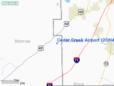
Location & QuickFacts
| FAA Information Effective: | 2008-09-25 |
| Airport Identifier: | 2OH4 |
| Airport Status: | Operational |
| Longitude/Latitude: | 082-38-07.6200W/40-37-28.2110N
-82.635450/40.624503 (Estimated) |
| Elevation: | 1220 ft / 371.86 m (Estimated) |
| Land: | 0 acres |
| From nearest city: | 2 nautical miles E of Shauck, OH |
| Location: | Morrow County, OH |
| Magnetic Variation: | 05W (1985) |
Owner & Manager
| Ownership: | Privately owned |
| Owner: | Dan Sorg |
| Address: | 7860 Co Rd 29
Bellville, OH 44813 |
| Phone number: | 419-362-8691 |
| Address: |
|
Airport Operations and Facilities
| Airport Use: | Private |
| Wind indicator: | Yes |
| Segmented Circle: | No |
| Control Tower: | No |
| Sectional chart: | Detroit |
| Region: | AGL - Great Lakes |
| Boundary ARTCC: | ZOB - Cleveland |
| Tie-in FSS: | CLE - Cleveland |
| FSS Toll Free: | 1-800-WX-BRIEF |
Runway Information
Runway 12/30
| Dimension: | 2200 x 150 ft / 670.6 x 45.7 m |
| Surface: | TURF, |
| |
Runway 12 |
Runway 30 |
| Traffic Pattern: | Left | Left |
| Displaced threshold: | 400.00 ft | 0.00 ft |
| Obstruction: | 50 ft trees, 200.0 ft from runway | 50 ft trees, 600.0 ft from runway |
|
Radio Navigation Aids
| ID |
Type |
Name |
Ch |
Freq |
Var |
Dist |
| MF | NDB | Manns | | 372.00 | 06W | 12.2 nm |
| MNN | NDB | Marion | | 201.00 | 05W | 19.8 nm |
| AAU | NDB | Ashland | | 329.00 | 07W | 26.8 nm |
| DLZ | NDB | Delaware | | 215.00 | 06W | 29.9 nm |
| MLR | NDB | Millersburg/dcmsnd | | 382.00 | 06W | 35.2 nm |
| HEH | NDB | Newark | | 524.00 | 06W | 36.8 nm |
| DKG | NDB | Don Scott | | 348.00 | 05W | 38.5 nm |
| TII | NDB | Tiffin | | 269.00 | 05W | 38.6 nm |
| CM | NDB | Sumie | | 391.00 | 05W | 38.8 nm |
| MRT | NDB | Marysville | | 403.00 | 05W | 40.5 nm |
| CHC | NDB | Grens | | 272.00 | 04W | 41.1 nm |
| OS | NDB | Fuler | | 515.00 | 05W | 42.0 nm |
| RUV | NDB | Rushsylvania | | 326.00 | 05W | 48.2 nm |
| FZI | NDB | Fostoria | | 379.00 | 05W | 48.4 nm |
| BUD | VOR | Buckeye | | 109.80 | 05W | 19.6 nm |
| TVT | VOR/DME | Tiverton | 112X | 116.50 | 03W | 25.3 nm |
| SKY | VOR/DME | Sandusky | 029X | 109.20 | 04W | 48.7 nm |
| DJB | VOR/DME | Dryer | 083X | 113.60 | 05W | 49.0 nm |
| MFD | VORTAC | Mansfield | 025X | 108.80 | 03W | 14.8 nm |
| APE | VORTAC | Appleton | 114X | 116.70 | 06W | 28.5 nm |
| CMH | VOT | Port Columbus | | 111.00 | | 39.6 nm |
Remarks
- PROVIDED MINIMUM 20:1 APCH SFCS PLUS 7:1 TRANSITIONAL SFCS MAINTAINED.
Images and information placed above are from
http://www.airport-data.com/airport/2OH4/
We thank them for the data!
| General Info
|
| Country |
United States
|
| State |
OHIO
|
| FAA ID |
2OH4
|
| Latitude |
40-37-28.211N
|
| Longitude |
082-38-07.620W
|
| Elevation |
1220 feet
|
| Near City |
SHAUCK
|
We don't guarantee the information is fresh and accurate. The data may
be wrong or outdated.
For more up-to-date information please refer to other sources.
|
|


