 |
|
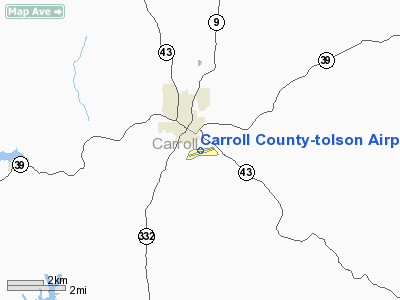
Carroll County-tolson Airport |
Location & QuickFacts
| FAA Information Effective: | 2008-09-25 |
| Airport Identifier: | TSO |
| Airport Status: | Operational |
| Longitude/Latitude: | 081-04-38.9500W/40-33-42.7260N
-81.077486/40.561868 (Estimated) |
| Elevation: | 1163 ft / 354.48 m (Surveyed) |
| Land: | 68 acres |
| From nearest city: | 1 nautical miles SE of Carrollton, OH |
| Location: | Carroll County, OH |
| Magnetic Variation: | 07W (1985) |
Owner & Manager
| Ownership: | Publicly owned |
| Owner: | Carroll County Arpt Auth |
| Address: | P.o. Box 266
Carrollton, OH 44615 |
| Phone number: | 330-627-5501 |
| Manager: | Alan Miller |
| Address: | 648 Longhorn St
Carrollton, OH 44615 |
| Phone number: | 330-627-5501
ADDITIONAL NUMBER 330-627-5250; AFT HRS CTC NGT SHERIFF 330-627-2141. |
Airport Operations and Facilities
| Airport Use: | Open to public |
| Wind indicator: | Yes |
| Segmented Circle: | No |
| Control Tower: | No |
| Lighting Schedule: | DUSK-DAWN
ACTVT MIRL RY 07/25; REIL RYS 07 & 25 - CTAF. |
| Beacon Color: | Clear-Green (lighted land airport) |
| Landing fee charge: | No |
| Sectional chart: | Detroit |
| Region: | AGL - Great Lakes |
| Traffic Pattern Alt: | 850 ft |
| Boundary ARTCC: | ZOB - Cleveland |
| Tie-in FSS: | CLE - Cleveland |
| FSS on Airport: | No |
| FSS Toll Free: | 1-800-WX-BRIEF |
| NOTAMs Facility: | CLE (NOTAM-d service avaliable) |
| Federal Agreements: | N |
Airport Communications
| CTAF: | 122.700 |
| Unicom: | 122.700 |
Airport Services
| Fuel available: | 100LLA
24 HR FUEL AVBL WITH CREDIT CARD. |
| Airframe Repair: | MAJOR |
| Power Plant Repair: | MAJOR |
| Bottled Oxygen: | NONE |
| Bulk Oxygen: | NONE |
Runway Information
Runway 07/25
| Dimension: | 4300 x 75 ft / 1310.6 x 22.9 m |
| Surface: | ASPH, Good Condition |
| Edge Lights: | Medium |
| |
Runway 07 |
Runway 25 |
| Longitude: | 081-05-04.0710W | 081-04-13.8280W |
| Latitude: | 40-33-33.5904N | 40-33-51.9338N |
| Elevation: | 1163.00 ft | 1163.00 ft |
| Alignment: | 64 | 127 |
| Traffic Pattern: | Left | Left |
| Markings: | Non-precision instrument, Good Condition | Non-precision instrument, Good Condition |
| VASI: | 2-light PAPI on left side | 2-light PAPI on left side |
| Runway End Identifier: | Yes | Yes |
| Centerline Lights: | No | No |
| Touchdown Lights: | No | No |
| Obstruction: | 23 ft tree, 690.0 ft from runway, 59 ft right of centerline, 21:1 slope to clear | 35 ft trees, 253.0 ft from runway, 194 ft right of centerline, 1:1 slope to clear
+30 FT TREES 100 FT FM 230 FT R. |
|
Radio Navigation Aids
| ID |
Type |
Name |
Ch |
Freq |
Var |
Dist |
| CFX | NDB | Cadiz | | 239.00 | 07W | 19.8 nm |
| AK | NDB | Akron | | 362.00 | 07W | 33.6 nm |
| MLR | NDB | Millersburg/dcmsnd | | 382.00 | 06W | 36.3 nm |
| UCP | NDB | Castle | | 272.00 | 09W | 40.9 nm |
| HBD | NDB | Hubbard | | 408.00 | 08W | 43.3 nm |
| PNU | NDB | Washington County | | 255.00 | 08W | 48.8 nm |
| BSV | VOR/DME | Briggs | 071X | 112.40 | 04W | 19.4 nm |
| CTW | VOR/DME | Newcomerstown | 055X | 111.80 | 07W | 27.1 nm |
| HLG | VOR/DME | Wheeling | 059X | 112.20 | 07W | 29.5 nm |
| ACO | VOR/DME | Akron | 091X | 114.40 | 04W | 33.3 nm |
| AIR | VOR/DME | Bellaire | 118X | 117.10 | 07W | 34.9 nm |
| TVT | VOR/DME | Tiverton | 112X | 116.50 | 03W | 48.4 nm |
| MMJ | VORTAC | Montour | 057X | 112.00 | 08W | 40.6 nm |
| EWC | VORTAC | Ellwood City | 105X | 115.80 | 08W | 42.5 nm |
| YNG | VORTAC | Youngstown | 027X | 109.00 | 05W | 49.7 nm |
| CAK | VOT | Akron/canton Regional | | 110.60 | | 27.0 nm |
Remarks
Images and information placed above are from
http://www.airport-data.com/airport/TSO/
We thank them for the data!
| General Info
|
| Country |
United States
|
| State |
OHIO
|
| FAA ID |
TSO
|
| Latitude |
40-33-42.726N
|
| Longitude |
081-04-38.950W
|
| Elevation |
1163 feet
|
| Near City |
CARROLLTON
|
We don't guarantee the information is fresh and accurate. The data may
be wrong or outdated.
For more up-to-date information please refer to other sources.
|
|


