 |
|
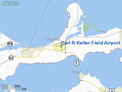
Carl R Keller Field Airport |
Erie-Ottawa Regional Airport
Carl R. Keller Field |
| IATA: PCW – ICAO: KPCW |
| Summary |
| Airport type |
Public |
| Operator |
Erie-Ottawa Airport Authority |
| Location |
Port Clinton, Ohio |
| Elevation AMSL |
590 ft / 179.8 m |
| Coordinates |
41°30′58.6″N 82°52′07.3″W / 41.516278°N 82.868694°W / 41.516278; -82.868694Coordinates: 41°30′58.6″N 82°52′07.3″W / 41.516278°N 82.868694°W / 41.516278; -82.868694 |
| Runways |
| Direction |
Length |
Surface |
| ft |
m |
| 9/27 |
5,004 |
1,525 |
Asphalt |
| 18/36 |
4,001 |
1,220 |
Asphalt |
Erie-Ottawa Regional Airport (IATA: PCW, ICAO: KPCW), also known as Carl R. Keller Field, is a public airport located 3.5 miles east of the city of Port Clinton in Ottawa County, Ohio, USA.
The above content comes from Wikipedia and is published under free licenses – click here to read more.
Location & QuickFacts
| FAA Information Effective: | 2008-09-25 |
| Airport Identifier: | PCW |
| Airport Status: | Operational |
| Longitude/Latitude: | 082-52-07.3000W/41-30-58.6000N
-82.868694/41.516278 (Estimated) |
| Elevation: | 590 ft / 179.83 m (Estimated) |
| Land: | 169 acres |
| From nearest city: | 3 nautical miles E of Port Clinton, OH |
| Location: | Ottawa County, OH |
| Magnetic Variation: | 06W (1995) |
Owner & Manager
| Ownership: | Publicly owned |
| Owner: | Erie Ottawa Arpt Auth |
| Address: | Po Box D
Port Clinton, OH 43452 |
| Phone number: | 419-734-6297 |
| Manager: | Jack Stables |
| Address: | 3255 East State Rd
Port Clinton, OH 43452 |
| Phone number: | 419-734-6297 |
Airport Operations and Facilities
| Airport Use: | Open to public |
| Wind indicator: | Yes |
| Segmented Circle: | No |
| Control Tower: | No |
| Lighting Schedule: | DUSK-DAWN
ACTVT MIRL RYS 09/27 & 18/36; REILS RYS 09 & 27;PAPIS RYS 09 & 27 - CTAF. |
| Beacon Color: | Clear-Green (lighted land airport) |
| Landing fee charge: | No |
| Sectional chart: | Detroit |
| Region: | AGL - Great Lakes |
| Boundary ARTCC: | ZOB - Cleveland |
| Tie-in FSS: | CLE - Cleveland |
| FSS on Airport: | No |
| FSS Toll Free: | 1-800-WX-BRIEF |
| NOTAMs Facility: | CLE (NOTAM-d service avaliable) |
| Federal Agreements: | NGY |
Airport Communications
| CTAF: | 122.800 |
| Unicom: | 122.800 |
Airport Services
| Fuel available: | 100LLA |
| Bottled Oxygen: | NONE |
| Bulk Oxygen: | NONE |
Runway Information
Runway 09/27
| Dimension: | 5004 x 75 ft / 1525.2 x 22.9 m |
| Surface: | ASPH, Fair Condition |
| Weight Limit: | Single wheel: 16000 lbs. |
| Edge Lights: | Medium |
| |
Runway 09 |
Runway 27 |
| Longitude: | 082-52-45.5560W | 082-51-40.4060W |
| Latitude: | 41-30-58.5270N | 41-31-04.8840N |
| Elevation: | 589.00 ft | 588.00 ft |
| Alignment: | 83 | 127 |
| Traffic Pattern: | Left | Left |
| Markings: | Non-precision instrument, Fair Condition | Non-precision instrument, Fair Condition |
| Crossing Height: | 31.00 ft | 28.00 ft |
| Displaced threshold: | 0.00 ft | 160.00 ft |
| VASI: | 4-light PAPI on left side
OTS INDEFLY. | 4-light PAPI on left side |
| Visual Glide Angle: | 3.50° | 4.00° |
| Runway End Identifier: | Yes | Yes |
| Touchdown Lights: | No | No |
| Obstruction: | 13 ft trees, 411.0 ft from runway, 153 ft right of centerline, 15:1 slope to clear | 15 ft trees, 458.0 ft from runway, 234 ft right of centerline, 17:1 slope to clear
APCH RATIO 27:1 TO DSPLCD THLD DUE TO +15 FT TREES 618 FT FR THLD 234 FT R. |
|
Runway 18/36
| Dimension: | 4001 x 75 ft / 1219.5 x 22.9 m |
| Surface: | ASPH, Good Condition |
| Edge Lights: | Medium |
| |
Runway 18 |
Runway 36 |
| Longitude: | 082-52-01.1840W | 082-51-59.2200W |
| Latitude: | 41-31-14.4860N | 41-30-34.9870N |
| Elevation: | 586.00 ft | 589.00 ft |
| Alignment: | 127 | 127 |
| Traffic Pattern: | Left | Left |
| Markings: | Basic, Fair Condition | Basic, Poor Condition
MARKINGS FADED |
| Runway End Identifier: | No | No |
| Centerline Lights: | No | No |
| Touchdown Lights: | No | No |
| Obstruction: | 72 ft trees, 1703.0 ft from runway, 175 ft right of centerline, 20:1 slope to clear | 15 ft road, 500.0 ft from runway, 20:1 slope to clear |
|
Radio Navigation Aids
| ID |
Type |
Name |
Ch |
Freq |
Var |
Dist |
| PCW | NDB | Port Clinton | | 423.00 | 06W | 0.1 nm |
| PT | NDB | Pelee Island | | 283.00 | 05W | 18.2 nm |
| TII | NDB | Tiffin | | 269.00 | 05W | 29.4 nm |
| FZI | NDB | Fostoria | | 379.00 | 05W | 30.9 nm |
| RYS | NDB | Grosse Ile | | 419.00 | 06W | 37.4 nm |
| CL | NDB | Harri | | 344.00 | 07W | 42.1 nm |
| AAU | NDB | Ashland | | 329.00 | 07W | 43.3 nm |
| G | NDB | Golf | | 398.00 | 05W | 44.5 nm |
| BNR | NDB | Benton Ridge | | 334.00 | 05W | 46.8 nm |
| QG | NDB | Windsor | | 353.00 | 06W | 47.9 nm |
| MF | NDB | Manns | | 372.00 | 06W | 49.0 nm |
| TOL | TACAN | Toledo | 072X | | 05W | 42.1 nm |
| MAH | VOR | Marathon | | 114.90 | 05W | 46.9 nm |
| SKY | VOR/DME | Sandusky | 029X | 109.20 | 04W | 10.8 nm |
| DJB | VOR/DME | Dryer | 083X | 113.60 | 05W | 33.2 nm |
| VWV | VOR/DME | Waterville | 078X | 113.10 | 02W | 34.9 nm |
| YQG | VOR/DME | Windsor | 085X | 113.80 | 06W | 44.1 nm |
| DXO | VOR/DME | Detroit | 081X | 113.40 | 06W | 47.4 nm |
| MFD | VORTAC | Mansfield | 025X | 108.80 | 03W | 40.9 nm |
| CRL | VORTAC | Carleton | 104X | 115.70 | 03W | 41.5 nm |
| CLE | VOT | Cleveland | | 110.40 | | 46.4 nm |
| DTW | VOT | Detroit Met Wayne | | 109.80 | | 48.2 nm |
Images and information placed above are from
http://www.airport-data.com/airport/PCW/
We thank them for the data!
| General Info
|
| Country |
United States
|
| State |
OHIO
|
| FAA ID |
PCW
|
| Latitude |
41-30-58.600N
|
| Longitude |
082-52-07.300W
|
| Elevation |
590 feet
|
| Near City |
PORT CLINTON
|
We don't guarantee the information is fresh and accurate. The data may
be wrong or outdated.
For more up-to-date information please refer to other sources.
|
|


