 |
|
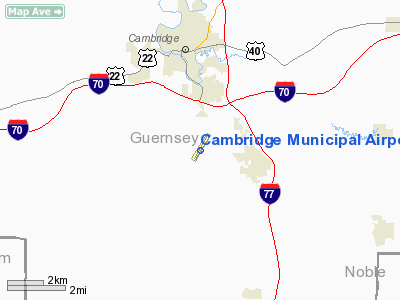
Location & QuickFacts
| FAA Information Effective: | 2008-09-25 |
| Airport Identifier: | CDI |
| Airport Status: | Operational |
| Longitude/Latitude: | 081-34-39.3000W/39-58-30.1000N
-81.577583/39.975028 (Estimated) |
| Elevation: | 799 ft / 243.54 m (Surveyed) |
| Land: | 75 acres |
| From nearest city: | 3 nautical miles S of Cambridge, OH |
| Location: | Guernsey County, OH |
| Magnetic Variation: | 07W (1990) |
Owner & Manager
| Ownership: | Publicly owned |
| Owner: | Cambridge Ae Reg Arpt Auth. |
| Address: | Box 73
Cambridge, OH 43725 |
| Phone number: | 740-432-3726 |
| Manager: | Terry Losego |
| Address: | 9732 Brickchurch Rd.
Cambridge, OH 43725 |
| Phone number: | 740-432-3726 |
Airport Operations and Facilities
| Airport Use: | Open to public |
| Wind indicator: | Yes |
| Segmented Circle: | Yes |
| Control Tower: | No |
| Lighting Schedule: | DUSK-DAWN
ACTVT MIRL RY 04/22; REIL RYS 04 & 22 - CTAF. |
| Beacon Color: | Clear-Green (lighted land airport) |
| Landing fee charge: | No |
| Sectional chart: | Cincinnati |
| Region: | AGL - Great Lakes |
| Traffic Pattern Alt: | 1000 ft |
| Boundary ARTCC: | ZOB - Cleveland |
| Tie-in FSS: | CLE - Cleveland |
| FSS on Airport: | No |
| FSS Toll Free: | 1-800-WX-BRIEF |
| NOTAMs Facility: | CLE (NOTAM-d service avaliable) |
| Federal Agreements: | NGY |
Airport Communications
| CTAF: | 123.075 |
| Unicom: | 123.075 |
Airport Services
Runway Information
Runway 04/22
| Dimension: | 4298 x 75 ft / 1310.0 x 22.9 m |
| Surface: | ASPH, Good Condition |
| Weight Limit: | Single wheel: 18500 lbs. |
| Edge Lights: | Medium |
| |
Runway 04 |
Runway 22 |
| Longitude: | 081-34-54.3915W | 081-34-24.2158W |
| Latitude: | 39-58-12.3559N | 39-58-47.9258N |
| Elevation: | 798.00 ft | 798.00 ft |
| Alignment: | 33 | 127 |
| ILS Type: | | LOC/DME
|
| Traffic Pattern: | Left | Left |
| Markings: | Non-precision instrument, Good Condition | Non-precision instrument, Good Condition |
| Displaced threshold: | 400.00 ft | 0.00 ft |
| VASI: | 2-box on left side | 2-box on left side |
| Visual Glide Angle: | 3.50° | 3.50° |
| Runway End Identifier: | Yes | Yes
OTS INDEFLY. |
| Centerline Lights: | No | No |
| Touchdown Lights: | No | No |
| Obstruction: | 69 ft pole, 1086.0 ft from runway, 244 ft left of centerline, 12:1 slope to clear
RWY 04 APCH RATIO 0:1; +60 FT TREES 0 FT FM THLD 378 FT R.
+0 FT CREEK 85 FT FM 250 FT L EXTENDING 214 FT R 200 FT. | 18 ft trees, 245.0 ft from runway, 184 ft right of centerline, 2:1 slope to clear
+0 FT CREEK 95 FT L FM EXTENDING 50 FT L 200 FT. |
|
Radio Navigation Aids
| ID |
Type |
Name |
Ch |
Freq |
Var |
Dist |
| PKB | FAN MARKER | Marietta Ohio | | | 03W | 36.3 nm |
| HRA | NDB | Zanesville | | 204.00 | 06W | 16.3 nm |
| CFX | NDB | Cadiz | | 239.00 | 07W | 30.3 nm |
| MLR | NDB | Millersburg/dcmsnd | | 382.00 | 06W | 36.7 nm |
| HEH | NDB | Newark | | 524.00 | 06W | 40.9 nm |
| TSO | NDB | Tolson | | 395.00 | 07W | 42.1 nm |
| ZZV | VOR/DME | Zanesville | 051X | 111.40 | 06W | 14.7 nm |
| CTW | VOR/DME | Newcomerstown | 055X | 111.80 | 07W | 16.0 nm |
| AIR | VOR/DME | Bellaire | 118X | 117.10 | 07W | 35.1 nm |
| TVT | VOR/DME | Tiverton | 112X | 116.50 | 03W | 38.5 nm |
| BSV | VOR/DME | Briggs | 071X | 112.40 | 04W | 46.5 nm |
| HLG | VOR/DME | Wheeling | 059X | 112.20 | 07W | 49.4 nm |
| JPU | VORTAC | Parkersburg | 023X | 108.60 | 03W | 33.4 nm |
| APE | VORTAC | Appleton | 114X | 116.70 | 06W | 47.7 nm |
Remarks
- RWY 04 OBSTN LGTD HILLS SW OF ARPT.
- GEESE & DEER INVOF RY.
Images and information placed above are from
http://www.airport-data.com/airport/CDI/
We thank them for the data!
| General Info
|
| Country |
United States
|
| State |
OHIO
|
| FAA ID |
CDI
|
| Latitude |
39-58-30.159N
|
| Longitude |
081-34-39.343W
|
| Elevation |
800 feet
|
| Near City |
CAMBRIDGE
|
We don't guarantee the information is fresh and accurate. The data may
be wrong or outdated.
For more up-to-date information please refer to other sources.
|
|


