 |
|
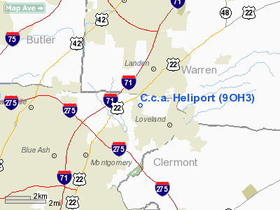
Location & QuickFacts
| FAA Information Effective: | 2008-09-25 |
| Airport Identifier: | 9OH3 |
| Airport Status: | Operational |
| Longitude/Latitude: | 084-17-51.7770W/39-17-00.2100N
-84.297716/39.283392 (Estimated) |
| Elevation: | 810 ft / 246.89 m (Estimated) |
| Land: | 10 acres |
| From nearest city: | 2 nautical miles SE of Loveland, OH |
| Location: | Clermont County, OH |
| Magnetic Variation: | 04W (1990) |
Owner & Manager
| Ownership: | Privately owned |
| Owner: | C.c.a., Inc.
CINCINNATI CONTRACTORS AVIATION, INC. |
| Address: | 9501 Union-cemetary Road
Loveland, OH 45140 |
| Phone number: | 513-871-3261 |
| Manager: | Thomas Blaho |
| Address: | 9501 Union-cemetary Road
Loveland, OH 45140 |
| Phone number: | 513-871-3261 |
Airport Operations and Facilities
| Airport Use: | Private |
| Segmented Circle: | No |
| Control Tower: | No |
| Lighting Schedule: | PHONE REQ
FOR PERIMETER LIGHTS CALL 517-871-3261. |
| Sectional chart: | Detroit |
| Region: | AGL - Great Lakes |
| Boundary ARTCC: | ZID - Indianapolis |
| Tie-in FSS: | DAY - Dayton |
| FSS Toll Free: | 1-800-WX-BRIEF |
Runway Information
Helipad H1
| Dimension: | 25 x 25 ft / 7.6 x 7.6 m |
| Surface: | CONC, |
| |
Runway H1 |
Runway |
| Traffic Pattern: | Left | Left |
|
Radio Navigation Aids
| ID |
Type |
Name |
Ch |
Freq |
Var |
Dist |
| MDE | NDB | Madeira | | 379.00 | 04W | 4.5 nm |
| ISZ | NDB | Cincinnati-blue Ash | | 388.00 | 04W | 4.8 nm |
| LUK | NDB | Cincinnati | | 335.00 | 04W | 7.7 nm |
| PWF | NDB | Sportys | | 245.00 | 04W | 13.0 nm |
| HAO | NDB | Hamilton | | 260.00 | 04W | 13.8 nm |
| HKF | NDB | Hook Field | | 239.00 | 04W | 14.7 nm |
| HW | NDB | Cubla | | 299.00 | 04W | 20.1 nm |
| OXD | NDB | Oxford | | 282.00 | 04W | 26.2 nm |
| UR | NDB | Burln | | 321.00 | 04W | 26.4 nm |
| IL | NDB | Airbo | | 407.00 | 04W | 28.9 nm |
| XEN | NDB | Xenia | | 395.00 | 03W | 31.1 nm |
| HOC | NDB | Hillsboro | | 278.00 | 05W | 35.6 nm |
| AMT | NDB | West Union | | 359.00 | 04W | 42.8 nm |
| CCJ | NDB | Clark County | | 341.00 | 04W | 42.8 nm |
| HLB | NDB | Batesville | | 254.00 | 02W | 44.8 nm |
| CSS | NDB | Court House | | 414.00 | 05W | 46.2 nm |
| FFO | TACAN | Patterson | 099X | | 04W | 34.1 nm |
| XSF | TACAN | Springfield | 065X | | 04W | 39.5 nm |
| MXQ | VOR/DME | Midwest | 076X | 112.90 | 04W | 24.7 nm |
| FLM | VOR/DME | Falmouth | 117X | 117.00 | 04W | 38.1 nm |
| SGH | VOR/DME | Springfield | 079X | 113.20 | 04W | 39.3 nm |
| DQN | VOR/DME | Dayton | 092X | 114.50 | 01W | 44.3 nm |
| CVG | VORTAC | Cincinnati | 120X | 117.30 | 04W | 24.8 nm |
| RID | VORTAC | Richmond | 043X | 110.60 | 03W | 37.9 nm |
| LUK | VOT | Cincinnati Muni/lunken | | 108.40 | | 11.1 nm |
| DAY | VOT | Dayton J M Cox-day | | 111.00 | | 37.3 nm |
Remarks
- ALL APCH/DEPARTURE ROUTE OPERATIONS ARE CONDUCTED IN AN AREA TO/FROM 090/270 DEGS USING THE TOUCHDOWN PAD AS THE CENTER OF A COMPASS ROSE; TAKEOFF/LANDING AREA IS MARKED; A NON-OBSTRUCTING WIND INDICATOR IS MAINTAINED ADJACENT TO THE TAKEOFF/LANDING AREA.
Images and information placed above are from
http://www.airport-data.com/airport/9OH3/
We thank them for the data!
| General Info
|
| Country |
United States
|
| State |
OHIO
|
| FAA ID |
9OH3
|
| Latitude |
39-17-00.210N
|
| Longitude |
084-17-51.777W
|
| Elevation |
810 feet
|
| Near City |
LOVELAND
|
We don't guarantee the information is fresh and accurate. The data may
be wrong or outdated.
For more up-to-date information please refer to other sources.
|
|


